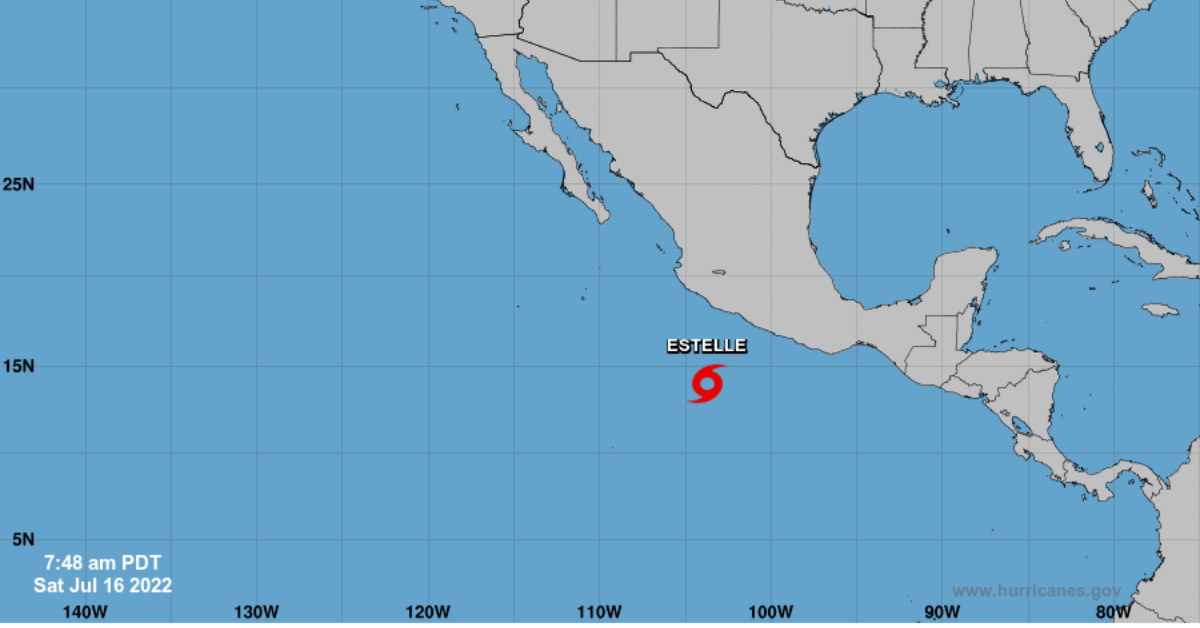
This Saturday, Tropical Storm Estelle will move to the south of the coasts of Colima and Michoacán; its cloud bands, in interaction with a low-pressure channel over western and central Mexico, will cause intense punctual rains in regions of Colima, Guerrero, Jalisco, Michoacán, and Nayarit, reported the National Meteorological Service (SMN).
SMN noted that early today, Estelle was located approximately 500 kilometers (km) southwest of Acapulco, Guerrero, and 615 km south-southeast of Manzanillo, Colima, with maximum sustained winds of 95 km/h, gusts 110 km/h, and displacement towards the northwest at 17 . . .