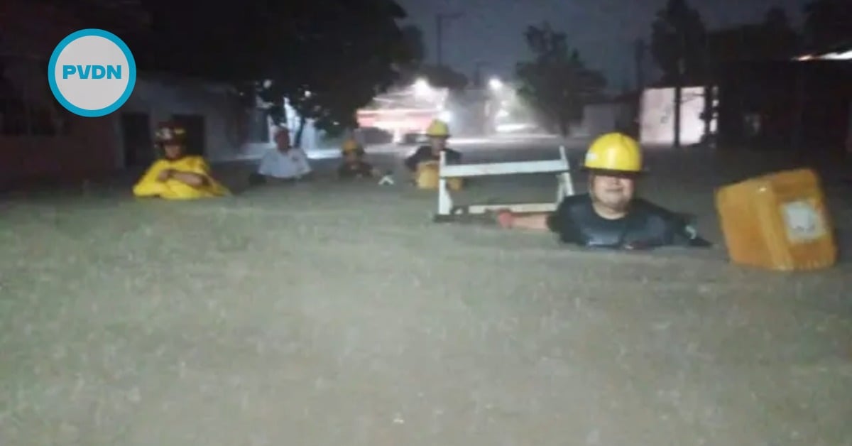
A late-night burst of tropical moisture pushed Puerto Vallarta’s drainage to the brink, turning familiar avenues into brown rivers and pushing water into low-lying neighborhoods. City rescue teams fanned out before dawn, pulling motorists to safety and urging everyone to stay home. This wasn’t a named storm crashing ashore. It was the soggy sting in the tail of Raymond—now a remnant low—wringing out over Jalisco. If you woke to sirens and standing water, you’re not alone. Here’s what happened, and what to expect next.
Puerto Vallarta’s Civil Protection and Fire Department warned residents early Sunday after heavy overnight rain flooded key avenues and several neighborhoods. The city flagged stretches of Francisco Villa, Francisco Medina Ascencio, and Avenida México, with the latter reported impassable at peak water levels. Crews moved through Tamarindos in Ixtapa, Portales, and Las Juntas to help families and check rising channels.
Officials said teams began working around midnight, responding to calls, moving stranded people, and monitoring arroyos. The message to the public was firm and straightforward: stay home unless you must go out, avoid flooded roads and crossings, and report emergencies via 911 while relying on official updates.
Puerto Vallarta flooding alert
What soaked the city wasn’t a direct landfall. The National Hurricane Center declared Raymond a remnant low late Saturday after it brushed past the southern tip of Baja California Sur. But the system’s moisture plume still draped over northwestern Mexico, and forecasters warned it could keep producing heavy rain and flash-flood risk for another day. That’s precisely when Puerto Vallarta’s showers intensified. Puerto Vallarta’s flooding alert is no hyperbole, given the already high runoff and overwhelmed drains.
On the ground, local outlets captured the scale of the response. Civil Protection chief Misael López Muro described an aggressive overnight deployment as reports stacked up from Vallarta and neighboring Bahía de Banderas. Street-level videos from Tamarindos in Ixtapa showed knee-deep water and stalled vehicles, a scene that matched the city’s warnings about avoiding low crossings.
The timing also matters. Puerto Vallarta had already absorbed a week of turbulent coastal weather. Earlier days brought high surf and flooding tied to Tropical Storm Priscilla’s close pass, with state officials temporarily closing beaches and cautioning against strong currents. When Raymond’s leftovers arrived, soils were primed and drains were stressed, turning a “few hours” of rain into neighborhood-level flooding.
What to know as cleanup begins
Civil Protection says protocols remain active. If you need help, dial 911 and keep phones charged. Do not drive into water that hides potholes, open manholes, or fast currents. Avoid walking across channels, even when the water looks calm. City crews and allied agencies will continue spot checks of arroyos, pump trouble spots, and clear debris from drains as the weather eases.
The good news: the broader tropical picture is calming. By Sunday morning, the NHC had ended Raymond advisories and listed no active cyclones in the Eastern Pacific. But remnant moisture can still wring out on localized terrain, especially around the bay and the foothills. Stay tuned to municipal channels for updates, and give crews space to work on flooded corridors like Francisco Medina Ascencio and connecting laterals.
If your home took in water, ventilate as soon as it’s safe, cut power at the main if outlets were submerged, and photograph damage for insurance or relief claims. City messaging emphasizes patience today. The overnight response was built for life safety; the next phase is clearing drains and reopening roads so neighborhoods can breathe again.