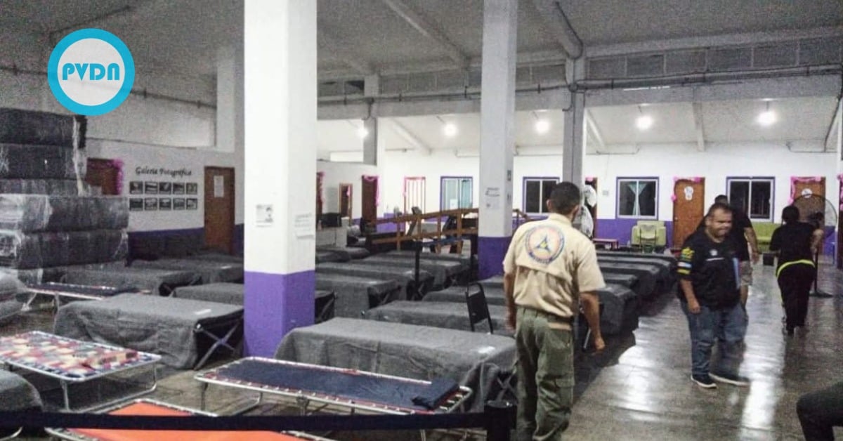
Tropical Storm Raymond is skimming the Pacific coastline, and Jalisco has already opened its storm shelters as a precaution. Officials say the sites—run with the state and municipal DIF systems—can offer a bed, food, and basic care if the weather worsens. Forecasts point to heavy rain, choppy seas, and the usual trouble spots: riverbeds, arroyos, and unstable slopes. Here’s what’s open now, what the forecast really means for the coast, and how to decide if—and when—you should move to a shelter.
Jalisco storm shelters open
Tropical Storm Raymond is running just offshore, and Jalisco’s Civil Protection and Firefighters Unit says temporary shelters are already operating along the North and South coasts. The sites, managed by the state DIF in collaboration with municipal DIFs, are ready to provide lodging, food, and basic care for families in need of a safe place during the storm. Reporters and officials listed locations in Cihuatlán, La Huerta, Tomatlán, and Cabo Corrientes, including addresses in Jaluco, San Mateo, and El Tuito.
Authorities are keeping the message simple: stay on official channels, follow Civil Protection instructions, and do not linger near riverbeds, streams, or unstable slopes. If you need help, call 911. Jalisco’s state account has flagged rains already reaching the South Coast and says teams are patrolling with local authorities to warn of risks and guide evacuations if needed.
What Raymond is expected to do
The U.S. National Hurricane Center has a Tropical Storm Warning from Punta San Telmo up to Cabo Corrientes, with a Watch for parts of Baja California Sur as Raymond tracks west-northwest near the shoreline. The center’s discussion notes a messy but steady circulation, with bursts of convection and the potential for heavy rain over higher terrain. For Jalisco’s coastal strip, advisories point to one to two inches of rain, with locally higher totals possible and a risk of flash flooding where hills squeeze runoff. Seas will be rough, and rip currents will be dangerous.
State and federal agencies say the broader emergency posture remains in place across Mexico’s Pacific states. National bulletins emphasize river monitoring and stand-up of shelters as needed. At the same time, Jalisco’s DIF has spent the season pre-positioning supplies in coastal municipalities for precisely this kind of event. The goal is speed: if roads wash out or a neighborhood floods, families have a staffed, stocked site within reach.
How to decide if you should go
Use common-sense thresholds. If your home is located near an arroyo, below a slope that sheds rock, or in a low-lying area prone to flooding, don’t wait for ankle-deep water to make the call. Pack essentials, secure what you can at home, and head to the nearest shelter while routes are open. If you stay, keep your phone charged, avoid crossing fast water, and keep away from the surf even when the sky looks fine—swells and rip currents outlast the rain. When in doubt, call 911 and ask for guidance; responders know which pockets usually get cut off first.
Officials stress this is a preventive operation, not a panic button. These shelters exist so families aren’t forced to choose between riding out a squall in harm’s way or paying for a hotel they can’t afford. If Raymond’s bands keep brushing the coast, the safest move is often the simplest: move early, stay dry, and come home when the water goes down. For hyper-local forecasts and warnings, rely on the National Hurricane Center and Mexico’s meteorological service feeds throughout the day.