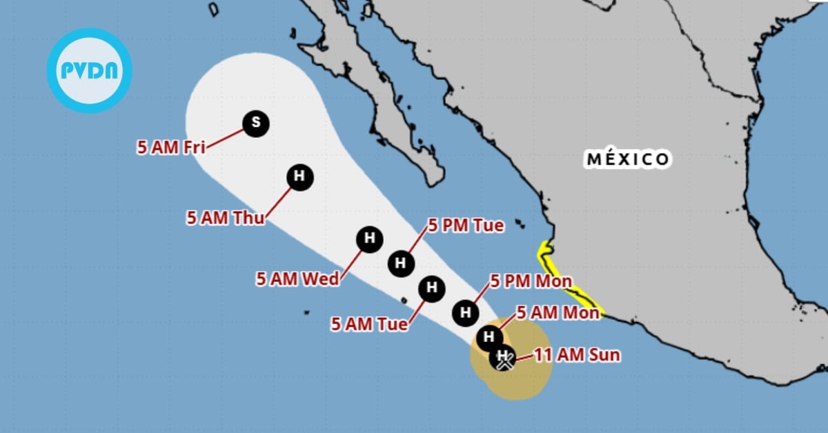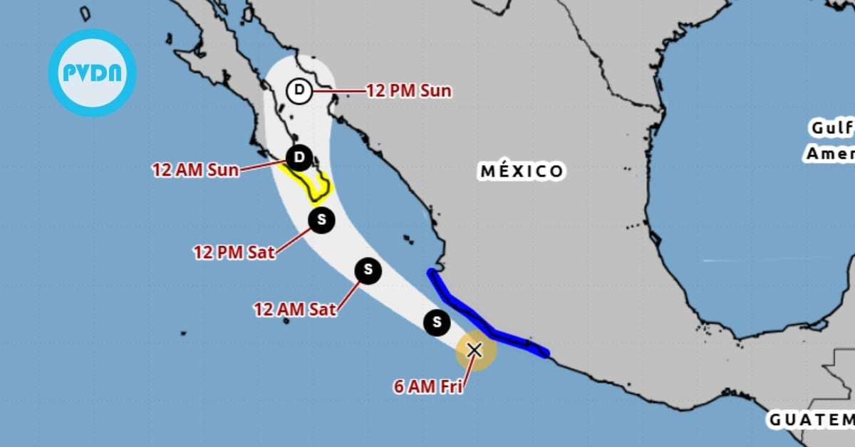
Tropical Storm Raymond is sliding along Mexico’s southwest coast this morning, pushing bands of rain onshore and churning up rough surf. A warning spans Zihuatanejo to Cabo Corrientes, while a watch covers southern Baja from Los Barriles to Santa Fe. Forecasts show slight strengthening today, then a gradual fade over the weekend as Raymond turns north toward Baja California Sur. Flash flooding is possible in higher terrain, with the heaviest rain likely in Guerrero and Michoacán. Local authorities urge residents to follow official advisories and stay clear of dangerous surf.
Raymond hovered just off the southwestern coast at daybreak Friday, with maximum sustained winds near 60 mph and a steady west-northwest track around 14 mph. Forecasters expect a turn toward the northwest tonight, then north on Sunday as a trough pulls the system toward Baja California Sur. Tropical-storm-force winds extend about 60 miles from the center.
A Tropical Storm Warning remains in effect from Zihuatanejo to Cabo Corrientes, meaning tropical storm conditions are expected in parts of that coastline within 36 hours. A Tropical Storm Watch is posted for southern Baja California Sur, from Los Barriles to Santa Fe, where those conditions are possible on Saturday. Local maritime authorities also warn of rough seas and strong currents as Raymond’s swell field spreads west.
Tropical Storm Raymond
The rain story matters most for communities in Guerrero and Michoacán, where outer bands could drop 2–4 inches, with pockets near six inches in mountainous terrain. Colima and Jalisco—including the Cabo Corrientes area south of Puerto Vallarta—are in line for lighter totals, generally one to two inches, enough to trigger street flooding in poor-drainage zones. Oaxaca’s coast may also see brief heavy squalls on Raymond’s far flank. Flash flooding is possible where downpours persist over hillsides.
Satellite loops early today showed a lopsided circulation with bursts of convection firing near the center—enough to hold intensity for now, but strong easterly shear and dry air ahead should cap Raymond’s ceiling. The official forecast keeps intensity near a plateau today, then trends weaker through the weekend, with the system expected to degrade into a remnant low over the Gulf of California after crossing the Baja Peninsula.
What to expect onshore
Along the warning coast, expect squally rain bands, brief gusts over tropical-storm strength, and rough surf building through tonight. Mariners and beach communities should plan for elevated waves and rip currents as swells push toward the Riviera Michoacana and Costa Grande, then into southern Baja on Saturday. Civil Protection agencies in Mexico are highlighting the risk of rapid runoff in canyons and urban flooding where drains clog. Keep an eye on local bulletins and avoid low-lying river crossings.
The bigger-picture moisture plume tied to Raymond may also feed into the U.S. Southwest early next week, adding to a separate flood threat already flagged by forecasters there. That cross-border piece won’t affect Mexico’s warnings today, but it underscores how October systems can move water far from their cores.
Residents in the watch area of southern Baja should use today to secure small boats, check drainage around homes, and review local shelter guidance. If you live on a hillside or near an arroyo, keep an ear out for overnight alerts—most quick-rising floods follow the heaviest nocturnal bands. For precise neighborhood-level instructions, follow your municipal Protección Civil and the national meteorological bulletins.