Mexico is the kind of place that keeps giving, even when you think you’ve seen it all. Beyond the colors, the cuisine, and the headlines, there’s a layer of stories and strange truths that don’t make the postcards. This list pulls back the curtain on 20 secrets about Mexico—some historical, some cultural, some ecological—that most people gloss over, even if they’ve lived here for years. These aren’t fluff; they’re real pieces of what makes Mexico complicated, resilient, and quietly surprising.

1. A Mexican engineer helped give the world color TV
Guillermo González Camarena, from Jalisco, invented an early practical color television system in the early 1940s (his “chromoscopic adapter”) and patented it in 1942. His work predated and influenced later developments, and he chose to keep the technology tied to Mexico rather than selling out.
He continued refining the system, and in 196,3 his technology produced Mexico’s first official color broadcast on XHGC (Channel 5), the station whose call letters honor him. His simplified color system was later adapted by NASA for planetary imaging, including the Voyager mission. González Camarena’s legacy includes influencing global television technology and inspiring Mexican science; institutions and honors (like the naming of Canal 5’s original call sign XHGC and foundations in his name) keep his story alive.
2. The “floating gardens” of Xochimilco (chinampas) powered the Aztec capital
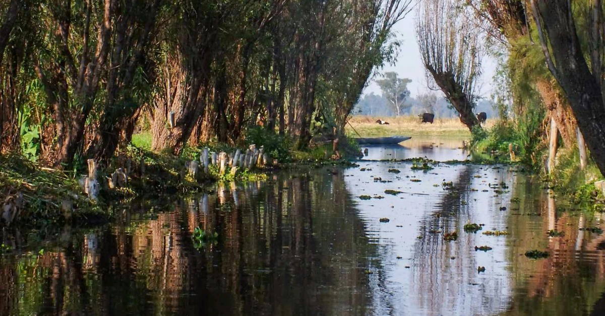
The chinampas are artificial, highly productive agricultural plots built on shallow lake beds around what is now Mexico City. Made from layers of mud, vegetation and reeds, they functioned like floating farms and sustained large urban populations. They’re still in use and being revived as sustainable food systems today.
Chinampas aren’t floating in the free-drifting sense; they are raised, rectangular plots built on shallow lake beds in the Basin of Mexico—especially around Xochimilco and Chalco—by the Aztecs (and with antecedents before them). Builders drove stakes (often from the native bonpland willow) into the lakebed to form a perimeter, then layered lake mud, decaying vegetation, and other organic matter to create a fertile island. Canals around them supplied water by capillarity, reducing the need for irrigation, and their design allowed multiple annual harvests—sometimes up to seven—from vegetables, flowers, and grains. The system was a dense, integrated wetland agriculture that sustained large urban populations in Tenochtitlán.
After centuries of drainage, neglect, and urban pressure, chinampas nearly vanished. In recent years, there’s been a revival: during the COVID food shocks, Mexico City residents turned back to chinampa producers for fresh, local food, and projects have scaled up restoration as part of urban resilience strategies. Revived chinampas today are framed as living infrastructure—filtering water, cooling the city, sequestering carbon, preserving biodiversity, and anchoring Indigenous cultural identity. Grassroots collectives (like Chinampa Refuge), ecological restaurants sourcing directly from Xochimilco gardens (e.g., Arca Tierra’s work with Baldío), and academic restoration initiatives are blending traditional techniques with modern support to keep the system alive amid threats from development and water scarcity.
3. Mexico City is sinking—and unevenly, because it was built on a drained lake
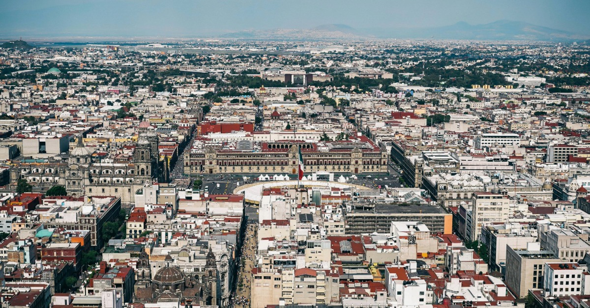
Mexico City was founded on the soft clay and sediments of the drained Lake Texcoco. That lakebed is highly compressible: as groundwater is pumped out to meet the needs of nearly 10 million residents, the clay layers compact and the ground settles. The result is land subsidence, and it doesn’t happen uniformly. Some neighborhoods and infrastructure zones are dropping far faster than others, creating differential sinking that warps streets, tilts buildings, and stresses bridges, sewer lines, and elevated transit. Satellite data and decades of monitoring show parts of the city have sunk as much as 20 inches (about 50 centimeters) in a single year in extreme pockets, and cumulative subsidence over the last century is measured in meters. This uneven movement is already damaging key systems: the Metro’s elevated lines are shifting, rails wobble, and maintenance has become more urgent and complex.
Attempts to “fix” the problem face limits because the clay’s structural change is largely permanent once compressed, and simply recharging aquifers isn’t enough to rebound the ground. The root drivers—overreliance on groundwater, legacy urban expansion over the old lake, and ongoing drought pressure—mean the city keeps sinking, with risks magnified in poorer areas that can’t afford adaptive retrofits. Researchers and engineers are mapping vulnerable stretches (including specific Metro segments) to prioritize reinforcements, but the underlying geological reality remains: Mexico City is literally settling into its past, and doing so unevenly, making infrastructure fragile and adaptation increasingly costly.
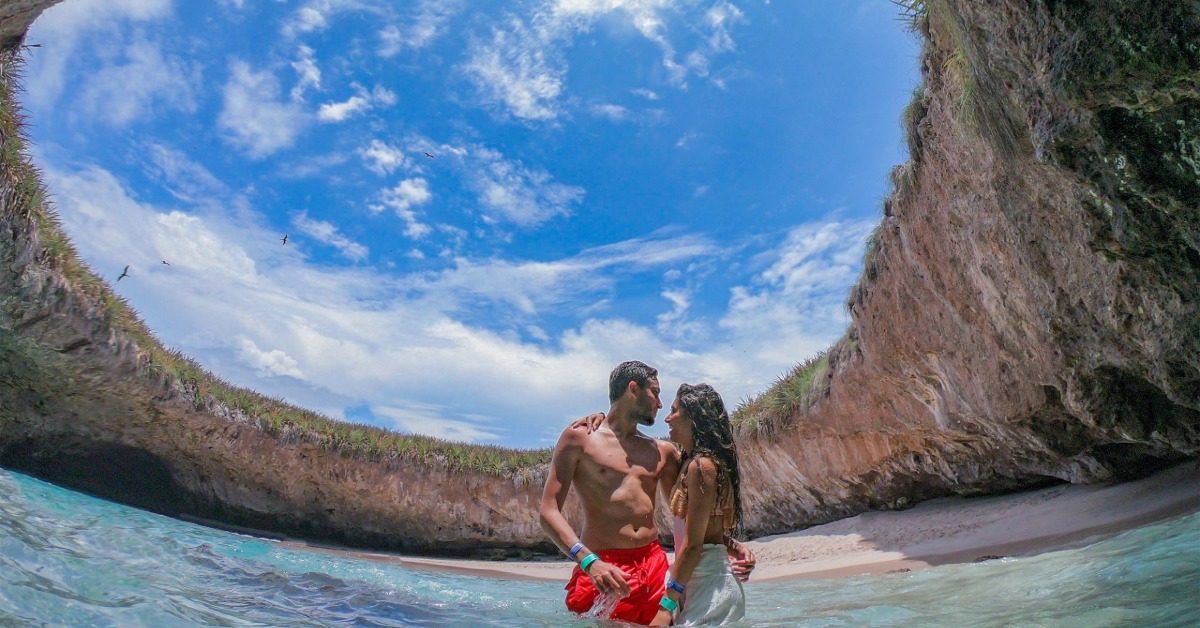
4. The “hidden beach” (Playa del Amor) is inside a collapsed volcanic-formed cavity, not a true volcano interior
Playa del Amor (Hidden Beach) sits in a collapsed, sinkhole-like cavity on the volcanic Marietas Islands off the Nayarit/Punta Mita coast. The islands themselves are volcanic in origin, but the signature hollow that shelters the beach was not a natural crater from recent geology—it was largely shaped by early 20th-century military bomb testing carried out by the Mexican government. Controlled explosions fractured the rock and, over decades, wave action washed debris out and brought in sand, slowly forming the small crescent of beach sealed inside the cavity. The result is a surreal, nearly invisible sandy pocket with a circular opening to the sky and access only through a narrow water tunnel that must be swum or kayaked.
What looks like a “secret volcanic beach” is thus a mix of human impact and natural sculpting—sensational descriptions calling it a beach inside a volcano overstate it; it’s more accurate to say it’s hidden in a collapsed hollow on volcanic islands. Conservation pressure rose after Jacques Cousteau and others protested the ecological harm of continued testing and unregulated tourism; the Marietas were eventually made a national park (2005) and later a UNESCO Biosphere Reserve (2008). Today, access to Playa del Amor is restricted to protect its fragile ecology: only a limited number of visitors (roughly a bit over 100 per day) can enter via authorized guided tours, and the approach requires swimming through the tunnel from the ocean side. Oversight and occasional temporary bans have been used to repair environmental degradation and manage coral/reef impacts, reflecting evolving polycentric governance of the park.
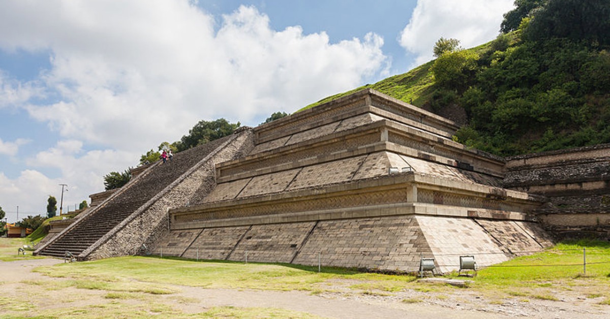
5. The largest pyramid by volume in the world is in Mexico
Known in Nahuatl as Tlachihualtepetl (“man-made mountain”), the Great Pyramid of Cholula in Puebla covers more volume than any other pyramid on earth—about 4.45 million cubic meters, nearly twice that of the Great Pyramid of Giza. Its visible profile today looks like a grassy hill because centuries of construction layered adobe platforms over earlier ones, and much of the structure was later buried and overgrown. The Spanish built the Iglesia de Nuestra Señora de los Remedios atop the hill in the 16th century, symbolically placing a church over the pre-Hispanic sacred site.
Cholula’s pyramid was built in multiple phases beginning as early as the 3rd century BCE, with significant expansions through the Classic period and modifications continuing for over a millennium. Archaeologists have found that its gradual accretion reflected persistent spiritual importance; different cultures reused and reinterpreted the site rather than abandoning it completely. Beneath the grassy hill, an extensive network of tunnels opened by archaeologists allows visitors to walk through layers of the structure and see the architectural evolution. The site remains partly unexcavated, and its scale was long obscured by the overlying earth and the church, making it a layered symbol of continuity, conquest, and cultural fusion.
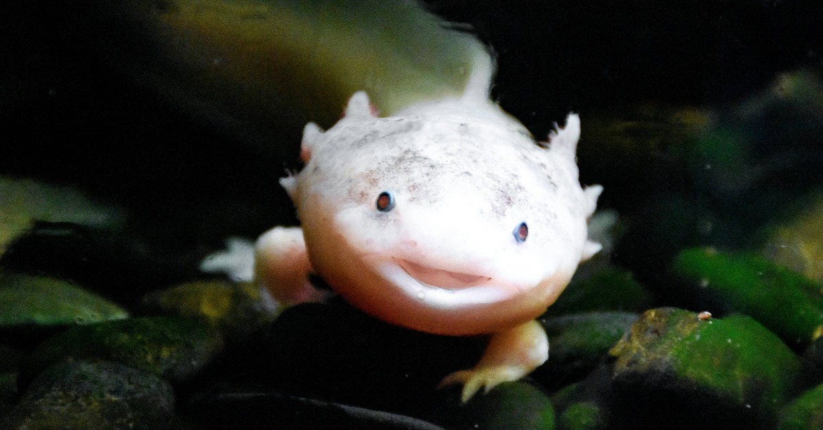
6. The axolotl, a salamander with near-miraculous regeneration, is native to Mexico and critically endangered in the wild
The axolotl (Ambystoma mexicanum) is a salamander found only in the wild in the Xochimilco canal system outside Mexico City. Unlike most amphibians, it remains in its larval form for life (a condition called neoteny), keeping its external gills and aquatic lifestyle while still capable of full sexual maturity. What makes it famous in science is its regenerative power: it can regrow entire limbs, parts of its spinal cord, heart tissue, and even sections of its brain without scarring. Researchers keep discovering new layers of how it does this—recent work has identified molecular “positional codes” that guide correct limb rebuilding and mechanisms controlling regeneration signaling—making the axolotl a lead model for potential future breakthroughs in human tissue repair.
Despite its scientific celebrity and abundance in captivity, the axolotl is critically endangered in the wild. Its natural habitat has been ravaged by urban expansion, pollution, invasive fish species, and the draining/degradation of the ancient chinampa wetlands that historically supported it. Wild population surveys show catastrophic declines; estimates from recent field efforts suggest only a few hundred to a thousand individuals remain in situ, down from thousands per square kilometer in prior decades. Conservationists have linked the health of chinampas and clean canal water directly to axolotl survival, framing their recovery as an integrated ecosystem effort.
Local and scientific initiatives are pushing back. Projects involve restoring and protecting chinampa wetlands, community-scientist partnerships to monitor and breed axolotls, and carefully managed reintroductions into artificial or rehabilitated canals. A 2025 study reinforced hope by showing that captive-bred axolotls can survive once reintroduced to protected wetland environments, and new habitat-creation efforts are combining traditional ecological knowledge with modern conservation science.
Beyond biology and ecology, the axolotl has become a cultural symbol of Mexican identity and resilience. It appears in art, currency references, and public awareness campaigns. Its image has even been leveraged to raise conservation visibility amid concerns that global popularity (including in games and merchandise) could overshadow urgent habitat needs. The axolotl now sits at the intersection of science, heritage, and environmental struggle—an “adorable” ambassador for a vanishing urban wetland.
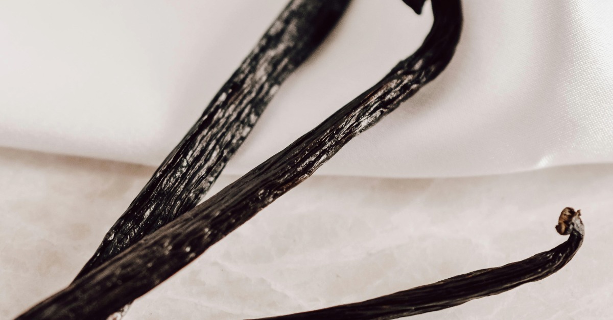
7. Vanilla is native to Mexico and was once impossible to cultivate elsewhere without a local pollinator
Vanilla* planifolia* began as a wild orchid in the humid forests of eastern Mexico, especially in the region of Totonacapan (modern-day Veracruz, around Papantla), where the Totonac people were the first known cultivators. They used vanilla in ritual, fragrance, and as a flavoring long before it reached Europe. When the Aztecs conquered the Totonacs, they adopted vanilla and mixed it with cacao in elite beverages.
What made vanilla so difficult to transplant successfully outside Mexico for centuries was its highly specific natural pollination biology. In its native range, vanilla flowers were pollinated by native Melipona stingless bees (and possibly other local insects), which had co-evolved with the orchid. Outside that narrow ecological context, the flowers would bloom for less than a day and then drop without setting fruit—until human intervention changed the game.
The breakthrough in global cultivation came in 1841, not in Mexico but on Réunion Island, when Edmond Albius, an enslaved 12-year-old, invented the efficient hand-pollination method still used today: manually lifting the membrane between anther and stigma to transfer pollen. That technique allowed vanilla to be grown commercially across the tropics (Madagascar, Comoros, etc.), breaking Mexico’s de facto production monopoly—but the flower’s deep cultural and ecological roots remained Mexican.
Mexico’s vanilla industry later declined as other countries scaled up using Albius’s method. In recent years there’s been a revival movement in Veracruz and Papantla focused on reclaiming heritage, protecting the remaining wild pollinators, and marketing “Mexican vanilla” as distinct from bulk global supply. That includes efforts to restore traditional growing knowledge, emphasize true planifolia beans (versus adulterated or synthetic vanilla), and reconnect the product to its cultural origin story.
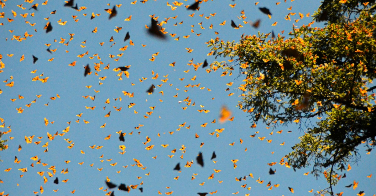
8. Monarch butterflies migrate thousands of miles to overwinter in central Mexico’s fir forests
Each fall, millions (historically up to a billion) of eastern North American monarchs begin a multi-generation journey from breeding grounds as far north as Canada and the U.S. Midwest. They travel roughly 2,500 to 3,000 miles to reach a handful of high-elevation oyamel fir forests in central Mexico (in the states of México and Michoacán), where they overwinter in dense clusters. The microclimate created by the fir canopy keeps them cool, humid, and protected; they enter a state of semi-dormancy, conserving energy until spring. Their wintering sites are protected as the Monarch Butterfly Biosphere Reserve, a UNESCO World Heritage site, because the concentration of butterflies there is one of nature’s most dramatic migration phenomena.
The migration faces growing pressure. The oyamel fir forests that provide the needed microclimate are threatened by illegal logging, land conversion, and climate change, which alters temperature and moisture regimes critical for the butterflies’ survival. Over the past few decades the eastern population plunged—estimates show declines of more than 80% from 1990s levels in central Mexico—putting the migration and overwintering cycle at risk. Conservation partnerships across North America (including federal agencies, NGOs, and community scientists) coordinate habitat protection both on the breeding grounds and in Mexico, while researchers explore assisted adaptations such as planting oyamel in higher-elevation refugia.
There is cautious optimism: the winter of 2024–2025 saw a near doubling in the area occupied by butterflies in Mexico’s forests (from 2.22 to 4.42 acres), signaling a rebound in numbers, though populations remain well below long-term averages and are still vulnerable to climatic swings and habitat degradation.
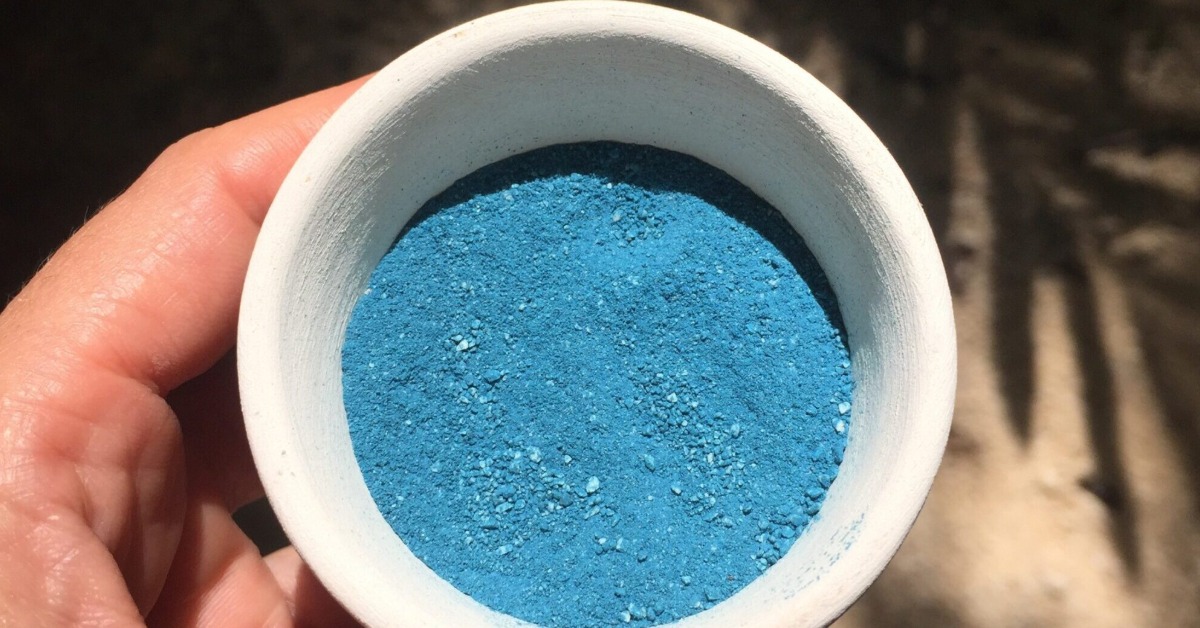
9. Maya Blue is a uniquely durable pigment created in ancient Mexico
Maya Blue is not just a color; it’s a hybrid material the Maya (and other Mesoamerican cultures) engineered more than a millennium ago that combines organic and inorganic chemistry in a way that still impresses researchers today. The pigment is made by binding indigo dye (from the añil plant, Indigofera suffruticosa) into the structural channels of the clay mineral palygorskite (and in some variants, sepiolite), then heating the mixture. That process traps the organic dye inside the clay’s nanopores, stabilizing it against chemical, biological, thermal, and UV degradation. The result is a bright turquoise/azure blue that survives centuries of weather, humidity, acids, and even biological attack—far beyond what ordinary organic dyes would endure.
Maya Blue appears in murals, codices, sculptures, and ceremonial items from at least the Classic period (around 800 CE) through the early colonial era. The pigment was valued not just for its color but its symbolic associations: blue was tied to fire’s center and spiritual potency in some cosmologies. The technique was so effective that the formula was lost after colonial disruption and only began to be systematically reconstructed in the late 20th century. Mexican art historian and chemist Constantino Reyes-Valerio published a working recipe in 1993, synthesizing archival research with microscopic and spectroscopic analysis to confirm how pre-Hispanic artisans combined materials.
Modern science continues to study Maya Blue both to understand its ancient origins and to inspire new materials. Recent work (2024–2025) has refined knowledge of its thermal synthesis conditions, showing how heating temperature and duration affect its resistance properties, and even uncovered a “second method” variation that sheds light on the flexibility of pre-Columbian material knowledge.
There’s also a cultural revival side: artisans in Yucatán, like Luis May Ku, have retraced and recreated the traditional pigment after nearly two centuries of its absence from living practice. Their work, confirmed by collaborations between Mexican and international researchers, reestablishes Maya Blue not just as an archaeological curiosity but as a living connection to pre-Hispanic material culture.
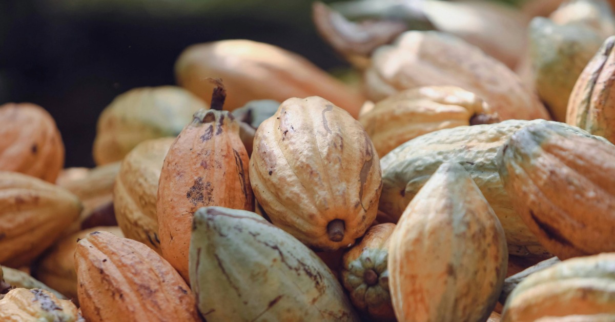
10. Cacao beans functioned as money in pre‑Hispanic Mexico
In the Aztec and Maya worlds, cacao beans were more than a luxury drink ingredient—they were units of exchange, tribute, and standardized value. The Codex Mendoza and colonial-era Spanish observers record cacao being used to pay for goods, services, and taxes. For example, in 1555 the Spanish set a formal conversion: 320 cacao beans equaled one Spanish silver peso (or 40 beans to a real), showing how entrenched cacao was as a quasi-monetary standard even after conquest. Common market prices recorded include a rabbit for about 30 beans, a turkey for 100 beans, and in extreme cases, slaves or high-value items priced similarly, making cacao a functional currency in daily commerce.
The system was sophisticated enough that counterfeiting arose—clay beans painted to resemble cacao were used to trick buyers, indicating both the value placed on the beans and the need for trust mechanisms in market transactions. Tribute demands also used standardized large units: the Aztec state collected cacao in large quantities (for instance, glyphic records show tribute measured in “pik,” units representing thousands of beans), and nobility used cacao in ceremonial exchanges.
The cultural weight of cacao extended beyond commerce: it was tied to elite identity, ritual consumption (often spiced and bitter), and divine associations, which helped cement its reliability as a store of value. Even after the Spanish arrival, cacao remained a critical medium in a cash-poor colonial economy, serving as “small change” and helping bridge indigenous and imposed economic systems.
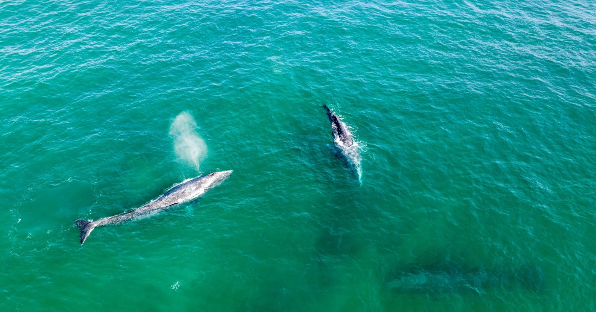
11. Gray whales give birth in Baja California lagoons, where they’re treated as guests, not trophies
The gray whales that migrate from Arctic feeding grounds to the warm, protected lagoons of Baja California—especially San Ignacio Lagoon, Laguna Ojo de Liebre (Scammon’s Lagoon), and Magdalena Bay—do so to mate, calve, and nurse their young. These lagoons are among the world’s most important gray whale nurseries. They are part of the Whale Sanctuary of El Vizcaíno, embedded in the larger El Vizcaíno Biosphere Reserve and recognized as a UNESCO World Heritage site precisely because they are critical breeding and calving grounds.
What makes the Baja encounter unusual—and, for many visitors, deeply affecting—is how the whales and humans now relate. Where whales were once hunted (San Ignacio was historically a whaling site), communities have built a cultural and economic relationship based on respectful, nonextractive tourism. Gray whale mothers and calves in places like San Ignacio are famously curious; they often approach small skiffs, gently brush alongside boats, and in some documented cases seem to invite human touch, a behavior that researchers describe as cultural and passed generationally among whales. That intimacy is not forced—swimming with whales is prohibited under Mexican regulation to protect their wellbeing—and interactions are tightly managed so that whales remain the ones “calling the shots.”
Local economies have shifted from extraction to guardianship. Whale watching in the lagoons is framed as both an eco-tourism draw and an engine of conservation. The growth of ethically governed whale watching (especially in San Ignacio) has helped diversify local income while creating strong incentives to preserve the habitat. Studies and reports note that the industry has become intertwined with environmental preservation—locals now actively defend the whales, regulate boat approaches, and enforce guidelines that keep mothers and calves safe during this vulnerable period.
The gray whale population’s recovery—from near-decimation by commercial hunting to a bounce-back in the eastern Pacific—is one of marine conservation’s rare success stories, enabled in part by protections around these lagoons and the shift in human attitudes from trophy to guest. Today the lagoons are managed to keep that balance: the whales’ presence drives protective oversight, and communities, in turn, steward the space that welcomes them.
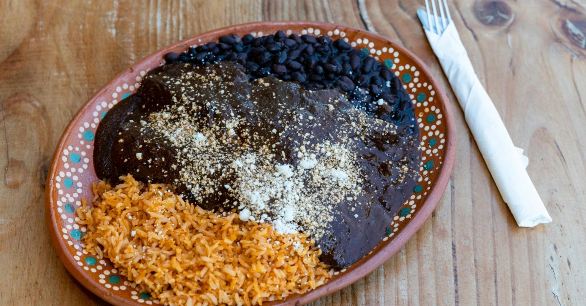
12. Mexican mole is a UNESCO-recognized culinary tradition with dozens of regional variations
In 2010, traditional Mexican cuisine, including its signature moles, was inscribed on UNESCO’s Intangible Cultural Heritage list as a community-based, ancestral system that links farming, ritual, cooking techniques, and shared eating. Mole is not a single sauce but a family of complex, layered sauces—some with 30 to 75 ingredients—whose recipes change radically by place, history, and purpose. In Puebla, mole poblano blends dried chiles, chocolate, nuts, and spices into a rich, balanced sauce; in Oaxaca, there are at least seven major moles (negro, verde, coloradito, chichilo, manchamantel, amarillo, and more), each with its own ingredient logic and ceremonial role. Other variants—like pipián (seed-based), almendrado (with almonds), and regional interpretations from Michoacán or Guerrero—show how terroir, pre-Hispanic technique, and colonial layers fused into locally guarded identities. The result is a culinary geography where a “mole” in one town can taste nothing like a mole in the next, and where the act of making it—roasting, grinding on a metate, slow simmering—is itself cultural preservation.
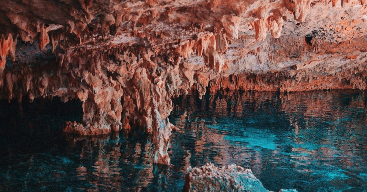
13. Mexico’s Yucatán Peninsula hides one of the largest underground river systems in the world
The surface of the Yucatán has almost no rivers because rainwater quickly sinks into the porous limestone platform. Instead, the peninsula’s hydrology depends on a vast karst aquifer and a network of subterranean rivers, caves, and cenotes—collapsed sinkholes that expose groundwater. This system, stretching beneath most of the peninsula (including the famous Ring of Cenotes and extensive cave complexes like Sac Actun and Ox Bel Ha), is among the largest and most complex karst groundwater systems globally. It supplies virtually all freshwater for communities, agriculture, and ecosystems across Yucatán, Campeche, and Quintana Roo, and supports unique subterranean biodiversity adapted to the dark, connected waterways.
The underground rivers are not just physical infrastructure; they are sacred to many Maya communities. Groups like the Guardians of the Cenotes (Kanan Ts’ono’ot) have pushed legal challenges to recognize the Ring of Cenotes as legal persons, arguing that acknowledging their rights would better protect them from contamination, over-extraction, and industrial encroachment—especially from polluting activities like mega pig farms that have fouled nearby aquifers. That movement reflects how hydrological health, cultural identity, and legal innovation are intertwining around these subterranean waters.
At the same time, large-scale infrastructure projects like the Maya Train have drawn criticism for threatening the integrity of this hidden world. Construction has disturbed cave systems, risked contamination, and raised alarms about irreversible damage to the very aquifer that sustains the region’s people and ecosystems. Environmentalists and indigenous leaders warn that undermining the karst network would imperil both water security and the migratory and cultural patterns tied to cenotes.
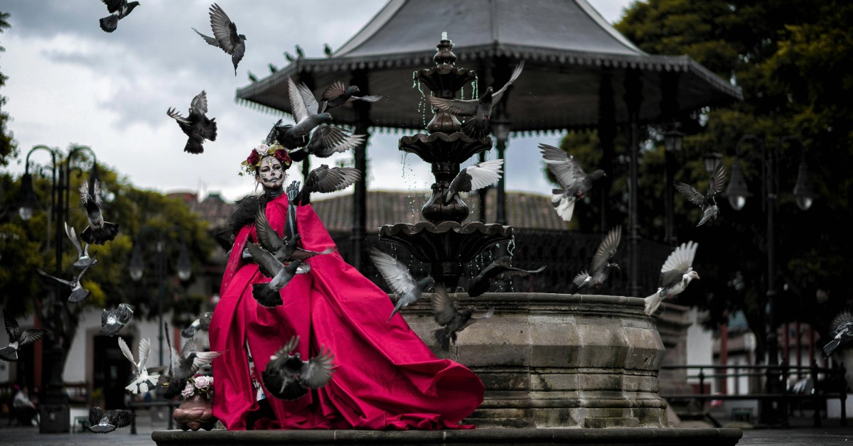
14. Day of the Dead in towns like Mixquic and Pátzcuaro is a full‑night greeting to ancestors, not just decoration
In places such as Mixquic (in Mexico City’s orbit) and Pátzcuaro (Michoacán), Día de Muertos is lived as an ongoing conversation with the dead—families don’t just set up pretty altars; they keep vigil, prepare meals, and sit beside graves all night as if their loved ones are arriving for dinner. In Mixquic, the tradition includes overnight cemetery vigils where families clean and decorate graves with marigolds, candles, photos, and favorite foods, then quietly wait beside them. The atmosphere is solemn but intimate: people talk to the deceased, share stories, and only pack up the food after the dawn hours, signaling the end of the visit.
In Pátzcuaro and its surrounding Purépecha communities, the ritual deepens into what locals call “Noche de Muertos.” On the night of November 1st, candlelit processions move toward islands like Janitzio, while families on the mainland light tens of thousands of candles in cemeteries, lay trails of cempasúchil (marigold) petals, and maintain elaborate ofrendas. These altars are stocked with the deceased’s favorite foods and personal items, and the vigils last through the night—there is no rush to “see and go.” The dead are treated as guests of honor; the living make space, light, and conversation, believing the spirits return to feed, rest, and reconnect.
These traditions are rooted in deeper indigenous cosmologies where death is part of a cyclical relationship, not an end. The ofrendas, marigold pathways, and candlelit watches are practical invitations—marking the way, illuminating the night, and signaling hospitality. The experience in both Mixquic and Pátzcuaro is often described by participants as a shared meal, a family reunion, and a sacred duty, far removed from the commodified versions tourists sometimes encounter.

15. The “Mexican standoff” phrase may trace conceptually to borderland standoffs in northern Mexico
The earliest known appearance of the phrase in print is March 19, 1876, in a New York paper (the Sunday Mercury), in a story set in Mexico about a bandit who robs a traveler but lets him go—suggesting the original nuance was someone losing money but keeping their life, a kind of uneasy outcome. Over time, the term shifted in U.S. English to mean a confrontation where no side can safely advance or retreat—what we now call a stalemate or deadlock.
Popular explanations and folk memory (including some from people in northern Mexico or borderlands) link the phrase to real or imagined tense stand-offs among bandits, vaqueros, and frontier figures where neither side would fire for fear of mutual destruction, giving it a cultural “borderland” flavor. That borderlands origin story circulates in informal forums and anecdotal accounts, but it lacks clear documentary support as the linguistic source; instead, early American usage appears tied to broader stereotypes and sometimes derogatory framing of Mexicans in the 19th century.
By the early 20th century, the phrase had fully crystallized in English as a term for any impasse in which no participant can act without triggering reciprocal harm—what makes a “Mexican standoff” distinct from a simple tie is that withdrawal isn’t safe either, so the tension holds until negotiation or outside intervention.
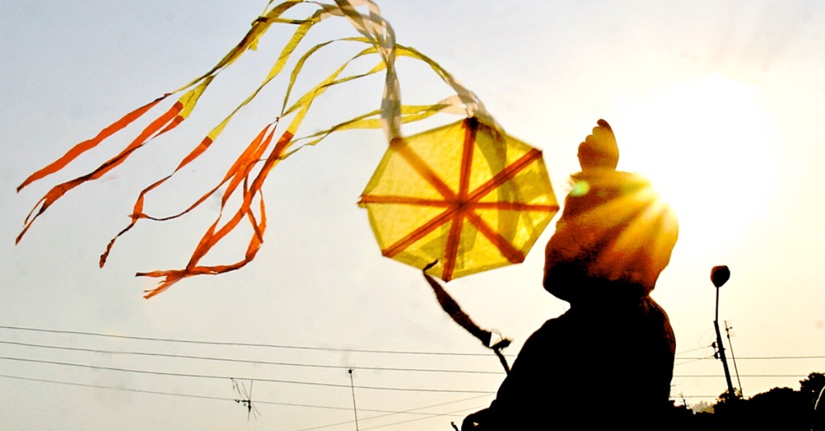
16. ‘Sky messages’ like papalotes (kites) or folded prayer planes are used in some rural festivals
In communities like San Mateo del Mar in Oaxaca (home to the Ikoots/Huave people), papalotes aren’t mere playthings—they’re vehicles for communication with ancestors. During Day of the Dead observances, children and adults build and fly kites to help souls “descend” or return; the higher the kite flies, the faster it is believed the spirit can reconnect. The practice is taught from a young age, passed generationally, and treated as a vital cultural duty. Kites are carefully constructed (and sometimes repaired in schools as part of cultural recovery), and each flight carries intention: a message, a greeting, a prayer. The tradition was nearly lost in some places but has been revived through community and educational efforts to reassert identity and maintain the link between the living and the departed.
That idea—sending deliberate messages aloft—finds echoes across Mesoamerica. In Guatemala’s giant kite festivals (especially in Sumpango and Santiago Sacatepéquez), massive kites are flown to honor the dead with images and written messages; smaller kites carry specific prayers or moral calls, and the act is described as a dialogue with ancestors and community conscience. While the scale differs, the underlying logic—using the sky as a conduit for memory, petition, and reunion—is shared.
Together, these practices show a regional thread: the vertical movement of a kite becomes a metaphorical and literal bridge, lifting voices upward while drawing the dead back into the circle of family and community.
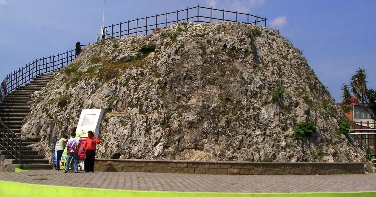
17. The world’s smallest volcano, Cuexcomate, is in Puebla, and visitors can climb it
In Puebla city, the Cuexcomate volcano—often called the world’s smallest—is only about 13 m tall. It’s an extinct geyser cone you can walk down into via a spiral staircase. Tourists and geology students visit, and it’s part of local educational routes.
Cuexcomate’s squat, conical shape gave rise to its tourist nickname, “the smallest volcano in the world,” but geologically, it is not a volcano. It’s the sinter cone of an extinct geyser (or hydrothermal vent) formed by geothermal circulation—likely activated before or around the 1064 eruption of Popocatépetl—when thermal waters pushed up through Mesozoic limestone and deposited calcite, building the cone over time. The structure is about 13 meters tall, with a base diameter of roughly 23 meters, and its inner crater is approximately 8 meters wide and 17 meters deep.
What makes Cuexcomate unusual and visitable is that tourists can descend via a metal spiral staircase into its interior crater. The inside is an enclosed hollow, once part of a geyser system, now mostly dry, and occasionally used for cultural events. The name comes from the Nahuatl cuezcomatl (a storage vessel), reflecting local metaphorical language around the shape. Over centuries, it accumulated myths—some saying it was used for sacrifices or linked to underground tunnels—but today it’s promoted as a quirky geological attraction in Puebla city, complete with local guides recounting both science and legend.
Though sometimes still labeled a volcano in popular materials, scientific sources and local interpretive content clarify its true nature as a calcitic geyser deposit, making it a rare place where visitors can walk into the “belly” of a geological feature that looks volcanic but tells a different story.
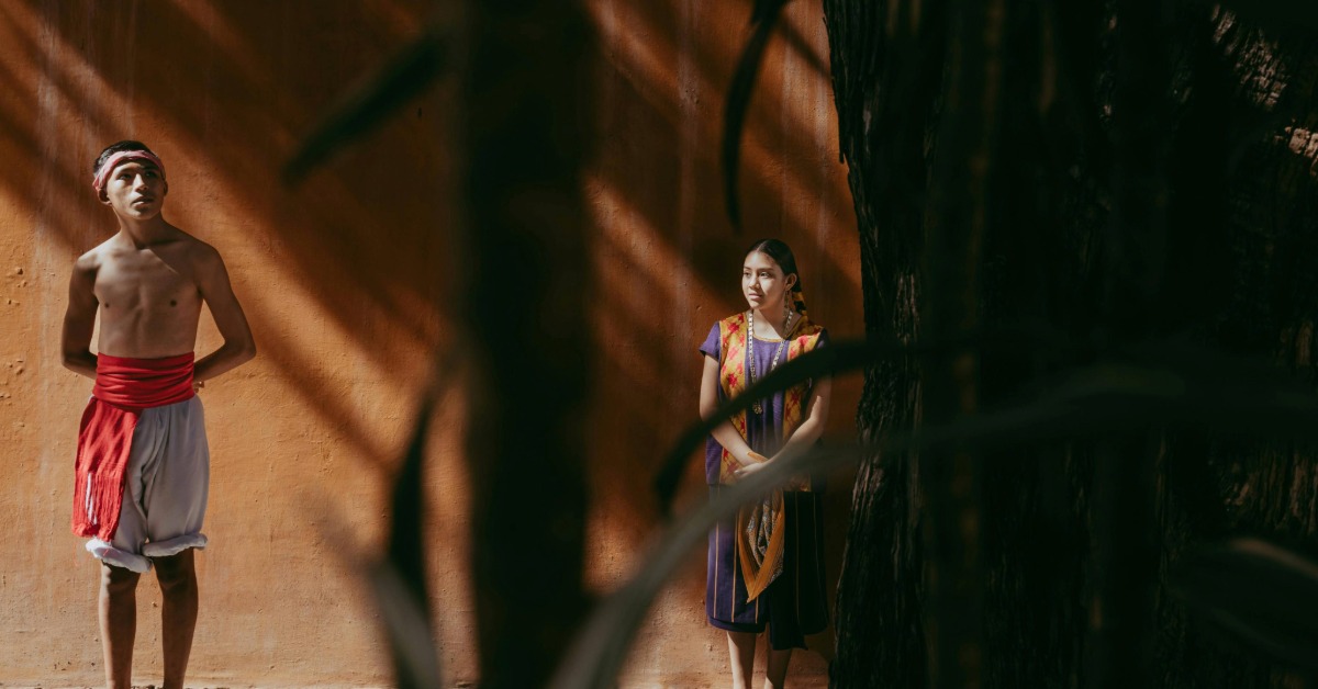
18. The discovery of pre‑Hispanic language diversity: Oaxaca alone has over 16 indigenous languages
Mexico is one of the most linguistically diverse countries. In Oaxaca state alone, there are 16+ living indigenous languages, including Zapotec, Mixtec, Triqui, Trique, Chinantec, and others. That linguistic complexity rivals many European nations. UNESCO works to preserve these languages, many of which have oral traditions only. (INEGI and UNESCO reports.)
Oaxaca’s language landscape rivals entire continents. The state officially counts 16 major indigenous language groups—including Zapotec, Mixtec, Mazatec, Chinantec, Mixe, Chatino, Trique, Huave, Cuicatec, Amuzgo, Oaxacan Chontal, and smaller ones like Ixcatec and Popoloca—many of which break further into dozens of mutually unintelligible dialects or variants. For example, Mixtec alone has 29 dialects; Chinantec encompasses multiple distinct languages; and Zapotec is itself a complex family with hundreds of thousands of speakers across regional subgroups.
That density of language is why linguistic scholars compare Oaxaca’s internal diversity to that of all of Europe—five indigenous linguistic families plus Spanish coexist in a relatively compact geographic area, and the combinations of family, regional, and community-level variation create a mosaic where neighboring towns can speak languages that are not mutually understandable.
The richness is fragile. Many of these languages and their variants are endangered; Mexico’s broader catalog includes 68 recognized indigenous languages and 364 linguistic variants, and Oaxaca contributes a large share of that diversity. Preservation efforts—through bilingual education, legal recognition, community-driven documentation, and cultural revival—are active but face pressures from migration, stigma, and the dominance of Spanish. Indigenous activist and rights movements, as well as UNESCO and national bodies like INALI, are working to keep these tongues alive, because each carries unique worldviews, oral histories, and knowledge systems.
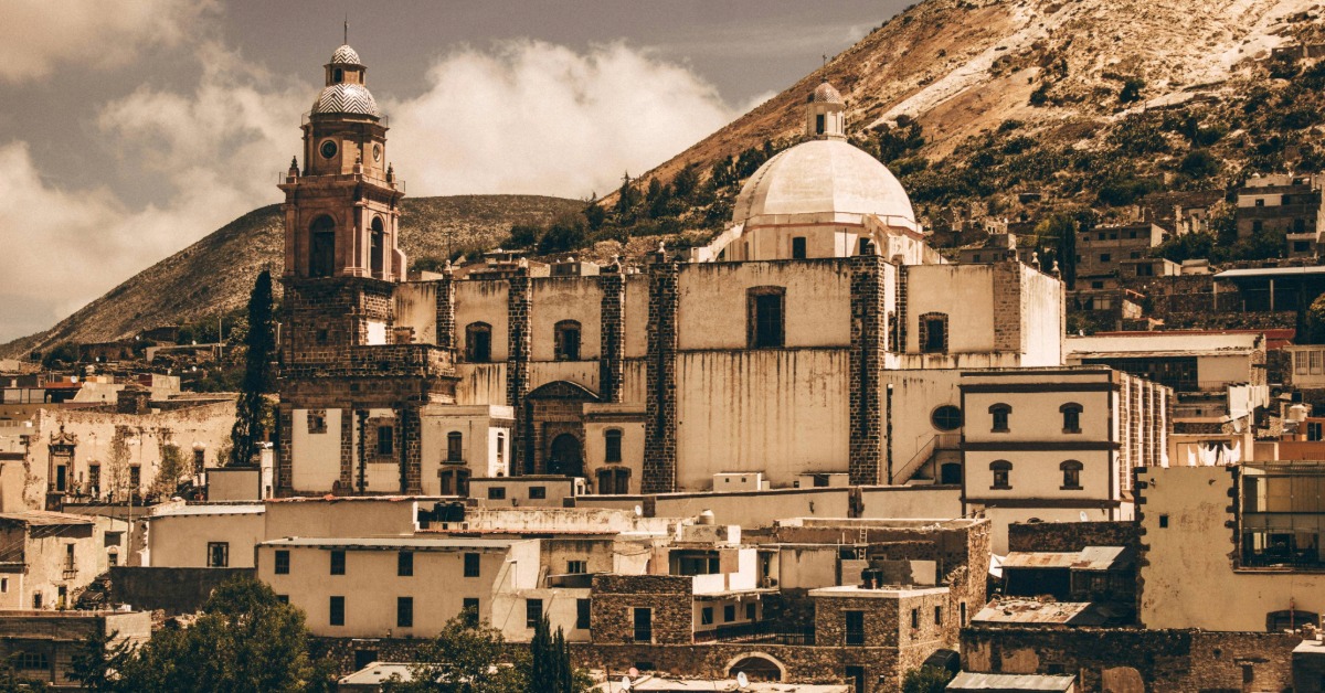
19. There’s a town (Real de Catorce) with an abandoned silver-mine ghost village where silence is preserved
Real de Catorce, in northern San Luis Potosí, rose in the 19th century as a silver mining boomtown and then largely emptied when silver prices collapsed. Today it exists in a layered state: part pueblo mágico with over a thousand residents and tourism infrastructure, part “ghost town” in its abandoned shafts and ruins, and importantly, a sacred pilgrimage site for the Huichol (Wixarika) people. The nearby Cerro El Quemado and the surrounding desert are central to Huichol cosmology and annual peyote rites; pilgrims travel there on foot in long, symbolic journeys to connect with ancestral and spiritual worlds.
That spiritual dimension carries rules of conduct. In areas tied to Huichol ceremonies and near sacred sites, there is an unofficial preservation of silence and restraint—not as a curated tourist “quiet zone,” but as a cultural norm rooted in respect for ongoing ritual life. Visitors are often warned to avoid disrupting ceremonies; guides stress not entering certain areas during active pilgrimages, and some sectors limit loud activity to prevent interference with the contemplative and sacred atmosphere. The tension between the town’s popular, sometimes noisy tourist side and these quieter spiritual zones creates the sense of stepping into different temporal layers, where silence itself becomes part of the lived memory of abandonment, reverence, and continuity.
Real de Catorce’s “ghost town” branding leans on its abandoned mining infrastructure and desert stillness, but the deeper quiet in pilgrimage contexts is intentional—an act of cultural safeguarding, where silence is a form of respect and connection. That makes the place feel both haunted and alive: the ruins echo history, while the Huichol presence and their protected ceremonial rhythms keep parts of the landscape intentionally undisturbed.
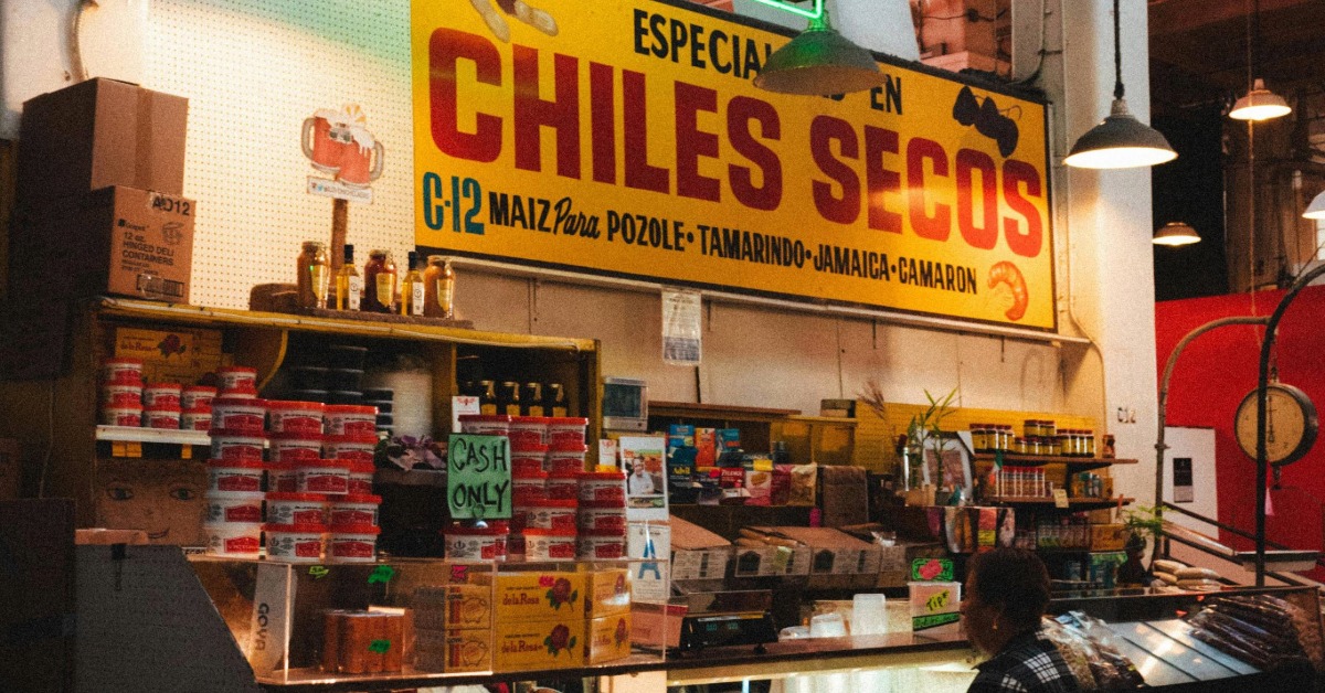
20. Hatch chile terroir: the flavor of chilies depends on soil and microclimate
In Mexico, chilies aren’t generic heat carriers; their flavor reflects the soil, altitude, microclimate, and local handling where they’re grown. Pasilla de Oaxaca—the smoked, dried form of the fresh chilaca pepper—is prized specifically because of the hills and mountain microclimates of Oaxaca. Its deep, smoky, fruity complexity comes from that place: growers in regions like the Sierra Norte and Mixe highlands cultivate variants (including Pasilla Mixe) whose flavor and heat profile shift with altitude, rainfall patterns, and traditional smoking techniques. Producers and chefs treat these chiles as terroir-driven ingredients—swap them for a non-Oaxacan substitute and the character of a mole or salsa changes noticeably.
Other Mexican chiles show similar regional signatures. Chile de árbol from different states carries variations in brightness and sharpness depending on soil and sun exposure, used in salsas and condiments where its clean heat is essential. Ancho (the dried ripe poblano) and guajillo reflect their origins in terms of sweetness, earthiness, and subtle fruit notes—local soil and climate influence their sugar development and skin thickness, which in turn affects texture and depth when rehydrated. Mexican cooks and markets often distinguish between these by origin because the same species from another valley or region can lack the nuanced balance valued in regional recipes.
The concept shows up in culinary practice: like wine, chefs and farmers in Mexico talk about “knowing where the chile comes from” because the combination of geography and traditional post-harvest treatment (drying, smoking, storing) locks in flavors tied to place. That’s why authentic regional dishes—Oaxacan moles, Puebla’s sauces, Yucatecan recados—depend on chilies grown and processed in their home terroirs, making those peppers part of a geographic flavor identity.
The more you look, the less “done” Mexico feels. These 20 facts are starting points, not finish lines. They’re invitations to ask questions, to take a different street, to sit longer with someone who remembers things differently. If the familiar version of Mexico is what brought you here, let these lesser-known threads be the ones that keep you coming back.