The center of Tropical Depression “TRECE – E” in the Pacific Ocean is located south of the coast of Oaxaca. Its cloud bands will cause intense rains with torrential downpours in the south and southeast of the country. The storm is expected to strengthen overnight and by Friday morning become Tropical Storm Lester.
A tropical storm watch has been issued from Lagunas de Chacahua, Oax. to Zihuatanejo, Gro.
In the next 24 hours: Intense rains with localized torrential rains are expected in Chiapas (southwest and south). Very strong rains with intense localized rains are expected in Guerrero, Oaxaca, Veracruz, and Tabasco. These rains will cause an increase in the levels of rivers and streams, with the potential of creating landslides and floods in low areas of those states.
The storm is generating winds with gusts of 50 to 60 km/h and waves of 1 to 3 meters high on the coasts of Oaxaca and Chiapas.
Take extreme precautions in the areas of the states mentioned due to rain, wind, and waves (including maritime navigation) and attend to the recommendations issued by the authorities of the National Civil Protection System, in each state.
Puerto Vallarta isn’t out of the woods

The rains from a weakened Tropical Storm Lester could reach Puerto Vallarta in the early part of next week with heavy rains. People living in low-lying areas and near rivers and streams should monitor the forecast over the weekend.
Another Pacific storm southwest of Jalisco has an 80% chance of tropical storm development over the weekend that could impact Puerto Vallarta at the same time as the remnants of Tropical Storm Lester arrives along the coast of Jalisco.
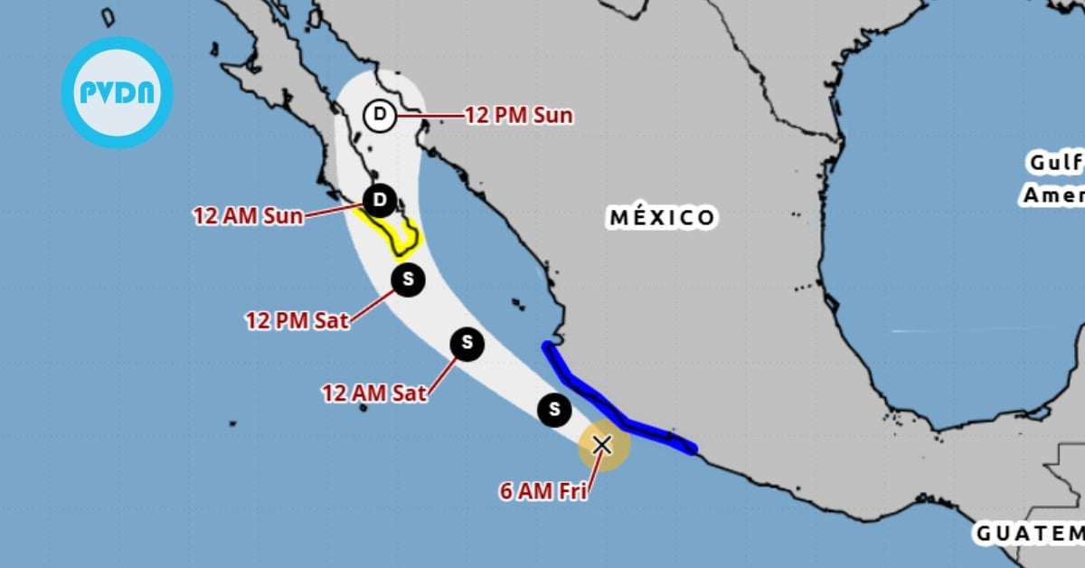
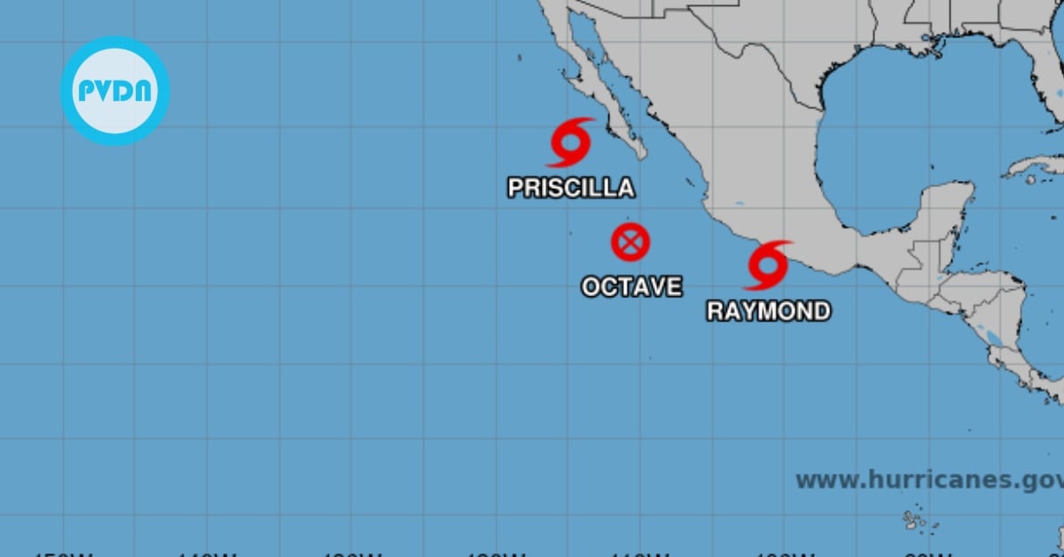
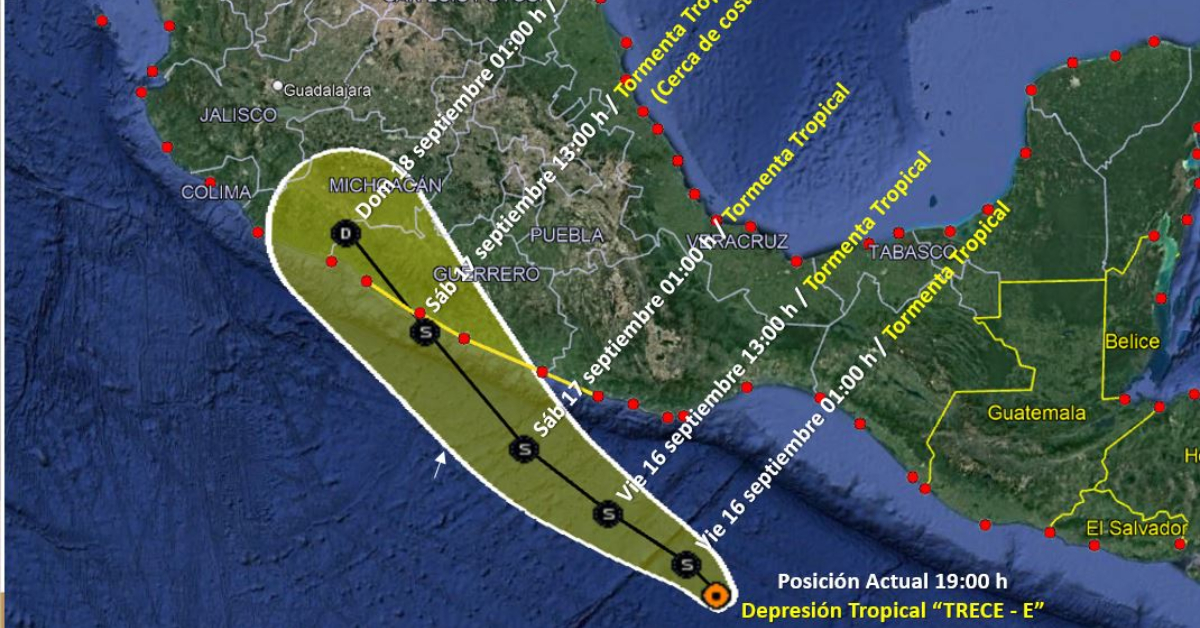
The center of Tropical Depression "TRECE - E" in the Pacific Ocean is located south of the coast of Oaxaca. Its cloud bands will cause . . .