Cancún’s surface may look solid, but city officials say some risks begin several meters underground. A new radar tool is changing how Benito Juárez Civil Protection checks streets, parks, and public areas before visible damage appears. The findings point to a wider issue beneath one of Mexico’s fastest-growing urban areas: karst soil, underground water movement, and aging infrastructure that can create hidden weaknesses long before a sinkhole opens.
Cancún turns to underground radar to spot hidden risks
Benito Juárez Civil Protection says ground-penetrating radar is changing how Cancún identifies possible sinkhole risks beneath streets, parks, and public spaces.
The agency says the equipment allows inspectors to look several meters below the surface before deciding how to repair or secure an area. That marks a shift from reacting only after cracks, depressions, or visible sinkholes appear.
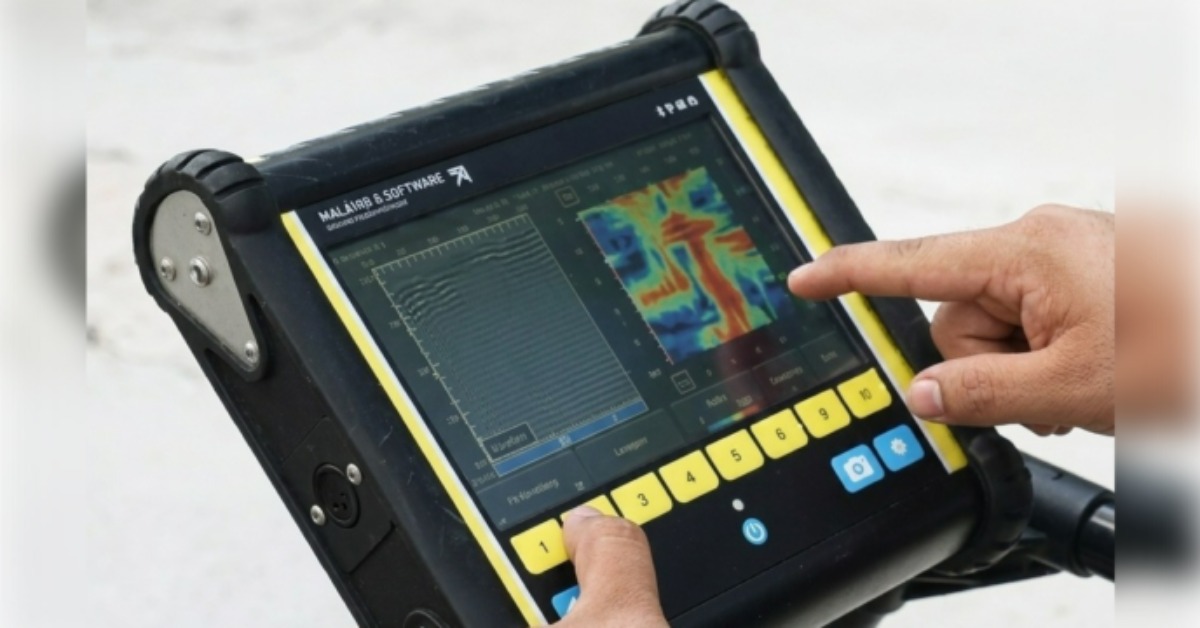
According to local Civil Protection information, the tool being used is an LMX-200 GPR georradar. It can scan up to about 8 meters deep and help detect underground cavities, moisture buildup, structural weaknesses, and damage associated with old or deteriorated infrastructure.
Officials say the rise in reported problem areas does not necessarily mean Cancún is suddenly developing more sinkholes. Instead, they say the city is now finding risks that were already underground but had not been properly diagnosed.
What the radar can see under Cancún
A georradar sends electromagnetic pulses into the ground. When those pulses encounter different materials, part of the signal is reflected back to the equipment. Those returns help technicians read changes below the surface.
In practice, the technology can help locate cavities, unstable fill, buried pipes, drainage lines, electrical infrastructure, and moisture patterns. Those details can guide repairs before crews dig into a street or fill a damaged area.
Civil Protection says this is important because surface repairs can miss the real cause of a problem. A depression in the pavement may be caused by water movement, poor compaction, a broken pipe, or a deeper cavity. Without a subsurface study, the same area may fail again.
The radar does not replace engineering judgment. It gives authorities a clearer picture of where to investigate and where to prioritize work. In karst areas like Cancún, that early information can make a major difference.
Why Cancún’s ground is different
Cancún sits in the Yucatán Peninsula, where much of the ground is karstic limestone. This type of terrain forms when water slowly dissolves rock over time, creating underground voids, caves, and channels.
That same geology is why the region has cenotes and underground water systems. It also means urban development sits above a landscape that can be more complex than it appears from the street.
Karst ground is not automatically unsafe. Much of Cancún has been built and used for decades. The challenge is that hidden cavities, water movement, and weak fill can become problems when heavy traffic, construction, storms, or aging infrastructure add pressure.
For residents, this helps explain why a small crack or dip in pavement should not always be dismissed as routine wear. In some cases, it may be the first visible sign of something happening below.
From emergency response to prevention
Civil Protection says it has been handling about one case per week involving possible underground risk. In a recent two- to three-month period, that represented roughly eight to 12 diagnoses.
The agency says the radar findings have mostly pointed to pre-existing problems, not newly formed hazards. That distinction matters because it changes how the city responds.
Instead of filling a visible hole and moving on, inspectors can now study whether water is moving underground, whether old infrastructure is damaged, or whether a deeper cavity needs attention. That can help public works teams decide whether to repair, reinforce, close part of a road, or monitor the site.
The approach also connects to broader urban planning. Cancún has grown quickly, and new neighborhoods, roads, and public works have placed more demand on land that was not always studied in detail before development.
What residents should watch for
For homeowners, drivers, and business owners, the main issue is not panic. It is reporting visible warning signs early.
Repeated pavement sinking, widening cracks, sudden dips, water pooling in the same spot, or holes forming near sidewalks and road edges can all deserve attention. A single surface flaw does not confirm a sinkhole, but it can help authorities decide where to inspect.
This is especially relevant during rainy periods. Water can expose weak areas, move through old fill, or worsen damage around drainage and utility lines.
Civil Protection’s use of radar gives the city a better tool to sort routine pavement problems from deeper concerns. It also gives residents a reason to report changes before they become emergencies.
A bigger test for urban safety
Cancún’s use of ground-penetrating radar reflects a more preventive approach to public safety. The city is not only waiting for sinkholes to appear. It is trying to identify risk before the ground fails.
That matters in a city where tourism, traffic, housing growth, and public works all depend on stable infrastructure. Roads, parks, utilities, and public spaces are part of daily life for residents and visitors alike.
The radar will not eliminate the risk that comes with karst soil. But it gives officials a better way to understand what is happening below the surface.
For Cancún, the larger question is whether this technology becomes part of routine planning, maintenance, and construction review. In a city built over complex ground, prevention may be the most important repair tool available.