A sargassum report can make Cancún sound either clear or covered, depending on which beach someone is talking about. The latest statewide monitoring showed every level at once, from beaches with no sargassum to beaches marked as excessive. That mixed picture matters for residents and visitors choosing where to swim, walk, or spend the day. The lesson is simple: do not read one beach report as a report for the entire coast.
Cancún sargassum changes beach by beach
A recent sargassum report for Quintana Roo showed a coastline with very different conditions from one beach to another.
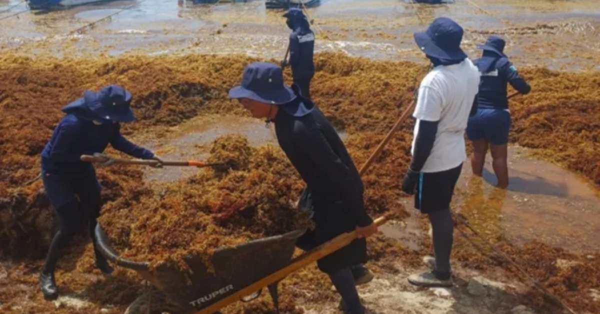
Out of 140 monitored beaches statewide, five had no sargassum. Another 31 had very low levels. The same report listed 24 beaches with moderate levels, 25 with abundant levels, and 55 with excessive levels.
That spread is the main point for anyone reading a sargassum semáforo. A statewide number can show the scale of the problem, but it does not tell you what one specific beach looks like that morning.
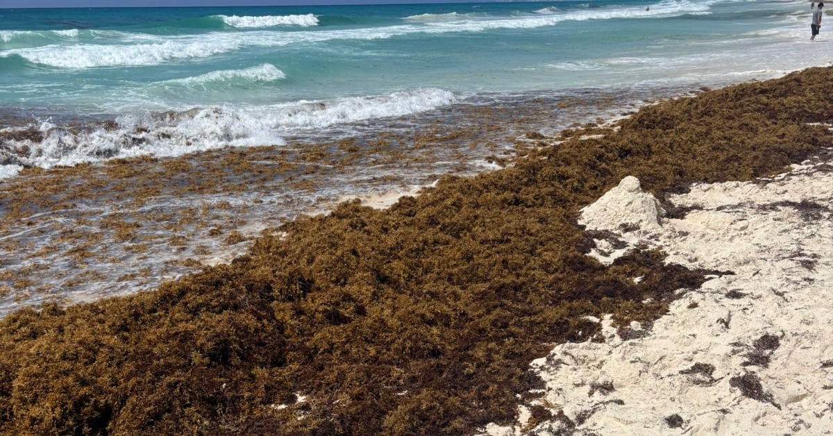
In Cancún, the same uneven pattern appeared within the destination itself. Beaches such as Playa del Niño, Puerto Juárez, Las Perlas, Langosta, Tortugas, and Caracol were listed green. At the same time, Punta Cancún, Gaviota Azul/Fórum, and Chac Mool were listed as red.
That means a person could see a clean-looking beach in one part of Cancún, then find heavy sargassum at another beach nearby.
How to read the sargassum semáforo
The sargassum semáforo is most useful when readers treat it as a beach-by-beach tool.
A green listing does not mean the whole area is clear. A red listing does not mean every Cancún beach is covered. The color applies to the beach named in the report.
For practical planning, it helps to look by area. North beaches, Hotel Zone beaches, Puerto Morelos, and Isla Mujeres can show different conditions on the same report. The same is true within Cancún’s Hotel Zone, where one public beach may show low levels while another may show excessive levels.
This is why the name of the beach matters. Searching only for “Cancún sargassum” can give a rough idea, but it may not answer the question most people actually have: which beach is better today?
Why conditions can change along the same coast
Sargassum does not arrive evenly. It moves with wind, currents, and the direction a beach faces.
In simple terms, wind and currents push floating sargassum toward some parts of the shore while leaving other areas with less accumulation. Beach orientation also matters. A beach facing one direction can receive more seaweed than a beach facing another direction.
That is why reports can show green and red beaches in the same destination on the same day. It is also why checking conditions once is not enough for a whole week.
A beach listed green today may not stay that way. A red beach may improve after a cleanup, a shift in wind, or a change in sea conditions. The report gives a snapshot, not a long-term guarantee.
What residents and visitors should check before choosing a beach
The most useful habit is to check the latest sargassum report before leaving home or a hotel.
Readers should look for the specific beach name, not just the municipality or destination. In Cancún, that can mean checking whether the report names Playa del Niño, Las Perlas, Langosta, Tortugas, Caracol, Punta Cancún, Gaviota Azul/Fórum, Chac Mool, or another beach.
For people who live in Mexico and travel within Quintana Roo, the same rule applies across the coast. A report covering 140 beaches is helpful because it shows the uneven pattern. It should not be reduced to one headline about whether Cancún has sargassum.