Hillsides failed in Los Cabos after a week of heavy rain and low-magnitude tremors. Now the municipality wants to modernize its planning, building, and preparation processes. The director of Civil Protection says two tools are due for a refresh: the local civil-protection bylaw and the municipal risk atlas. Both guide where homes can rise, how hotels harden, and when evacuations begin. If the updates land with teeth, they could reshape permitting on unstable slopes and standardize seismic and wind resistance across new projects. The question is how fast City Hall can deliver.
Los Cabos Civil Protection
Civil Protection confirmed it will seek updates to the bylaw and the municipal risk atlas, citing recent hillside slides in Cabo San Lucas and San José del Cabo. The agency says the atlas work began earlier in the current administration with firefighters, UABCS researchers, and other authorities. The bylaw exists but is outdated, according to director Francisco Cota. The goal is to incorporate seismic activity and hydrometeorological threats into new builds, enabling them to resist these events.
Officials are already taking parallel steps. In a recent council session, the Cabildo instructed the Municipal Civil Protection Council to review public and private structures and emergency protocols for earthquakes—an explicit push to tighten enforcement while the rulebook is rewritten.
Why the risk atlas matters now
The risk atlas is the map that decides what should be built, where, and with which safeguards. Los Cabos last publicized a significant municipal atlas effort in 2020 through its planning institute (IMPLAN), framing it as a tool to diagnose hazards and vulnerability; state academics completed a statewide atlas in 2024 and stressed that these instruments must be kept current. A static atlas lags reality when urbanization climbs into steeper, looser soils.
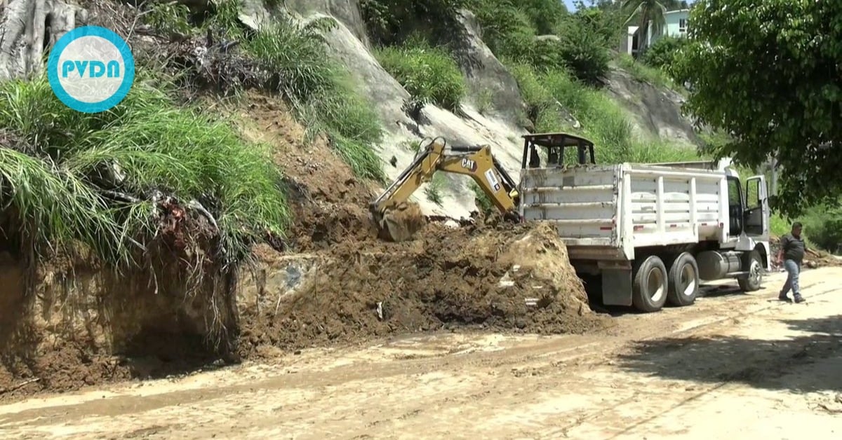
In early September, Tropical Cyclone Lorena drenched the southern peninsula and triggered slides and street flooding across Los Cabos. Local agencies and newsrooms documented slope failures in the Santa Rosa area and around Cabo San Lucas; firefighters logged responses tied to the storm’s rains. National and international outlets warned of landslide risk as Lorena crossed Baja California Sur.
Seismic jitters complicate hill-slope living
The peninsula’s crustal dynamics add another variable. The National Seismological Service has recorded multiple small quakes near San José del Cabo this month, including a widely noted magnitude 3.3, with dozens of micro-events reported in the area. Shaking on already saturated slopes amplifies slide risk even when magnitudes are modest. That mix of rain and tremor is the backdrop for the update push.
What may change for builders and residents
Reading the direction of travel, three policy lines are clear.
First, the bylaw update is likely to set firmer geotechnical requirements for permits on or below unstable hillsides, and tie approvals to atlas-based hazard zoning. The municipal government has a civil-protection regulation in force today; officials say it is “very out of date,” which suggests new chapters on slope stability, evacuation routes, and inspection triggers after heavy rain or felt quakes.
Second, the atlas refresh should sync with the 2024 state atlas and the National Risk Atlas portal, so municipal maps align with current rainfall, flood, landslide, and wind models. That alignment matters for insurance, disaster funds, and post-storm rebuilding rules.
Third, enforcement may tighten. The Cabildo’s instruction to review structures and protocols after the recent quakes points to more inspections across public buildings, hotels, and high-occupancy venues. That could mean more apparent retrofit timelines for older properties and stricter temporary closures when thresholds are met.
How fast can City Hall move
Civil Protection says the atlas work began early in this administration, with UABCS experts and first responders at the table. The pace now will hinge on contracting, data integration, and public consultation. State authorities have pressed municipalities to keep atlases current, and UABCS researchers argue for updates on a regular cycle to keep policy in step with growth. If Los Cabos follows that advice, residents should see draft maps and rules move through commissions before the next peak-rain window.
The Santa Rosa slide destroyed a vehicle but spared lives. Other slope failures forced precautionary checks, evacuations, and long detours as crews cleared mud. For hillside neighborhoods, the measure of success will be less drama during the next downpour: fewer emergency calls, fewer red-tagged homes, more precise guidance for where to build and where to walk away. That is what a living atlas and a modern bylaw are supposed to deliver.