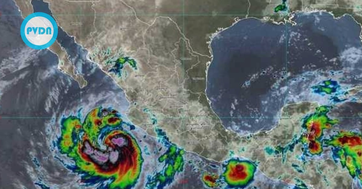
Officials in Los Cabos moved first—ordering Los Cabos hurricane evacuations in known high-risk zones and opening shelters before Hurricane Priscilla’s worst weather arrives. The call came with surf already building and a slow-moving storm still fanning influential bands across the Pacific coast. Civil Protection says evacuations are preventive, not a matter of panic, and emphasizes a simple goal: to get families out of floodplains and away from unstable slopes while there’s still time. Ports face restrictions, beaches are under watch, and more bands are on the way tonight.
Authorities in Los Cabos have activated Los Cabos hurricane evacuations in high-risk neighborhoods and opened temporary shelters as Hurricane Priscilla crawls north-northwest off Mexico’s Pacific coast. Local officials say the move is preventive. The aim is to protect families in flood- and landslide-prone areas before the worst bands arrive.
The municipal Civil Protection council is meeting in permanent session. The mayor’s office urged residents to follow official channels and prepare to relocate if asked. Beach lifeguards and inspectors expanded patrols as surf built along the corridor. Shelters are on standby for people living near arroyos and unstable slopes, where runoff can turn sudden and violent.
Forecasters at Mexico’s water commission and national weather service expect Priscilla’s broad rain bands to drive dangerous seas, strong gusts, and periods of heavy rain across the central and northwestern Pacific states. While the hurricane’s center has tracked parallel to the coast, its slow motion and wide wind field increase the risk of prolonged swells and persistent onshore flow. That raises flood risk even without a direct hit.
In Los Cabos, state and federal agencies coordinated port restrictions and beach warnings as conditions deteriorated. Local outlets reported a temporary closure at the Cabo San Lucas port and preparations to scale up shelters if needed. Officials stress that early evacuations ease pressure on rescue crews once conditions worsen.
Los Cabos hurricane evacuations
The evacuation orders target zones flagged in the municipal risk atlas—low-lying colonias near riverbeds and steep hillsides where slides are standard after intense rain. Civil Protection teams have been canvassing at daybreak, using loudspeakers and door-to-door outreach in Spanish to move people well before nightfall. A parallel effort is underway to check signage and access at designated shelters, ensuring that potable water and basic supplies are in place.
Priscilla’s winds and surf have already forced authorities along the Pacific to restrict small-craft navigation in several ports. The system intensified to Category 1 and held a slow course, sending long-period swells toward the Baja California Sur coast. National updates warn of intense rainfall bands, with risk of flash flooding and rapid rises in arroyos. Residents in informal housing and those with mobility challenges are being prioritized for transport.
Regional media note that evacuations aren’t limited to Baja California Sur. Municipalities in neighboring states have also begun moving families from floodplains as bands sweep north. The common theme is speed: move early, avoid nighttime rescues, and keep beachgoers out of dangerous rip currents. Local lifeguards and maritime authorities are enforcing beach closures where necessary.
Officials emphasize the storm’s pace could prolong hazards. A slow system can continue to accumulate water along exposed coastlines and saturate slopes over days, not hours. That explains the conservative call in Los Cabos: activate shelters before they are needed, not after. Forecast discussions suggest that Baja California Sur will continue to experience rough seas and intermittent bursts of heavy rain as the week unfolds. Some models point to remnant energy reaching the peninsula late in the week, but confidence hinges on the storm’s crawl and interaction with cooler waters.
What to expect next
Expect more rain bands, elevated surf, and intermittent gale-force gusts, especially along open beaches and headlands. The municipal council plans to keep its session open through the night and into tomorrow to adjust shelter capacity and, if required, expand the evacuation footprint. Port captains will reassess restrictions with each advisory, and beach closures will be based on surf and rip-current strength.
For residents, the guidance stays calm and straightforward: if you live near an arroyo or a slope that slides, relocate to the nearest shelter or with family inland. Keep phones charged, secure documents, and avoid driving through flowing water. For visitors, respect beach flags and closures and stay off breakwaters and rocks. The ocean will look dramatic; it will also be unforgiving.