
CDMX – Authorities in Mexico City have kept high-level weather alerts in effect today, following Sunday night’s torrential downpour that paralyzed transportation, flooded the airport, and left streets impassable across multiple boroughs. The storm was described by meteorologists as the most intense of the season. It disrupted daily life on a scale the city has not seen in years.
Overnight Chaos and Record Rainfall
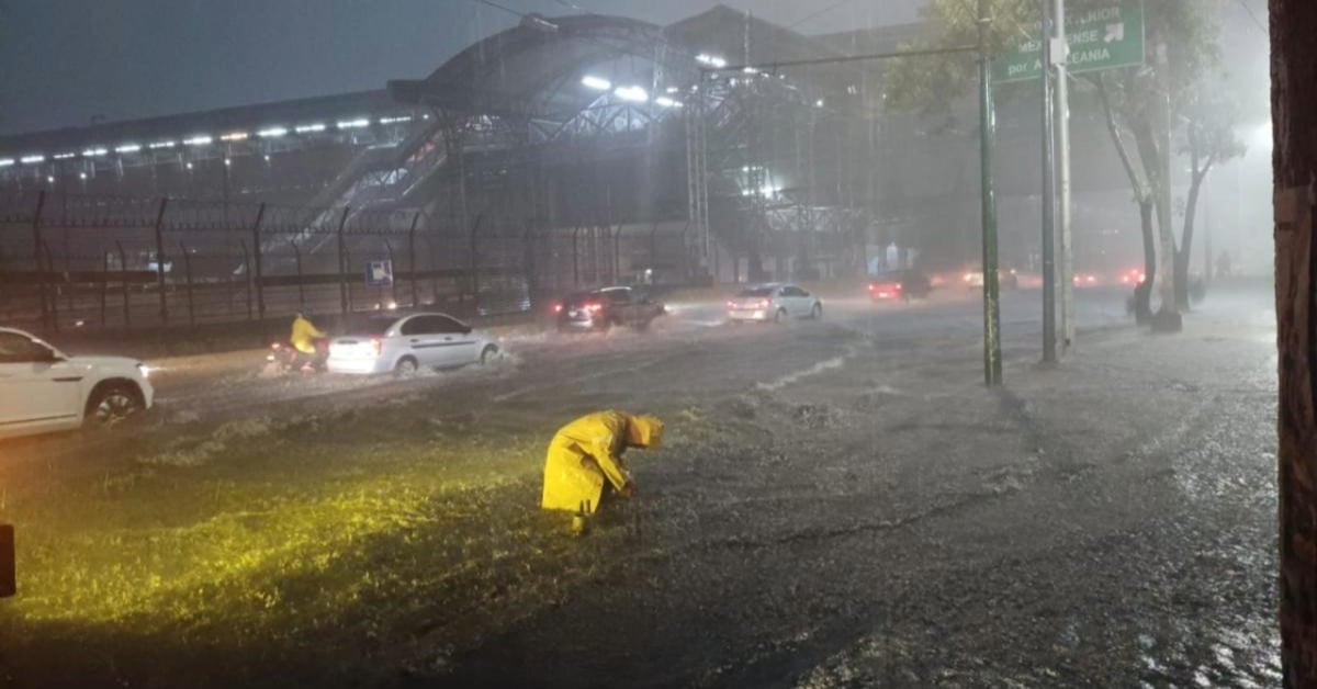
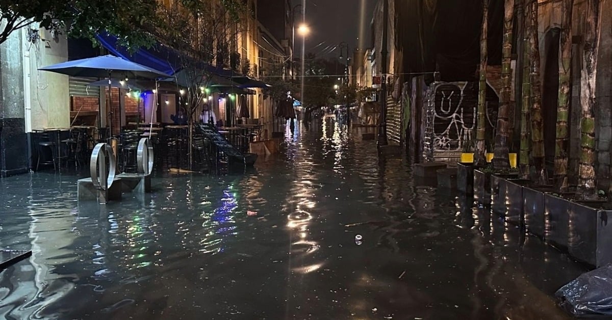
On the night of August 10, residents across Mexico City witnessed extraordinary rainfall that tested the limits of the city’s drainage systems. At the Zócalo, precipitation reached 67 millimeters, making it the heaviest recorded in that location since 1952. In the Centro Histórico, the rainfall total climbed even higher, reaching 84 millimeters. An astonishing 50 millimeters fell in just 20 minutes. This deluge quickly overwhelmed infrastructure, especially in neighborhoods with older drainage systems. Nonetheless, even areas with recent public works projects experienced significant flooding.
The force of the storm turned streets into rivers within minutes. Videos circulating on social media showed stranded vehicles, water rushing into storefronts, and pedestrians wading through waist-deep water. Emergency services reported receiving hundreds of calls from residents whose homes or businesses had flooded. Power outages were reported in multiple boroughs.
Transportation Comes to a Standstill
The city’s transportation system was among the hardest hit. Operations at Benito Juárez International Airport were suspended at 7:45 p.m. Severe flooding on the runways, combined with near-zero visibility, made takeoffs and landings unsafe. Flights were diverted to other airports, and several incoming planes were forced to circle until conditions improved. Terminals also reported flooding, despite maintenance and drainage improvements made over the past two years.
The Metro system faced significant challenges of its own. A short circuit on Line 2 caused an explosion and led to a service shutdown lasting more than 90 minutes. Flooding also forced temporary closures at stations along Lines 3 and 5, leaving thousands of commuters stranded. The Metrobús system suffered as well, with severe delays on Lines 4, 5, and 6 due to impassable streets. Authorities warned that even after the water receded, residual effects on the transport network would likely continue into Tuesday.
Authorities Mobilize Under Plan Tlaloque
In response to the chaos, the city activated Plan Tlaloque, a coordinated emergency protocol designed to respond to severe flooding. More than 140 engineers, technicians, and emergency crews were dispatched to address 41 critical incidents. These included submerged streets, toppled trees, and stranded motorists. The boroughs most severely affected included Cuauhtémoc, Azcapotzalco, Álvaro Obregón, Benito Juárez, Iztacalco, Miguel Hidalgo, and Venustiano Carranza.
Mayor Clara Brugada urged residents to exercise extreme caution, noting that August and September historically bring the heaviest rains of the year. While she acknowledged that millions of pesos had been invested in drainage and flood prevention systems, she conceded that no infrastructure could fully withstand the kind of intense rainfall experienced on Sunday night. President Claudia Sheinbaum echoed that sentiment and confirmed that federal assistance would be directed to the areas most heavily impacted.
Double Alert Issued for Monday
The Secretaría de Gestión Integral de Riesgos y Protección Civil (SGIRPC) issued a double weather alert for Monday, August 11. They warned residents to prepare for additional heavy rainfall and possible hail between 2:00 p.m. and 10:00 p.m. Under the current forecast, several boroughs—including Álvaro Obregón, Azcapotzalco, Cuajimalpa, Gustavo A. Madero, Magdalena Contreras, Miguel Hidalgo, and Tlalpan—are under an orange alert. This means rainfall could reach between 30 and 49 millimeters and be accompanied by hail.
Other boroughs, including Benito Juárez, Coyoacán, Cuauhtémoc, Iztacalco, Iztapalapa, Milpa Alta, Tláhuac, Venustiano Carranza, and Xochimilco, remain under a yellow alert. This forecasts precipitation levels between 15 and 29 millimeters, also with a possibility of hail. Authorities emphasized that even moderate rain could cause localized flooding in areas still recovering from Sunday’s storm.
Safety Measures for Residents
Authorities are advising residents to remain indoors during the alert period unless travel is necessary. Homeowners are encouraged to inspect and clear gutters, drains, and grates to prevent blockages that could worsen flooding. In public spaces, caution is urged around unstable trees, loose signage, and downed power lines. People are also being reminded to avoid crossing flooded streets, both on foot and by vehicle, as water depth and current can be deceptive and dangerous.
Sunday’s storm serves as a stark reminder that Mexico City’s infrastructure remains vulnerable to extreme weather events, even after significant investment. With the rainy season only halfway through, both city and federal governments face mounting pressure to strengthen flood prevention systems. They also need to enhance emergency response capacity. For now, the immediate focus remains on clearing the damage from Sunday night and preparing for the possibility of another disruptive storm in the days ahead.