
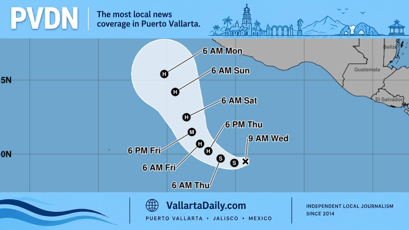
Puerto Vallarta, Jalisco, October 21, 2026 — Tropical Depression Twenty-Two-E formed south of Mexico Wednesday, and forecasters expect it to strengthen rapidly into a hurricane by Friday.
The National Hurricane Center issued its first advisory at 9 a.m. Puerto Vallarta time. Its initial five-day forecast keeps the center offshore and south of Puerto Vallarta through Monday, October 26.
For people around Bahía de Banderas, the question is whether this developing system could bring another round of dangerous weather to the coast.
Forecasters’ first concern is ocean swell. The NHC’s Wednesday morning advisory says swells should begin reaching parts of southern and southwestern Mexico this weekend and continue into next week, potentially producing dangerous surf and rip currents.
At 9 a.m., the depression was about 825 kilometers south of Acapulco, with maximum sustained winds of 55 km/h. It was moving west at approximately 11 km/h, well away from Puerto Vallarta.
That relatively modest wind speed is expected to change quickly.
In its first forecast discussion, the hurricane center projected winds reaching 115 mph, approximately 185 km/h, by Friday evening. That would make the system a Category 3 hurricane.
“Environmental conditions are highly conducive for rapid intensification,” NHC forecaster Kelly wrote.
The discussion describes very warm ocean water, abundant moisture, and little vertical wind shear — changes in wind speed or direction with height that can disrupt a developing cyclone. Together, those conditions give the depression room to strengthen.
Its direction also deserves attention. Forecasters expect the initial westward movement to gradually turn northwest, then north-northwest, as the system moves around an area of high pressure over Mexico.
The first forecast places its center near 15.4 degrees north latitude on Monday morning, still well south of Puerto Vallarta. That five-day outlook does not indicate where the system will go after Monday.
For residents making plans on the water, the coastal forecast can become relevant before a storm approaches land. For example, someone arranging a fishing trip or a boat ride across the bay this weekend would need to check local marine conditions and any harbor master’s restrictions alongside the hurricane’s track.
The regional swell forecast does not yet provide a specific wave height or arrival time for Bahía de Banderas.
Recent events show how those decisions can differ from simply watching the storm’s center. As Vallarta Daily reported when Puerto Vallarta’s port reopened Monday, large and small vessels could resume navigation after Trudy moved offshore. Separate coverage that day documented continued concern over dangerous surf and rip currents.
The official eastern Pacific hurricane season continues through November 30. Wednesday’s development leaves another system to follow as coastal communities still deal with the practical consequences of recent storms.
The next complete NHC advisory is scheduled for 3 p.m. Puerto Vallarta time Wednesday, providing the next update on how quickly the depression is strengthening and where its northward turn could take it.