A stubborn rain system over Playa del Carmen prompted the city to take action, dispatching 17 emergency brigades to clear drains, guide traffic, and inspect known flood-prone areas. Officials warned the instability could last several days and asked residents to stay alert, avoid tossing trash that blocks grates, and report hazards. Behind the wet stretch: a tropical wave interacting with an upper-level trough over the Yucatán, a setup that can keep storms firing even when the sun briefly returns. Here’s what the city did—and what residents can expect next.
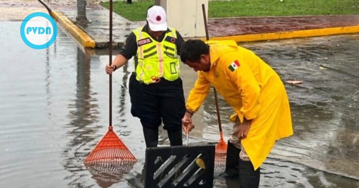
The city dispatched 17 emergency brigades onto Playa del Carmen’s streets as heavy showers settled in this week, prioritizing drain clearing, traffic safety, and rapid assistance for residents in flood-prone areas. City Hall said Public Services crews and Civil Protection teams fanned out to keep water moving and roads open while the system remains in place. The mayor asked people to remain cautious and follow official updates, noting that the instability could persist for several days.
Playa del Carmen rains
Workers rotated through known trouble spots, lifting grates, vacuuming debris, and checking absorption wells as bursts of rain swept from the coast across neighborhoods. Civil Protection urged drivers to slow down—particularly near the shoreline—where stronger onshore gusts and higher surf can push water onto low sections of road. Officials also repeated a familiar ask: don’t toss trash on the street. A single bag can seal a drain and pool water into someone’s doorway in under an hour when bands of rain stack up.
Behind the wet spell is a straightforward tropical pattern. A tropical wave—tagged as Tropical Wave 34 by forecasters—interacted with an upper-level trough over the Yucatán, a combo that feeds clouds and repeated downpours. Mexico’s weather service has called for strong showers in Quintana Roo during this window, with storms flaring on and off through midweek. Local advisories in Solidaridad have echoed that outlook, flagging periods of heavy rain, lightning, and gusty winds.
What it means for residents as the system lingers
For now, the city’s “all-hands” posture is about keeping the little things little. Clearing a curbside pile can mean the difference between a wet lane and a blocked avenue. Crews will continue to check known low points and school zones, monitoring how water drains as showers recur. If you commute early, expect slick patches and occasional lane closures where crews are working. If you live near a canal, keep your entrance and sidewalk clear and move cars off corners so trucks can reach the grates quickly.
This isn’t a landfalling cyclone for the Caribbean side. Still, the broader atmosphere is busy: elsewhere in Mexico, the Pacific storm Narda has been driving its own rain story, and the national forecast continues to advertise strong to extreme rainfall across several states, including parts of the Yucatán Peninsula. That backdrop helps explain why the showers here may feel relentless even between sunny breaks. The advice from Civil Protection holds: monitor official channels, respect beach and port guidance, and call 9-1-1 for emergencies.