Jalisco Civil Protection has called on residents, public agencies, schools, businesses, and community groups to take part in a macro-drill on May 6 at 11:00 a.m.
The exercise will simulate a magnitude 8.0 earthquake in the Pacific Ocean, off the coast of Chamela in the municipality of La Huerta. The hypothetical quake would occur at a depth of 13 kilometers.
The scenario also includes a tsunami affecting coastal communities near the epicenter. State officials say the exercise is designed to test response capacity, evacuation planning, and coordination between authorities and the public.
This is a drill, not a forecast. Authorities are not warning of an earthquake or tsunami on that date. The purpose is to practice what people should do if a coastal emergency happens with little warning.
Why the drill matters on the Jalisco coast
The drill scenario focuses on one of the most time-sensitive risks along Mexico’s Pacific coast. In the simulation, a tsunami would reach nearby coastal areas within 7 to 14 minutes after the earthquake.
That short window is why officials are focusing on immediate evacuation, quick decision-making, and clear public instructions. In a local tsunami scenario, people near the beach may not have much time to wait for official directions.
The planned exercise includes a simulated train of waves exceeding 5 meters. Authorities said the affected areas in the scenario include Chamela, Punta Pérula, Melaque, and Barra de Navidad.
The drill also includes closing access points to the shoreline and moving people toward higher ground. Tourism areas are part of the planning because visitors may not know local evacuation routes.
What people should expect on May 6
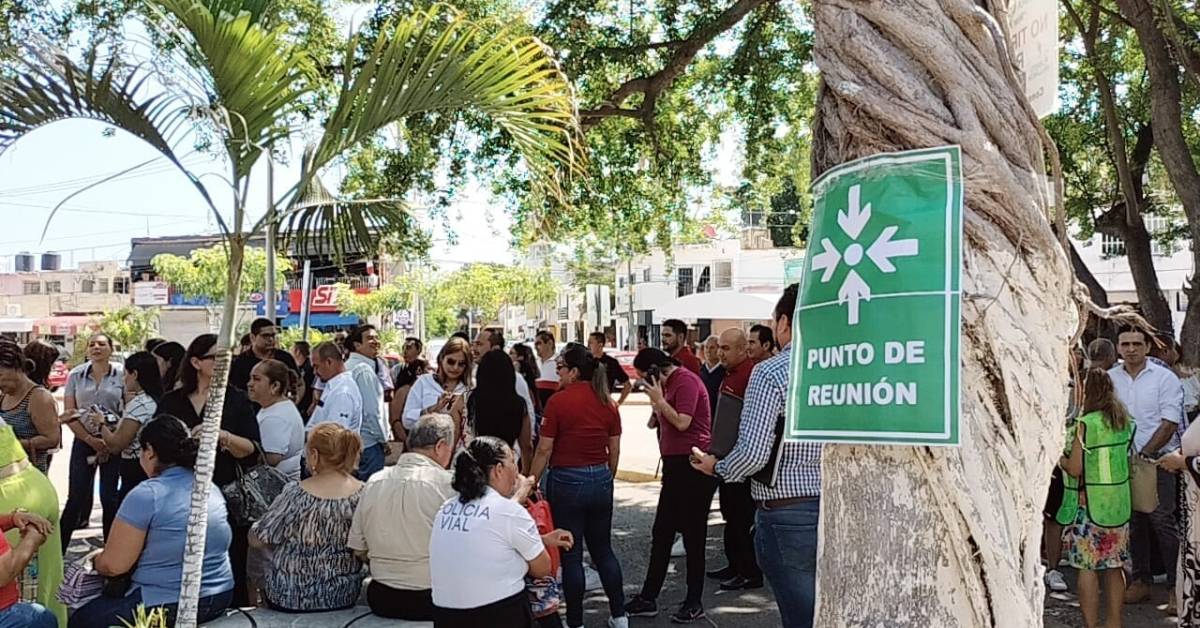
The macro-drill is scheduled for 11:00 a.m. on Wednesday, May 6. Public and private institutions that register for the exercise are expected to carry out their own evacuation and response procedures.
For homes, hotels, and businesses, the drill is a chance to review basic questions before an emergency happens. People should know where the nearest higher ground is, which route avoids the beach, and how family members or coworkers will reconnect after evacuating.
The exercise also gives hotels, restaurants, and tour operators a chance to review how they would help guests who may not speak Spanish or understand local warning signals. That matters in coastal towns with large numbers of foreign residents and visitors.
For expats living near the coast, the main lesson is simple. A strong earthquake near the beach is itself a warning sign. Moving away from the shoreline and toward higher ground can matter more than waiting for confirmation.
The Pacific coast has a real tsunami history
Mexico’s Pacific coast is exposed to both local and distant tsunami risks. Local tsunamis can be generated by offshore earthquakes near the coast, while distant tsunamis can travel across the Pacific after major earthquakes elsewhere.
Mexico’s Tsunami Warning Center identifies Jalisco, Colima, Michoacán, Guerrero, Oaxaca, and Chiapas among the states exposed to both local and distant tsunami threats. The risk is tied to the tectonic activity along Mexico’s western coast.
The Jalisco-Colima region has a history of major earthquakes. The 1932 Barra de Navidad earthquake is widely cited as one of the strongest recorded in Mexico’s instrumental era. That history is one reason emergency planning remains important along the coast.
Tsunamis are not common events in daily life, which can make them easy to dismiss. But emergency planning is built around low-frequency events that can cause severe damage when they happen.
What the drill is meant to test
The May 6 macro-drill is meant to test more than whether people leave a building. It is meant to show how quickly communities can organize, move people away from risk areas, and account for those evacuated.
Participants are expected to report evacuation numbers shortly after completing the exercise. Institutions may also upload evidence and evaluation forms after the drill.
That reporting helps authorities identify gaps. A drill can reveal unclear routes, slow communication, crowded exits, weak signage, or confusion over who is responsible for each step.
For coastal communities, the value is practical. The goal is not to create fear. It is to make the correct response feel familiar before a real emergency forces quick decisions.
What residents and visitors can do now
People living or staying near the coast should use the drill as a reminder to identify their closest evacuation route. This is especially important for anyone living at beach level, working near the shoreline, or staying in a hotel close to the water.
Residents should also review a basic emergency plan with family members, neighbors, or coworkers. That plan should include where to meet, what to carry, and how to communicate if phone service is disrupted.
Visitors should ask hotels or rental hosts where to go in a tsunami evacuation. The answer should be specific, not general. “Higher ground” should mean a known route and a known place.
The May 6 drill will pass quickly. The bigger question is whether people remember the route when it matters.