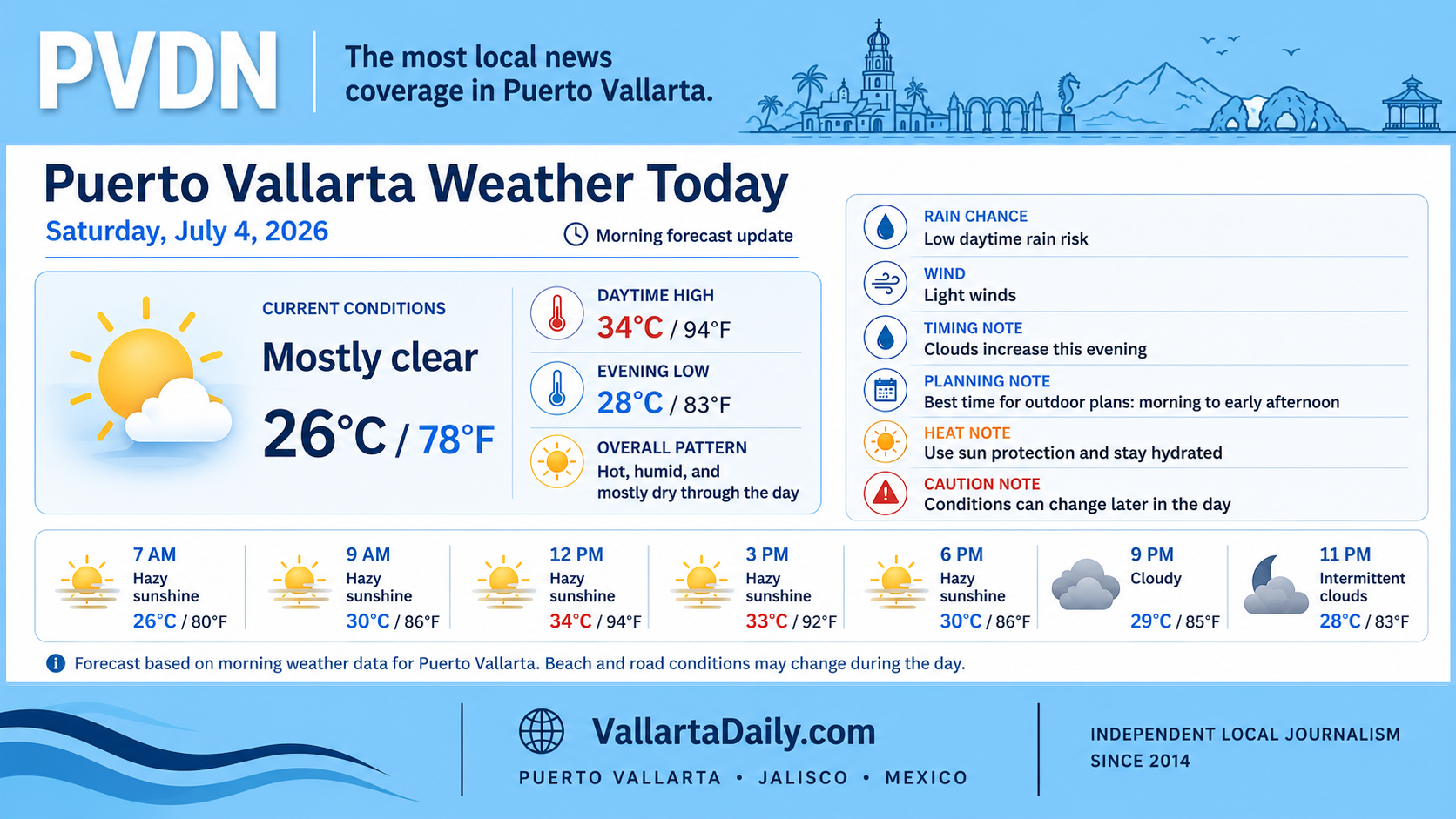
Puerto Vallarta, Jalisco, July 4, 2026 – Puerto Vallarta started Saturday with mostly clear conditions and a temperature near 26°C, or 78°F, as of 6:24 a.m. local time. The day is expected to turn hot and humid, with a forecast high near 34°C (94°F).
The main planning issue is the afternoon rain window. Point forecasts differ on how much rain reaches the city itself, but the most likely timing for isolated showers or thunderstorms is from early to late afternoon, roughly between 1 p.m. and 5 p.m.
Mexico’s national weather service also flagged western and central Jalisco for heavier rain potential on Saturday, so residents and visitors should treat afternoon and evening conditions as changeable, especially outside the hotel corridor and along hillside routes.
Morning Conditions
Early conditions are warm and humid but manageable for errands, beach walks, and outdoor plans. Temperatures should climb quickly after midmorning, reaching the low 30s Celsius by late morning and the mid-30s Celsius during the afternoon.
Humidity is the factor that makes the day feel hotter than the thermometer reading. Forecasts indicate the “feels like” temperature could reach 38°C to 42°C (100°F to 107°F) around midday and early afternoon.
Rain and Thunderstorm Timing
Rain is not expected to be constant. The better risk is for scattered or isolated storms later in the day, with short downpours possible if cells develop over the bay, the mountains, or the urban corridor.
One hourly forecast shows isolated thunderstorms from about 2 p.m. through 5 p.m., with rain chances in the mid-30% range during that period. Another forecast keeps precipitation chances lower for Puerto Vallarta International Airport, mostly below 20% through the evening.
That split is common during rainy season. A dry forecast for one part of the bay can still mean rain over the hills, along rivers, or in nearby neighborhoods.
Wind, Bay, and Beach Notes
Winds look light for most of the day, generally under 15 km/h, or under 10 mph, in the point forecast. That does not rule out brief gusts near thunderstorms.
The National Hurricane Center reported no active tropical cyclones in the Eastern Pacific as of its Saturday morning update. Its marine discussion showed no nearby named storms affecting Puerto Vallarta, though broader Pacific swell and storm activity can still quickly change local water conditions.
Beachgoers should follow posted lifeguard flags at each beach. Conditions can shift during the day, especially if afternoon storms build over the bay.
Roads and Outdoor Planning
The best window for longer outdoor plans is the morning through early afternoon, before heat and storm chances peak. Carry water, use sun protection, and plan shade breaks between late morning and midafternoon.
If rain develops, use extra caution on low-lying streets, underpasses, and routes near arroyos or fast-draining hillsides. Drivers should not cross flooded sections of road, even when water appears shallow.
For evening plans, keep an eye on radar and local civil protection updates before crossing town. Today does not call for alarm, but it does call for normal rainy-season flexibility.