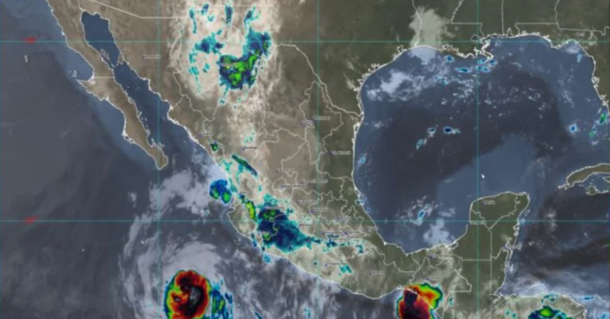
Hurricane Bonnie has decreased its intensity and was downgraded to a category 2. Likewise, the cyclone is gradually moving away from the Mexican coast due to its trajectory heading northwest (280°) at a speed of approximately 22 km per hour. Its current location is closest to Cabo Corrientes, Jalisco, 570 km south-southwest, and from the Baja California Peninsula, it is 790 km south-southeast of Cabo San Lucas.
Cloudy skies throughout the day, with heavy punctual rains in Nayarit, Jalisco, Colima, and Michoacán, these rains could generate an increase in the levels of rivers and . . .