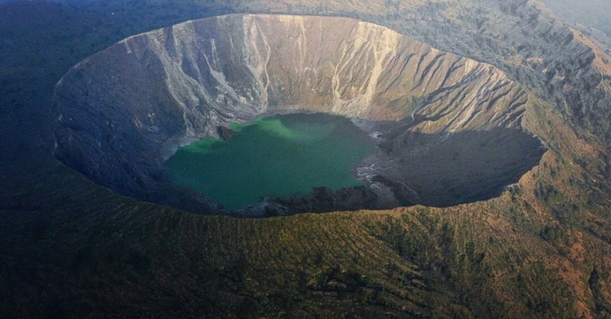
A quiet stretch in northern Chiapas woke up to a new routine this week: a unified command post, round-the-clock scientists, and door-to-door visits in the five-kilometer high-risk zone around El Chichón. The move follows a cluster of small quakes recorded since June. Officials insist there’s no imminent eruption risk, yet they are checking evacuation routes and talking with families in communities closest to the crater lake. What they’re watching, why the 5-km radius matters, and how 1982 still informs today’s playbook—inside.
Authorities in Chiapas have established a unified command post near El Chichón following an increase in small earthquakes around the volcano. Teams from federal, state, and municipal agencies began community visits within a five-kilometer radius and updated evacuation protocols. Scientists say the tremors reflect a change worth tracking, not a crisis. The official line remains clear: no eruption risk at this time.
El Chichón earthquakes
Monitoring now operates 24 hours a day, with specialists from the National Seismological Service, UNICACH, and CENAPRED. Access to the crater is restricted while crews review signage and road conditions on evacuation routes. The command post is coordinating field checks in nearby communities, including Esquipulas Guayabal, Viejo Volcán, and Nuevo Progreso, where residents live well inside the five-kilometer zone.
Officials describe the activity as having low magnitude and shallow depth. The recent sequence follows hundreds of micro-earthquakes logged between early June and mid-August. None caused damage. Still, when quakes cluster at a volcano with El Chichón’s history, the correct answer is caution backed by science and clear communication.
What scientists are watching
Specialists point to signs consistent with changes in the hydrothermal system. That can include small shifts in the crater lake, gas output, ground deformation, and seismic swarms. These do not automatically signal magma on the move. They do, however, warrant tighter surveillance and frequent checks of evacuation plans. Mexico’s disaster-prevention system is built for this kind of escalation: a command post, a standing scientific committee, and a steady feed of verified updates to nearby towns.
Residents will notice more patrols, more clipboards, and more conversations at their door. The aim is practical. Are routes passable in heavy rain? Do families know the location of the nearest safe shelter? Does every household understand not to descend into the crater or approach fumaroles, even on calm days? The messaging is preventive by design.
Communities living with a famous volcano
The five-kilometer radius is not a guess. It lines up with hazard mapping and hard lessons from 1982, when El Chichón produced Mexico’s deadliest modern eruption. Over one week that spring, a series of powerful blasts destroyed villages, sent pyroclastic flows racing through ravines, and spread ash across Chiapas and Tabasco. The event reshaped the landscape and the country’s approach to volcano risk.
That history explains why small changes today trigger considerable, visible precautions. People living in Chapultenango and Francisco León have lived with the volcano’s presence for generations. Many still remember the stories or the losses. For them, the command post is not alarmist. It is reassuring that everyone—from field geologists to road crews to the health brigade—is on the same page.
What “no imminent risk” means in practice
Officials are not sugarcoating uncertainty. “No imminent risk” means that the current data do not indicate an eruption scenario, and daily monitoring shows low-level signals. It also means that those signals could evolve, and if they do, the public will likely hear about it first through civil protection channels. Until then, the advice is simple. Respect closures near the crater. Treat social-media rumors with skepticism. Follow guidance from Protección Civil in Chiapas and the federal coordination.
The command post will continue to meet while the instruments remain in operation. If the swarm dissipates, restrictions can be eased. If parameters change, people closest to the crater will be the first to know—and the first to see the plan move from paper to practice.