The company behind a large Holbox plan says the island’s late-August blaze doesn’t help its projects and insists it started far from its land. Environmental groups aren’t convinced and want a 20-year freeze on permits in the burned area. Satellite imagery suggests the fire began more than half a kilometer away, yet spread into private property. Authorities now face a difficult task: prove how it started, protect a fragile reserve, and referee a long-running fight over growth on a sandbar that’s already feeling the pressure.
Holbox fire developer denial
Península Maya Developments says the August blaze on Holbox harms, not helps, its plans. In a statement to El Economista, the firm argued that satellite images show the fire began more than half a kilometer from its land, then spread into its parcels. The company says it filed a criminal complaint and will coordinate a reforestation program with authorities. Holbox fire developer denial is now the center of a broader fight over how, and whether, the island should grow.
Environmental groups want investigators to treat the burn scar as a red line. A coalition that includes CEMDA and Amigos de Sian Ka’an is asking for a 20-year veda on permits in the affected zone, a tool Mexican law allows to prevent land-use changes after wildfires. Their statement says the blaze fragmented habitat on the island, stressing mangroves that buffer storms and erosion. They also want every agency—from Semarnat to Profepa and the municipality—to honor the freeze while peritajes determine damage.
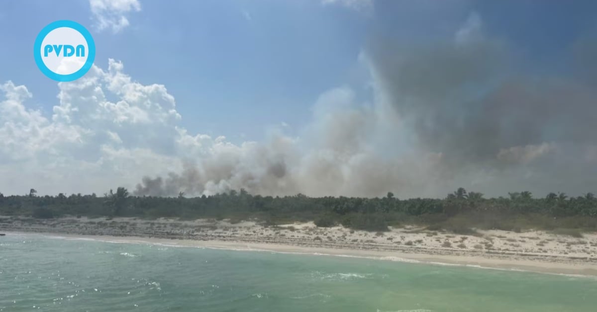
The fire ignited on August 22 in the Punta Mosquito–La Ensenada area of the Yum Balam protected reserve. It burned for days before being declared liquidated in early September. Estimates vary, but reports put the affected area at roughly 670 to just over 700 hectares. Quintana Roo’s Civil Protection noted it was the only off-season wildfire recorded in the state this year, a rarity that amplified concern.
Península Maya Developments is the promoter of “La Ensenada,” a long-running proposal that dates to 2012. Company figures cited by El Economista say their project would directly impact about 93 hectares—less than 10 percent of their property—and occupy “under 2 percent” once built out, avoiding mangroves and using pilings. The plan has become a proxy for Holbox’s future: a mix of hotels and real estate in a place where even small changes can ripple through dunes, wetlands, and a shallow lagoon.
What investigators still need to prove
The satellite record offers a starting point, not a verdict. El Financiero reviewed Sentinel-2 and Landsat imagery and concluded the fire’s origin sits outside PMD’s parcels, over half a kilometer away, before winds and dense brush carried flames onto private land. That bolsters the company’s core claim but doesn’t explain the spark. Was it negligence? A natural strike? Something deliberate? Only field forensics can close that gap, and authorities have not released a cause determination.
Pressure is rising because the island’s development politics are already raw. Activists have long warned that large projects could overwhelm Yum Balam’s management plan. Prior legal fights over boundaries and federal jurisdiction—some of them involving PMD—left scars well before this fire. That history is why NGOs are pressing for a blanket veda now, before any permits advance across the burn. For residents and small businesses, clarity matters: tourists will come back, but trust is more complex to rebuild.
Península Maya Developments says a burn makes approvals harder, not easier. The company argues that an intentional fire would only add restrictions to any review, slow timelines, and increase scrutiny. It also says it will reforest affected areas in coordination with authorities. Those promises will be judged by what happens next: transparent investigations, public data on damage, and a clear call on whether to freeze permits until the land recovers. That is the test Holbox faces after the flames.