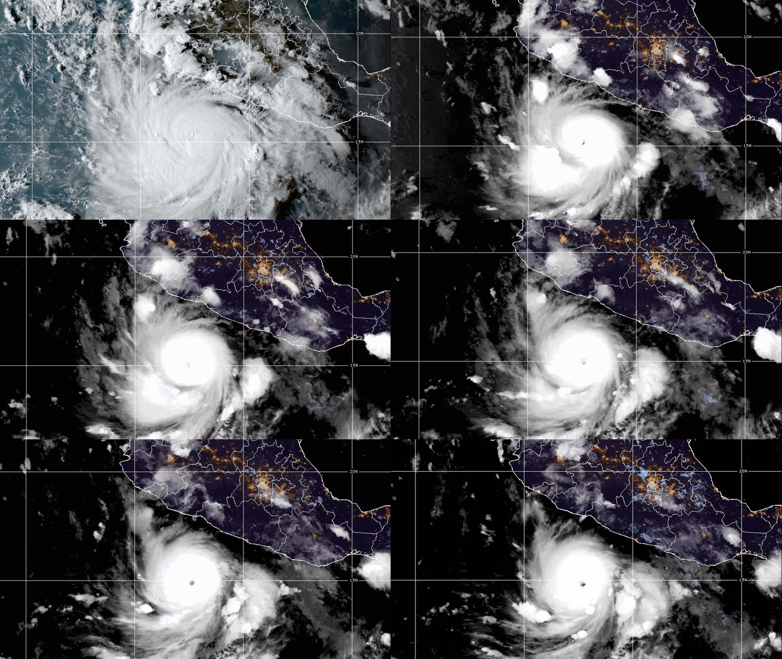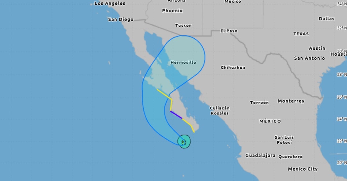
Lorena has strengthened to a hurricane just off Baja California Sur, and forecasters say a burst of intensification could come before the storm encounters colder water. The rain has arrived first. Bands are sweeping north across the peninsula, with a growing risk of flash flooding through Friday and dangerous surf along the Pacific side. The track remains tricky. Guidance leans toward a turn into Baja California Sur late this week, but a slight shift could keep the center offshore. Either way, the flooding threat won’t wait.
Hurricane Lorena Baja Sur
Hurricane Lorena was upgraded at 5:00 a.m. MST on Wednesday after new radar and satellite data showed a tightening core. Top sustained winds are near 75 mph. The center was at 21.9°N, 111.1°W, about 105 miles southwest of Cabo San Lucas and 215 miles south-southeast of Cabo San Lázaro. Lorena is moving northwest at 15 mph, with a minimum pressure of 990 mb. Hurricane-force winds reach only about 10 miles from the eye. Tropical-storm-force winds extend up to 60 miles.
Forecasters expect steady to rapid strengthening through tonight. Peak winds near 85 knots are possible, though that may be conservative. Colder water and increasing wind shear should flip the script on Thursday and Friday, with quick weakening as the system nears the peninsula.
Track leans toward a late-week approach
The steering pattern gets complicated after today. Lorena is sliding around a high over Mexico, then into a weakness in the subtropical ridge. The GFS keeps Lorena stronger and turns it north-northeast into northwestern Mexico, crossing Baja California Sur in about 60 to 72 hours. The European and Canadian models are weaker and slower to open due to this weakness. In those runs, the low-level center peels west over cooler Pacific water and misses land.
Given Lorena’s current structure, the official forecast leans toward the GFS scenario while noting high uncertainty. A slight jog will matter. Communities should prepare for tropical-storm impacts even if the center stays just offshore.
Warnings and watches on the Pacific side
A Tropical Storm Warning is in effect on the west coast of Baja California Sur from Santa Fe to Cabo San Lázaro. A Tropical Storm Watch covers two stretches: from Cabo San Lucas north to Santa Fe, and from Cabo San Lázaro north to Punta Abreojos. Tropical-storm conditions are expected in the warning area tonight into Thursday. Conditions are possible in the watch areas through Thursday night.
Surf will build this morning and persist through Friday along exposed Pacific beaches. Swells and rip currents may be life-threatening. Obey local beach closures and guidance from civil protection.
Flood risk extends into Sonora and Arizona
Rain is the headline risk. Bands will continue across Baja California Sur today and spread into southeastern Baja California and southwestern Sonora Thursday into Friday. Totals of five to ten inches are possible, with local peaks up to fifteen inches in parts of Baja California Sur. That much rain can trigger dangerous flash floods and mudslides, especially in higher terrain and along arroyos.
Moisture ahead of Lorena reaches north into Sonora and Arizona. One to three inches are likely, with local four-inch pockets through Friday. Isolated to scattered flash flooding is possible in urban spots and dry washes.
What to expect today through Friday
Expect a wet, windy day across the southern peninsula, with the heaviest rain in squalls. Winds should increase tonight into Thursday on the Pacific side as Lorena slows and edges north. Rapid weakening is likely as the storm meets cooler waters, but the rain threat will linger after peak winds ease.
Keep devices charged. Avoid low crossings and arroyos. If you live in a flood-prone area, move vehicles and valuables to higher ground. Mariners and beachgoers should stay in port and off exposed beaches until conditions improve.
Bold reminder: Hurricane Lorena Baja Sur remains a dangerous rainmaker even if the center never makes landfall. Flooding will arrive faster than the forecast track can settle.