Hurricane Priscilla didn’t make landfall, but it didn’t need to. The storm pushed the Pacific into streets, forced flight cancellations, shut beaches, and sent hundreds into shelters from Los Cabos to Puerto Vallarta and Bahía de Banderas. Federal and state crews fanned out with heavy machinery, while classrooms stayed dark and ports closed to ride out the worst. Authorities say there are no reported deaths or injuries so far. The storm is moving northwest and remains dangerous, and officials are maintaining pressure on preparedness.
Hurricane Priscilla Mexico
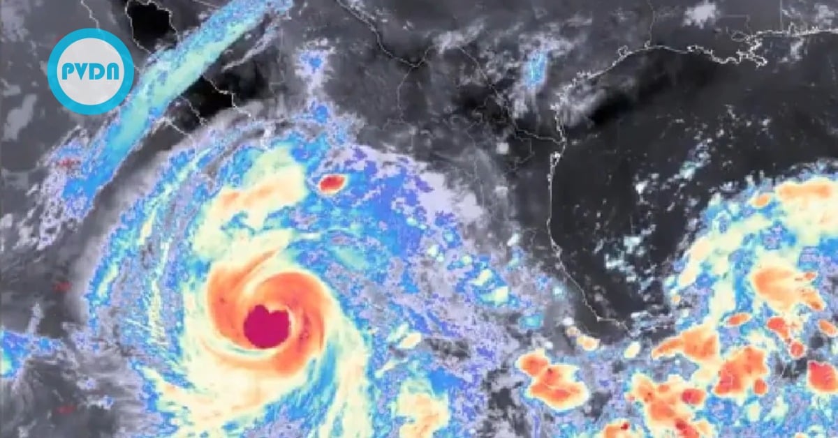
Hurricane Priscilla tracked along the Pacific, generating large surf in western Mexico and disrupting daily life across Baja California Sur, Jalisco, and Nayarit. By early Wednesday, October 8, the system had become a Category 1 hurricane, moving northwest offshore of the peninsula, with sustained winds near 130 km/h and higher gusts. Forecasts called for continued heavy rain, rough seas, and rip currents even without a direct landfall.
Officials say there are still no reported injuries or deaths tied to the storm’s impacts in those three states. The federal Civil Protection agency also confirmed a task force of 2,508 personnel, 330 vehicles, and 189 heavy-machinery units operating mainly in Baja California Sur.
In Baja California Sur, the government suspended classes and many public activities through Wednesday as a precautionary step. Los Cabos ordered beaches closed and restricted sales at semi-permanent and food stalls to reduce health risks during flooding and high surf. Airports in La Paz and San José del Cabo stayed open, though some flights were canceled as airlines adjusted to the weather. The Navy and port captains also imposed rolling closures for large and small craft as the swell built along the corridor.
Shelters opened across Los Cabos, and local authorities maintained patrols in flood-prone neighborhoods while state and municipal emergency councils met in permanent session. The federal government activated its standard disaster plans across the Army, Navy, and National Guard, and established a secondary command post in La Paz.
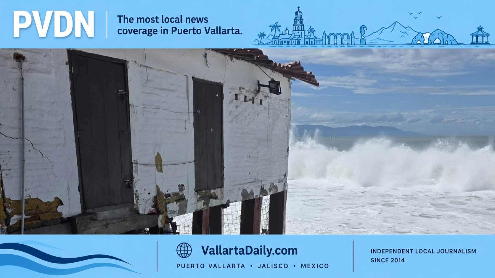
In Puerto Vallarta, waves flooded streets and commercial spaces along the boardwalk and the north shore, where authorities reported 16 shops inundated at Plaza Las Glorias and two small boats capsized off Mismaloya with no injuries. Civil Protection also noted damage to a business on the Malecón, including beachside restaurants and ramadas, as well as partial infrastructure loss at a turtle camp near Boca de Tomates. The local port shut to smaller boats as a precaution while cleanup crews worked the waterfront.
Nayarit experienced seawater entering streets in Bahía de Banderas, San Blas, and Santiago Ixcuintla, with depths reaching approximately 60 centimeters in some low-lying areas. Municipal officials urged people to avoid the surf zone and respect red-flag closures as long-period swell kept building through the day.
What the data says right now
As of the morning report on Wednesday, October 8, the hurricane’s center was roughly 310 km southwest of Cabo San Lucas, moving northwest. Surface observations and satellite guidance showed sustained winds near 130 km/h and gusts to 150 km/h, consistent with a low-end Category 1 cyclone. The National Weather Service in Mexico has warned of intense rain bands and dangerous seas spreading across the southern part of the peninsula and into the Gulf of Mexico. Follow local port captain advisories; conditions can flip quickly with these bands.
Federal agencies stressed readiness. The electricity utility CFE kept crews on standby and asked residents to report outages through official channels. Civil Protection continued to coordinate with the meteorological service and water commission on flash-flood risk, while the Navy’s Plan Marina remained in its prevention phase for Pacific coastal states. Keep your phones charged and heed evacuation or shelter guidance if your area is prone to flooding.
There’s relief in the numbers: no casualties reported and most disruptions classified as minor to moderate so far. But the images tell the other side—flooded storefronts, rock-strewn promenades, and families bedding down in shelters while the storm grinds past offshore. In places like Vallarta, the sea walked over the curb and into town, one set of waves at a time. Authorities are keeping schools closed, beaches dark, and patrols active until the surge and squalls subside. It’s working—and it’s why the story today is about inconvenience and cleanup, not tragedy.