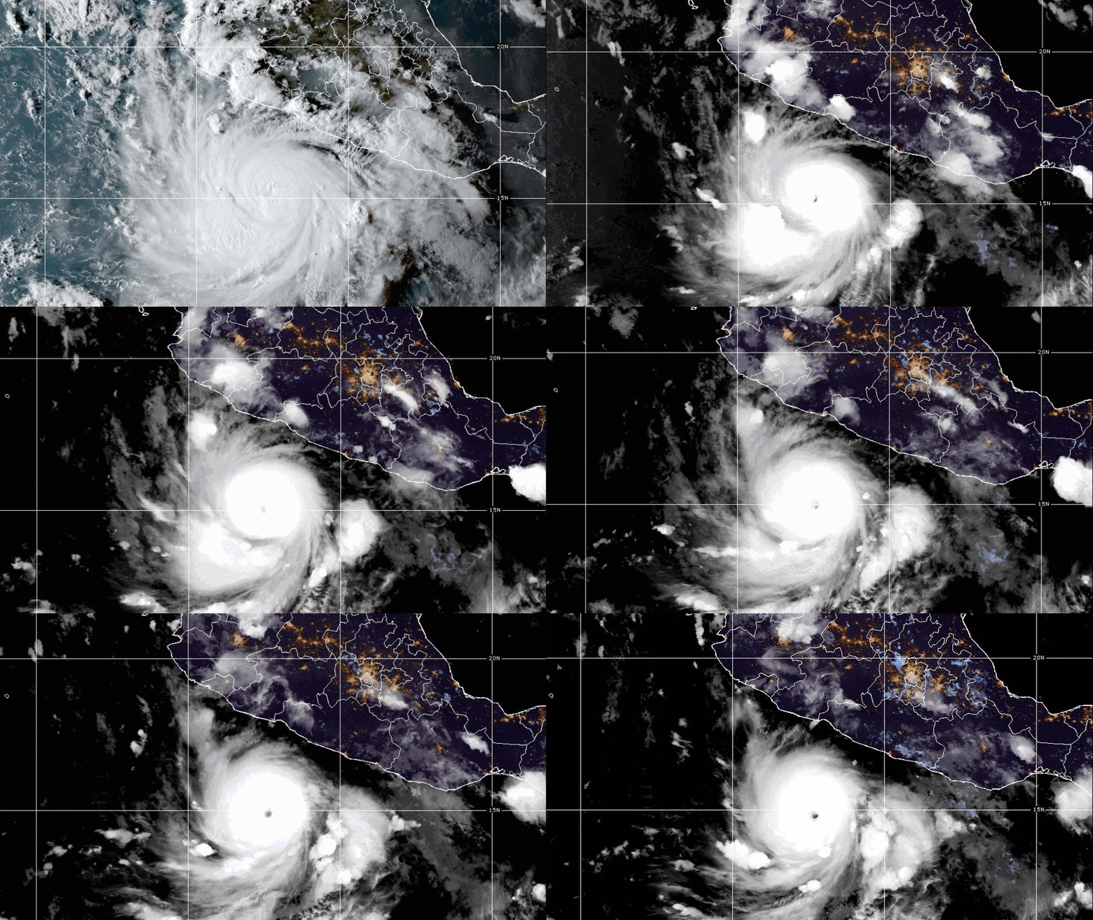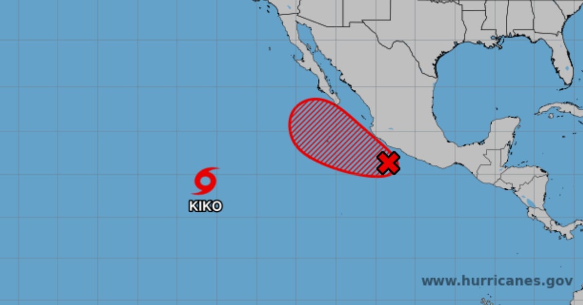
A tropical wave just off Mexico’s southwest coast is organizing fast, and forecasters say it has high odds of spinning up into a depression as early as mid-week. For Puerto Vallarta, that doesn’t mean a guaranteed direct hit—but it does mean a higher risk window for heavy rain, choppy seas, and sudden street flooding. NOAA also warns the system could angle toward Baja later in the week, which would complicate surf and travel along the Pacific corridor. Here’s what matters locally, and what to watch hour by hour.
Puerto Vallarta’s next rainmaker is taking shape offshore
NOAA says a tropical wave less than 150 miles off southwestern Mexico is getting better organized, with satellite-derived winds already near 35 mph. The agency now puts the odds of development at 80% within 48 hours and 90% over seven days, making a tropical depression by mid-week a realistic scenario. The disturbance is expected to track west-northwest to northwest, just offshore, at speeds of about 10 to 15 mph.
For Jalisco’s coast—including the bay—this setup points to a period of heavier showers, embedded thunderstorms, and rougher seas. NOAA’s outlook also highlights the flash-flood risk, where terrain drives runoff quickly from hills into neighborhoods and low-lying areas. Those hazards tend to arrive before any official cyclone forms, especially when deep tropical moisture lifts into the Sierra Madre foothills around the bay.
Local seas are the early tell. Mexico’s national forecaster (SMN) projects waves of roughly 2.5 to 3.5 meters on Tuesday along Jalisco, Colima, and Michoacán as the tropical wave brushes the coast. That kind of surf can close beaches, rip out temporary sand berms, and complicate small-craft operations in and out of the bay.
Mid-week timing and what could change
Guidance from NOAA points to a notable inflection around Wednesday–Thursday, September 3–4. If the disturbance consolidates, it may nudge farther north and approach the Baja California peninsula later in the week. NOAA cautions that watches or warnings could be required for parts of Baja as early as Tuesday, depending on how quickly the center organizes. For Puerto Vallarta, the practical takeaway is a higher-impact rain and surf window even if any eventual center remains offshore. Track shifts of only a few dozen miles can change which coastlines take the brunt of bands.
SMN’s multi-day outlook aligns with this timing, indicating a potential for very heavy to intense rain in Baja California Sur mid-week once the low consolidates southwest of the peninsula. That pattern often drags deep tropical moisture north along the mainland coast, keeping showers and thunderstorms pulsing around the bay through the middle of the week.
What matters for the bay right now
For residents and visitors, two near-term issues matter most: street flooding from short, intense bursts and dangerous rip currents on open beaches. NOAA’s outlook explicitly warns of flash flooding in mountainous areas, which for Puerto Vallarta includes corridors where runoff funnels into arroyos and low-lying streets. If you plan to move around the city during peak hours, allow extra time and be prepared for sudden closures at familiar low-traffic areas.
A note on terminology: as of Monday, September 1, NOAA has not issued tropical storm watches or warnings for Jalisco. That could change if the center drifts closer or intensifies faster than expected; however, the first formal watch discussion from NOAA is currently aimed at Baja California Sur. Locally, Puerto Vallarta Civil Protection may post beach and boating advisories tied to surf and currents even without a named cyclone.
The bottom line for Puerto Vallarta
An organizing system offshore has a high probability of becoming a depression by mid-week. For Puerto Vallarta, the most likely impacts between Tuesday and Thursday are periods of heavy rain, localized flooding, and rougher surf with powerful rip currents. Forecast confidence is higher on rain and surf than on any direct wind event along the bay at this stage. Keep an eye on official updates; small track changes can quickly raise or lower local risk.