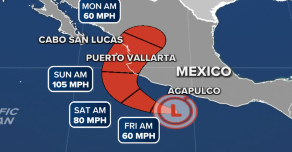
Today, tropical storm Roslyn will move near the coast of the central Mexican Pacific and will cause intense punctual rains (from 75 to 150 millimeters [mm]) in regions of Colima, Guerrero, and Michoacán, and strong (from 25 to 50 mm) in areas of Jalisco, as well as gusts of wind of 60 to 80 kilometers per hour (km/h) with waves of 2 to 4 meters (m) in height on the coasts of Colima, Jalisco, and Michoacán . . .