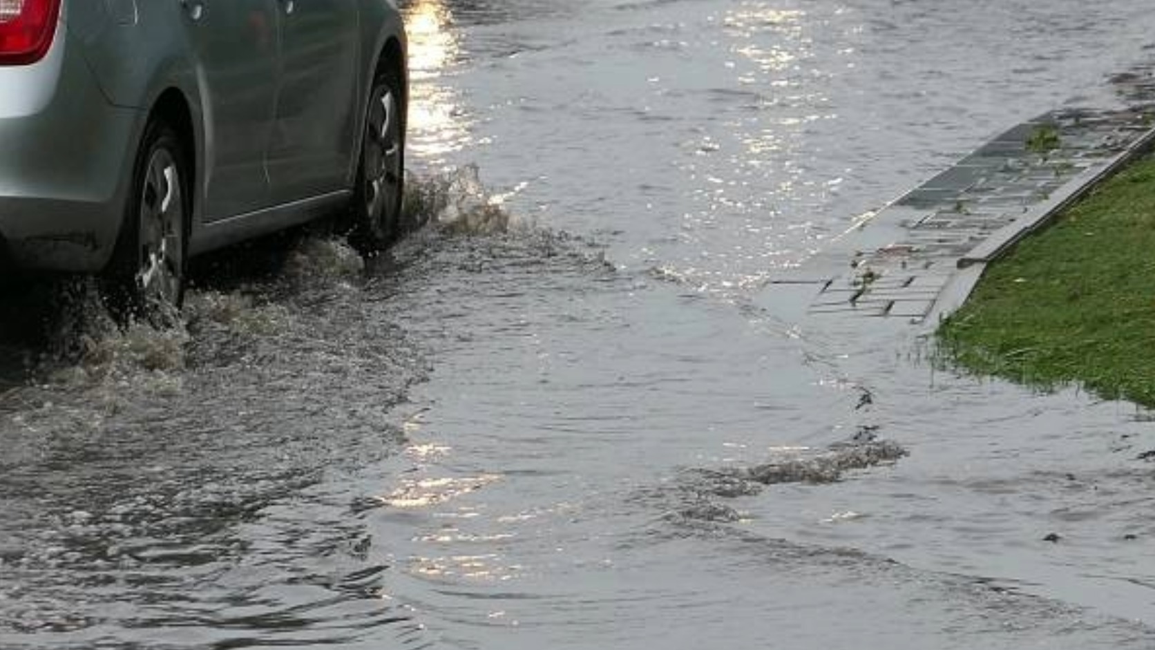
A 2026 municipal map identifies 26 recurring roadway flood points, where elevation and drainage capacity can separate a flooded street from a passable one.
The same inventory lists 12 places where rivers or channels may overflow. It includes Las Juntas, Bobadilla, El Calvario, La Floresta, El Aguacate and Paso del Guayabo.
The result is a block-by-block travel risk. Standing water at Avenida Francisco Medina Ascencio and Politécnico Nacional does not create conditions on another route nearby.
How the difference affects residents and commuters
A roadway can receive water from roofs, parking lots, and streets uphill. It is not limited to rain falling on its pavement.
The federal urban drainage manual says storm inlets collect surface runoff and direct it into the drainage system. They are generally placed near intersections, along major avenues, and at low points.
Their capacity must match the small drainage basin feeding them. If two neighboring streets drain different areas, they can carry different volumes during the same storm.
The 2026 map identifies the entrance to the Centro Universitario de la Costa, Calle Gaviotas, Calle Montessori, and Avenida Víctor Iturbe as separate trouble spots. It also marks properties near Calle Berlín, Calle Jacarandas and IMSS Clinic 42.
For residents, that can mean one route to work, school, or medical care becomes impassable while another remains open. Ground-floor homes and businesses face a separate risk when the street begins storing water instead of moving it away.
Puerto Vallarta’s 2024-27 municipal development plan classifies the city’s flood vulnerability as “alta,” or high. It cites rivers, low elevations, urban growth, and heavy rains from June through October.
The consequences are documented. Our reporting after the Oct. 12, 2025, floods covered a state tally of 703 affected homes, 85 businesses, and two schools.
For this explainer, I compared the new monitoring list with municipal risk and development plans, federal drainage guidance, SEAPAL notices and a recent local expert interview. The records point to several overlapping causes.
Vallarta is divided into small drainage basins
The Puerto Vallarta risk atlas identifies nine microbasins that drain toward Banderas Bay. Some begin outside the municipality.
A microbasin is the land area that sends rainwater toward one channel or outlet. A ridge or high section of pavement can send water in another direction.
That divide may be difficult to see from a car. Yet it can determine whether runoff reaches Avenida Francisco Villa, the Río Pitillal, Estero El Salado, or another channel.
The atlas also distinguishes rain falling over the urban area from rain falling in the mountains. Mountain runoff can reach and saturate the river network within tens of minutes, according to the document.
Puerto Vallarta’s municipal geographic profile describes limited flat land between the mountains and coast. It identifies the Ameca, Mascota, Pitillal, and Cuale rivers, along with El Salado and several southern streams.
Water moves quickly through steeper terrain before slowing in flatter areas. Streets in Ixtapa, Mojoneras, Bobadilla and other low sectors can therefore receive runoff generated beyond the immediate neighborhood.
Streets can become part of the drainage system
A storm drain is only the entry point. Pavement, curbs, and gutters must first deliver water to it.
If the roadway slopes away from an inlet, water may bypass the opening. If the inlet sits above a depression in the pavement, the pipe below may have unused capacity while water remains on the surface.
That is an engineering inference, not a diagnosis of any specific intersection. Confirming the cause at one location requires elevation measurements and an inspection of the inlet, pipe, and outlet.
Municipal planning records show how Vallarta streets can have different drainage roles. An adopted district plan described the underground Las Glorias channel as receiving runoff from Medina Ascencio, Versalles, and Díaz Ordaz before discharging near Hotel Pelícanos.
The document described another channel along Calle Violeta that reaches the coast near the Sheraton. It also identified separate flood-prone segments of Avenida Francisco Villa.
Those segments included José Jesús González Gallo to Jesús Rodríguez Barba, Avenida Fluvial Vallarta to Paseo de las Gaviotas, and the area between Viena and Morelia.
The plan called Morelia a “calle canal,” or street channel, carrying water toward the Libramiento Luis Donaldo Colosio drainage channel. The document is not a 2026 condition survey, but it shows how parallel streets can serve different hydraulic functions.
A blockage is only one possible bottleneck
For water to leave a street, the surface route, inlet, underground line, open channel, and final outlet must work together. A restriction at any point can slow the entire route.
A separate municipal plan for District 7 identified several recurring causes of flooding. They included altered channels, inadequate rainwater collection, undersized channels, construction within restricted areas, and obstruction by sediment or waste.
The plan said some areas relied on surface flow along streets because they lacked dedicated stormwater collectors. That can place a larger volume on one avenue while a nearby street carries little water.
Blockages can change conditions within a single storm. In June 2026, municipal crews removed trash, sand, and other material from a channel serving the Francisco Villa and Medina Ascencio area.
A blocked grate may flood one approach to an intersection while the opposite side continues draining. Sediment farther downstream can produce the same surface result even when the nearest grate appears clean.
Maintenance restores available capacity. It does not enlarge an undersized line or change the elevation of a low street.
In May, PVDN reported that the city’s annual channel-clearing program was 45% complete at that stage. Crews were targeting rivers and channels with a history of overflow.
Even a clear system has a limit. CONAGUA’s flood-control manual says providing total protection from every possible storm would require drainage works of disproportionate size and cost. Systems are instead designed around selected rainfall and risk levels.
Standing water does not prove that maintenance failed. Rain may have exceeded the system’s design capacity, a downstream channel may already be full, or the final outlet may be restricted.
Storm drains and sanitary sewers are different
Street drainage and wastewater collection are related, but they are not interchangeable.
SEAPAL’s drainage guidance says its sanitary subcollectors and collectors are calculated for wastewater discharges. They are not designed to receive rainwater from roofs and patios.
When a property sends rainwater into a sanitary line, the added volume can overwhelm the line and contribute to a backup inside the building, according to SEAPAL. The utility recommends sending roof runoff toward a suitable stormwater route or absorption system.
In July 2026, SEAPAL said rainy-season calls involving water and drainage pipe breaks rise by at least 25%. It estimated that more than 40% of the city’s roughly 4,000 kilometers of hydrosanitary pipes were nearing the end of their useful lives.
Those figures cover water and sanitary infrastructure. They do not measure the capacity of every municipal storm drain or open channel.
Using the aging-pipe figure to explain all street flooding would therefore mix two different systems. Rainwater can pool on a road without a sanitary failure, while an overloaded sanitary line can create a property-level problem away from the deepest street flooding.
The coast can restrict the final exit
Puerto Vallarta also faces coastal flooding. That has a different source from runoff flowing down a street.
The National Center for Disaster Prevention says rain-swollen rivers can meet an elevated storm tide at the coast. The higher sea level can oppose water trying to leave the river or channel.
A gravity-fed outlet has less ability to discharge when coastal water is already high. Rain, river flow, tide, and waves can then produce a compound flood.
Puerto Vallarta experienced that distinction during high surf associated with Hurricane Priscilla in October 2025. SEAPAL said water around Playa Camarones and Playa Las Glorias came from the sea and sediment in nearby channels, not from its sanitary sewer network.
Crews also worked along the lateral lanes of Avenida Francisco Medina Ascencio near Versalles. PVDN’s coverage of the coastal flooding documented water reaching roads and businesses along the waterfront.
A coastal street can therefore remain flooded while a higher inland street drains. Establishing the cause requires checking rainfall, tide, wave conditions, and the condition of the outlet.
Urban development changes how much water reaches the street
Concrete, asphalt and rooftops reduce the land available to absorb rain. More water then moves across the surface and reaches drains sooner.
CONAGUA’s flood-control manual says urban expansion can produce “un escurrimiento muy superior” — much greater runoff — from the same amount of rainfall.
That means a drainage line designed for an earlier, less developed basin may face a larger flow after more land is covered. New streets and buildings can also change the route and timing of that water.
José Alfonso Baños Francia, an urbanist and professor at the University of Guadalajara’s Centro Universitario de la Costa, addressed that issue in an Aug. 29 interview.
Baños Francia attributed growing vulnerability to paved land, altered natural flows, development near channels and limited stormwater infrastructure. He identified Arboledas, Rincón del Puerto, Mojoneras and Ixtapa among the lower areas with a history of problems.
He also said residential floors should generally sit 30 to 40 centimeters above the street. Reducing that separation can increase the chance that street water enters a building, he said.
Flooding beside a construction project does not, by itself, prove the project caused it. That conclusion would require before-and-after elevation data, approved drainage calculations, outlet records and an inspection of downstream capacity.
Climate pressure does not determine the affected block
Puerto Vallarta’s 2020-30 climate program projects a greater concentration of rainfall during July, August and September under its modeled scenario.
For the La Desembocadura station, the models projected more intense wet-season precipitation during the 2015-39 period. They also projected monthly rainfall falling 5 to 40 millimeters below the historical norm during other parts of the year.
The program links that seasonal concentration to increased flood and landslide risk. These are projections, not measurements showing that every recent flood resulted from climate change.
The Intergovernmental Panel on Climate Change has found that impermeable urban surfaces interact with heavy precipitation to increase urban flooding. It also identifies sea-level rise and storm surge as added risks for coastal cities.
Taken together, the findings describe two scales of risk. Climate conditions can increase the volume or intensity of water reaching the city. Local elevation, drainage routes and outlet capacity decide where that water collects during a particular storm.
No individual flooded corner can be attributed to climate change from a photograph or rain report alone.
Reading the risk on a particular block
For a home, business or regular travel route, five checks provide more information than a neighborhood name:
- Upstream area: Identify the streets, roofs, parking areas or channels that send water toward the block.
- Local elevation: Find the low point, storm inlets and doorway height relative to the pavement.
- Downstream exit: Determine whether runoff reaches a pipe, open channel, river, El Salado or the bay.
- Flood history: Ask for dated photographs, water depths and drainage times from several storms. One dry season provides little evidence.
- Type of flooding: Rainwater pooling, river overflow, coastal incursion and sanitary backup have different causes and require different responses.
The municipal map is a screening tool, not a guarantee that every vulnerable location has been recorded. Its developers invited residents to report additional recurring points.
During active flooding, Puerto Vallarta Civil Protection advises motorists and pedestrians not to cross affected roads or moving water. CENAPRED warns that runoff can reach low ground quickly, even when the nearest river is several kilometers away.
A passable street one block away shows only the condition of that street at that time. In Puerto Vallarta, each block’s elevation, basin, inlets, channels, and outlet determine where the rain goes.