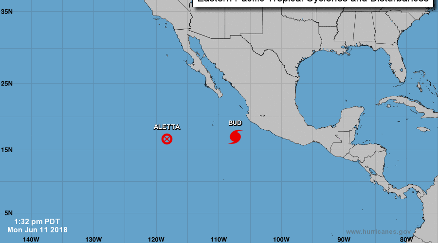
At 300 PM MDT (2100 UTC), the eye of Hurricane Bud was located near latitude 17.0 North, longitude 107.4 West. Bud is moving toward the northwest near 7 mph (11 km/h), and this motion is expected to continue through tonight with a decrease in forward speed. A turn toward the north-northwest is expected on Tuesday, and this general
motion should continue into mid-week. On the forecast track, the core of Bud and its stronger winds are expected to continue moving away from the southwestern coast of mainland Mexico.
Maximum sustained winds remain near 120 mph . . .