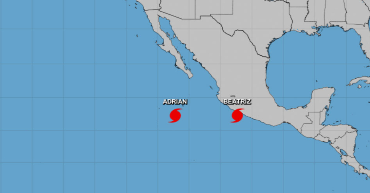
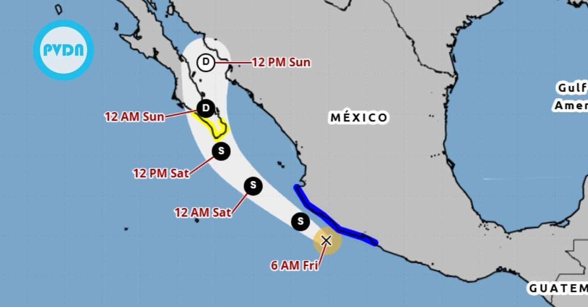
PUERTO VALLARTA (PVDN) – The Mexican government has today raised the alarm for regions across the nation’s west-central coast as Hurricane Beatriz gains strength. Significant areas from Zihuatanejo to Cabo Corrientes are under a Hurricane Warning, with further stretches from North of Cabo Corrientes to Punta Mita under a Hurricane Watch.
PLEASE MAKE SURE YOU ARE READING THE MOST RECENT UPDATE – UPDATES HERE
A Tropical Storm Watch has also been issued for Las Islas Marias and areas North of Punta Mita to San Blas, marking the widening impact of the tropical cyclone. The previous Tropical Storm Warning south of Tecpan de Galeana has, however, been discontinued.
The Hurricane Warning, issued 36 hours before the first expected impact of tropical-storm-force winds, indicates the imminent arrival of hurricane conditions that make outside preparations hazardous. Residents in the warning zones are being urged to complete preparations to protect life and property urgently.
Similarly, a Hurricane Watch means that hurricane conditions are possible within 24 to 36 hours, while a Tropical Storm Warning and a Tropical Storm Watch indicate that tropical storm conditions are expected and possible, respectively, within their designated areas in the specified time frames.
Residents of the west-central coast of Mexico and the southern portion of the Baja California peninsula are being urged to stay vigilant and monitor the progress of the storm. Additional watches or warnings may be required later today or on Saturday.
As of 10:00 AM CDT, the center of Hurricane Beatriz was located near latitude 17.3 North, longitude 102.3 West, moving northwest at around 13 mph. The hurricane is expected to decrease its forward speed and turn toward the west-northwest on Sunday. The forecast predicts that the center of Beatriz will pass near or over parts of the southwestern Mexican coast from later today through Saturday, before moving away from the west-central coast on Saturday night and Sunday.
Satellite images have confirmed the upgrade of Beatriz to hurricane status, with maximum sustained winds of up to 75 mph. Winds are anticipated to strengthen today and tonight if the hurricane center remains over water, but weakening is expected to begin on Sunday.
Hurricane-force winds currently extend up to 10 miles from the center of Beatriz, with tropical-storm-force winds extending up to 70 miles.
The estimated minimum central pressure of Hurricane Beatriz is 991 mb.
Among the key hazards presented by Beatriz are powerful winds, rainfall, storm surges, and surf. Hurricane conditions are anticipated in the hurricane warning areas through Saturday. Tropical storm conditions are also likely in the tropical storm warning areas, with possibilities of such conditions extending to the tropical storm watch areas by Saturday night.
Rainfall accumulations of 3 to 5 inches, with maximum amounts of 8 inches, are predicted across southern Mexico from Guerrero west-northwest to Nayarit due to Beatriz. This could lead to localized flash flooding and mudslides.
A dangerous storm surge is also expected to cause significant coastal flooding, accompanied by large and destructive waves along the shore. Swells caused by Beatriz are forecasted to spread along the southwestern coast of Mexico, leading to potentially life-threatening surf and rip current conditions.
The public is being urged to monitor products issued by their national meteorological service for detailed storm information. Further updates on Beatriz can be found on the website hurricanes.gov.
PUERTO VALLARTA (PVDN) - The Mexican government has today raised the alarm for regions across the nation's west-central coast as Hurricane Beatriz gains . . .