Puerto Vallarta, Jalisco, Sept. 15, 2026 – Puerto Vallarta began Tuesday under mostly cloudy skies, with a temperature of 24 C (76 F) at 6:20 a.m. local time. Humidity was near 80%, and winds were light.
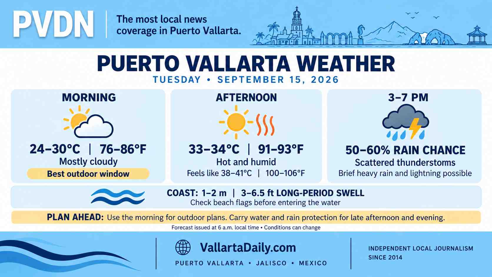
Temperatures are expected to climb to 33–34 C (91–93 F) during the afternoon. Humidity could push the apparent temperature toward 38–41 C (100–106 F) during the hottest part of the day.
The main rain window opens during the afternoon and continues into the early evening. Point forecasts place the peak chance of rain near 50–60% between about 3 and 7 p.m., although rainfall may be uneven across the city.
Heat Builds Before Afternoon Storms
Morning and midday should offer the best conditions for errands, outdoor work, and travel around the bay. The hottest period is expected between noon and 4 p.m., with limited relief from light winds.
Puerto Vallarta’s hour-by-hour forecast shows the chance of scattered thunderstorms increasing during the afternoon. People attending Independence Day activities should carry rain protection, particularly if arriving in Centro before sunset.
Rain probabilities decrease later in the evening in several point forecasts, but individual storm cells can develop or shift quickly.
Southwest Jalisco Under Broader Rain Alert
The National Meteorological Service’s 6 a.m. forecast calls for localized rainfall of 50–75 millimeters, or about 2–3 inches, in parts of southwestern Jalisco.
That regional maximum does not mean Puerto Vallarta will receive that amount citywide. It indicates that a concentrated storm could produce heavy rain somewhere within the forecast area.
The agency said Tropical Wave 39, positioned south of Jalisco, could support thunderstorms with lightning and sudden wind gusts. Gusts of 40–60 km/h (25–37 mph) are possible in parts of the state, although regular winds around Puerto Vallarta are expected to remain much lighter away from storms.
A heavy downpour could temporarily reduce visibility and leave standing water on low-lying streets. Drivers should avoid entering flooded crossings and use extra care on Highway 200, hillside roads and streets near river channels.
Swell Requires Attention at Beaches
The federal forecast includes long-period swell of 1–2 meters (3–6.5 feet) along the Jalisco coast. Conditions will vary by beach, and the regional forecast does not establish a beach restriction or port closure.
Swimmers should check the flag posted at each guarded beach and follow lifeguard instructions. Conditions near river mouths can change after heavy rain because of stronger currents, runoff and debris.
Operators of small boats and water taxis should consult the latest SEMAR port status before departure.
Best Window for Tuesday Plans
Outdoor plans will be easier during the morning, before temperatures and humidity peak. Anyone heading to afternoon or evening Independence Day events should take water, use sun protection, and carry a compact umbrella or rain jacket.
Weather and beach conditions can change during the day. Updated radar, municipal alerts and beach flags should take priority over the morning forecast.