Puerto Vallarta, Jalisco, Oct. 8, 2026 — Tropical Storm Simon is forecast to strengthen rapidly, with heavier rain and rising coastal surf expected through Saturday, U.S. and Mexican forecasters said.
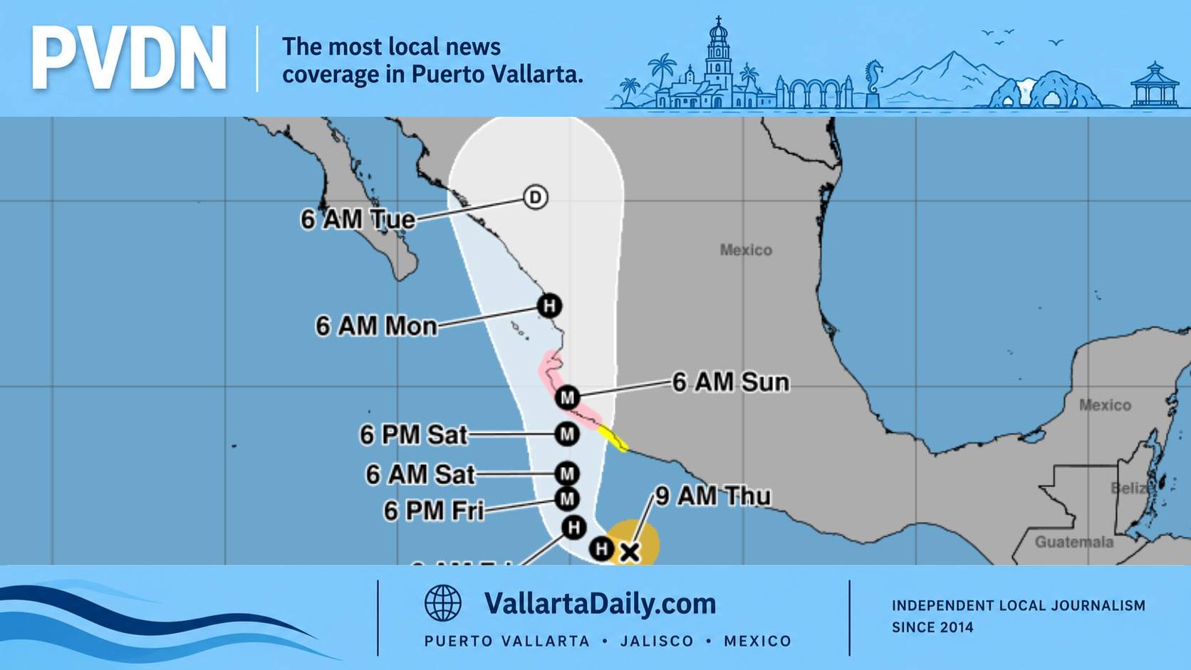
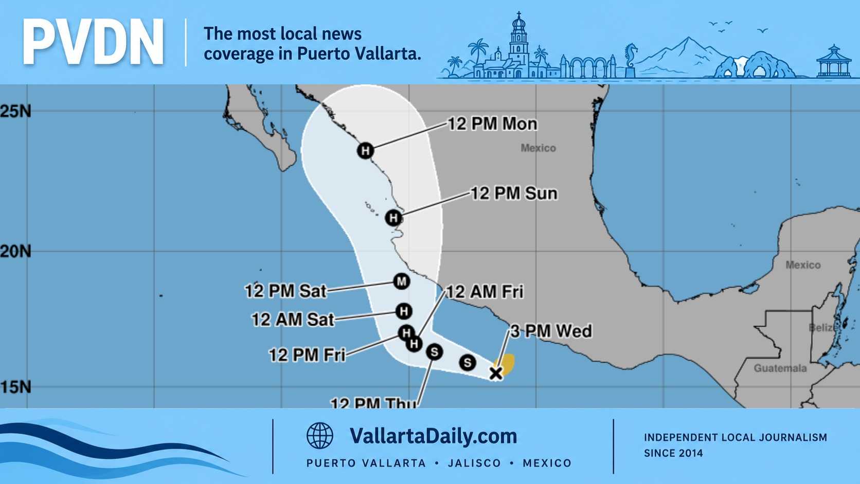
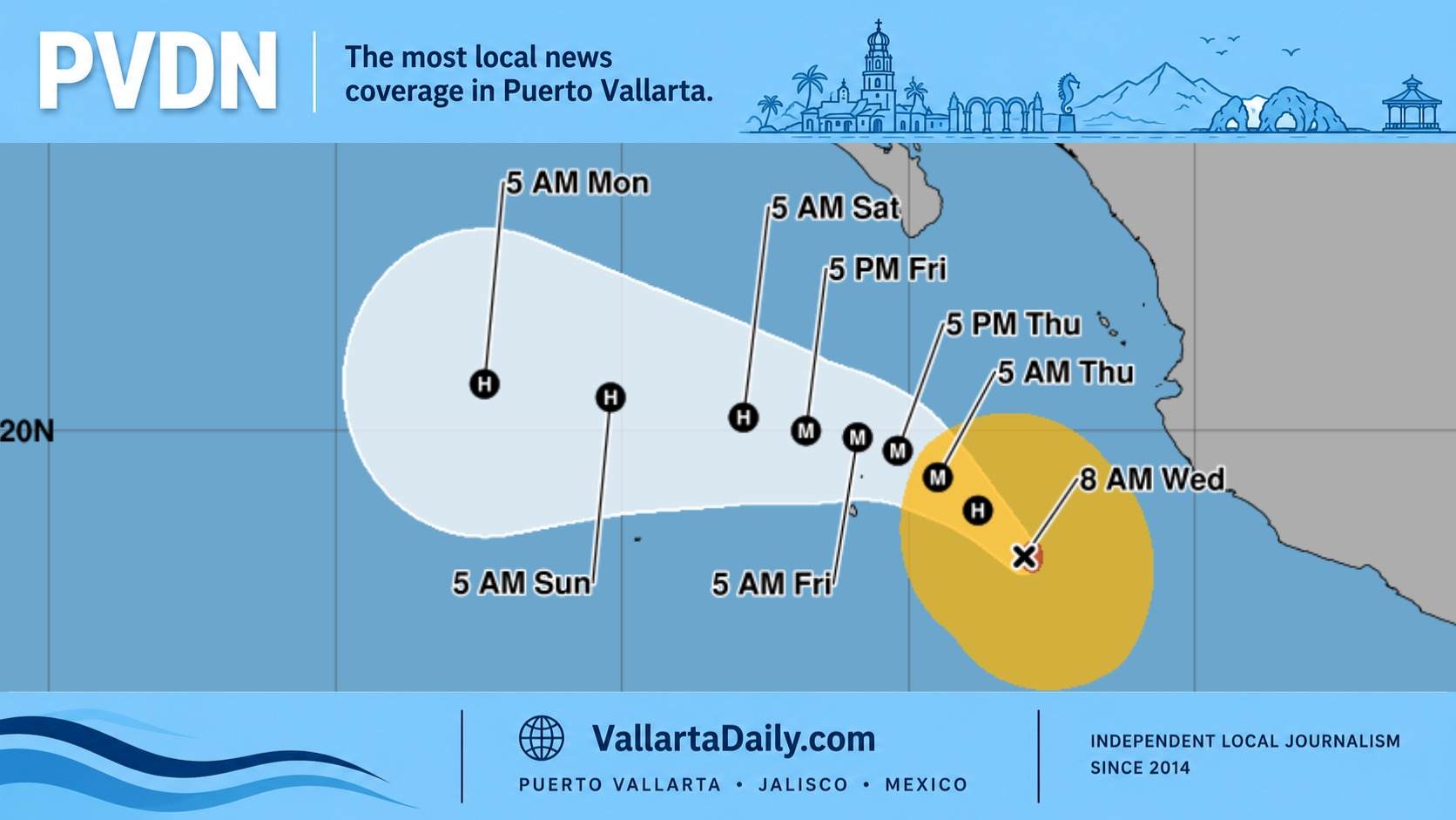
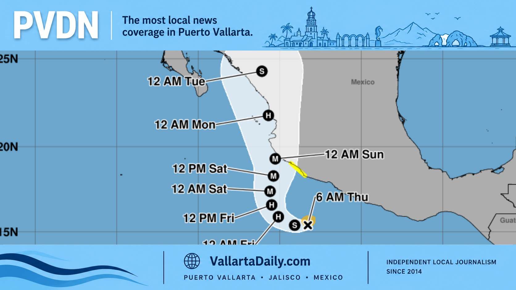
Simon had sustained winds of 50 mph, or 85 kph, in the National Hurricane Center’s 6 a.m. Thursday advisory. Forecasters expect it to become a major hurricane by late Friday or early Saturday.
Mexico’s tropical storm watch covered the coast from Punta San Telmo to Manzanillo. Puerto Vallarta was outside that watch area in the morning advisory.
Rain and coastal conditions through Friday
For this report, I compared Mexico’s regional forecasts with the National Hurricane Center’s storm advisories. The Mexican weather service’s Thursday outlook calls for localized rainfall of 25–50 millimeters across western and southern Jalisco.
Its extended forecast raises that range to 50–75 millimeters Friday. Along Jalisco’s coast, forecast waves increase from 1–2 meters Thursday to 2–3 meters Friday, with Friday gusts reaching 30–50 kph. These figures cover broad regions, rather than individual Puerto Vallarta neighborhoods or beaches.
For residents and commuters, the weather service identifies several hazards associated with those downpours. Rain could raise river and stream levels, cause flooding and landslides, and reduce visibility. Thunderstorms could also bring lightning.
Beachgoers face a separate risk from swell arriving along Mexico’s southwestern and west-central coast. The hurricane center warns that these swells could produce “life-threatening surf and rip current conditions” through the weekend.
Simon’s projected approach toward Jalisco
The hurricane center placed Simon about 415 kilometers south-southeast of Manzanillo Thursday morning, moving west at 11 kph. Its forecast calls for a turn toward the north Friday night and an approach toward southwestern Mexico Saturday. That forecast does not establish a Puerto Vallarta landfall.
Jalisco’s civil protection director, Sergio Ramírez López, said Wednesday that authorities were preparing for several possible coastal approaches. He described “one of the scenarios” as an entry between Colima and Jalisco. He said the scenarios could change over the following 48–72 hours.
Mexico’s extended outlook forecasts a further increase Saturday: 75–150 millimeters of rain in western and southern Jalisco, coastal gusts of 80–90 kph and waves of 5–6 meters. These are regional, full-day forecasts that extend beyond the 48-hour window ending Saturday morning. They should not be read as exact conditions for Banderas Bay at dawn.
Drainage repairs and road restrictions already underway
The new rainfall forecast comes while Puerto Vallarta’s utility continues recovering from earlier storms. SEAPAL said Wednesday that it added pumping equipment at the Norte I wastewater treatment plant after damage from Polo and Rachel. The utility reported lower sewer levels and reduced overflow risks, particularly in Versalles.
SEAPAL’s pipe modifications on Avenida Las Palmas also bring intermittent lane restrictions during approximately six weeks of work. Traffic will continue while crews work one lane at a time. Our coverage of the Las Palmas lane closures provides additional commuter context.
Preparing homes and avoiding floodwater
Puerto Vallarta’s Civil Protection and Fire Department recommends clearing drains and gutters, securing loose outdoor objects and protecting important documents. Its seasonal guidance also calls for an emergency bag containing water, food, first-aid supplies, a flashlight, spare batteries and cash.
The department advises residents to establish evacuation routes and a family meeting point. Anyone needing a temporary shelter should confirm which locations are active through municipal announcements.
For drivers and pedestrians, the city’s instruction is direct: avoid flooded streets, river crossings and moving water. Its guidance warns that currents can sweep away both vehicles and people.