Puerto Vallarta, Jalisco, Sept. 14, 2026 — Puerto Vallarta began Monday partly cloudy and humid. At 6:25 a.m., the airport-area weather observation showed 28°C (82°F).
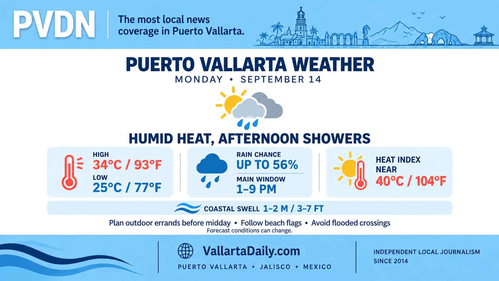
The temperature is forecast to reach approximately 34°C (93°F), with an overnight low near 25°C (77°F). The heat index could approach 40°C (104°F) between noon and late afternoon.
Morning plans have the best chance of staying dry. Showers become more likely after midday and could continue intermittently into the evening.
Rain chances increase during the afternoon
Local hourly forecasts differ on the precise arrival time. One hourly outlook places the rain chance at 51% around 1 p.m. and 56% at 2 p.m., with additional shower chances through the evening. Another forecast shifts the higher probability closer to sunset.
Residents should treat roughly 1 p.m. through 9 p.m. as the main rain window. A shower is not guaranteed in every neighborhood, and rainfall may be uneven across the bay.
The 6 a.m. national forecast places western Jalisco within an area where localized rainfall totals could reach 50 to 75 millimeters, or about 2 to 3 inches. That is a regional forecast and does not mean Puerto Vallarta will receive that amount.
Any stronger cell could produce lightning, brief gusts, street flooding, and reduced visibility. Drivers should avoid entering flooded crossings or flowing arroyos.
Humidity will make the afternoon feel hotter
Humidity was near 80% to 85% early Monday. Although it will fall as temperatures rise, the combination of heat and moisture could push the heat index near 40°C (104°F) from midday through approximately 4 p.m.
Outdoor work and exercise will be more comfortable early. Anyone outside during the hottest hours should carry water and take breaks in shade or air conditioning.
Higher swell expected along the coast
Routine winds around Puerto Vallarta should remain light, generally 6 to 10 km/h (4 to 6 mph). Thunderstorms may produce stronger, short-lived gusts.
The National Meteorological Service forecasts a long-period swell of 1 to 2 meters, approximately 3 to 7 feet, along the Jalisco coast. Beach conditions can vary by location, so swimmers should follow posted flags and lifeguard instructions.
Monday’s rain is associated with Tropical Wave 39 and other areas of atmospheric instability. It is not forecast as a direct impact from Tropical Storm Norbert, which the official Pacific cyclone bulletin says is moving away from Mexico.
The best window for Monday plans
Complete outdoor errands during the morning when possible. Carry rain protection for afternoon and evening activities, and allow extra travel time if a storm reaches the city.
Conditions can change quickly during the rainy season. The next scheduled national forecast is due at 6 p.m., or earlier if conditions change significantly.