X
The Pacific hurricane season runs from May 15 to November 30 each year, stretching over more than six months of opportunity for tropical cyclones. These storms originate near the equator, fueled by warm ocean waters and guided by atmospheric conditions. While the Atlantic hurricane season often grabs the spotlight, the eastern Pacific basin quietly spins out storms that can rake Mexico’s western shore and occasionally push toward Hawaii. In this essay, we’ll explore the season’s mechanics, historical trends, forecasting tools, and the particular cases that have shaped Puerto Vallarta’s storm history.
The Anatomy of the Pacific Hurricane Season
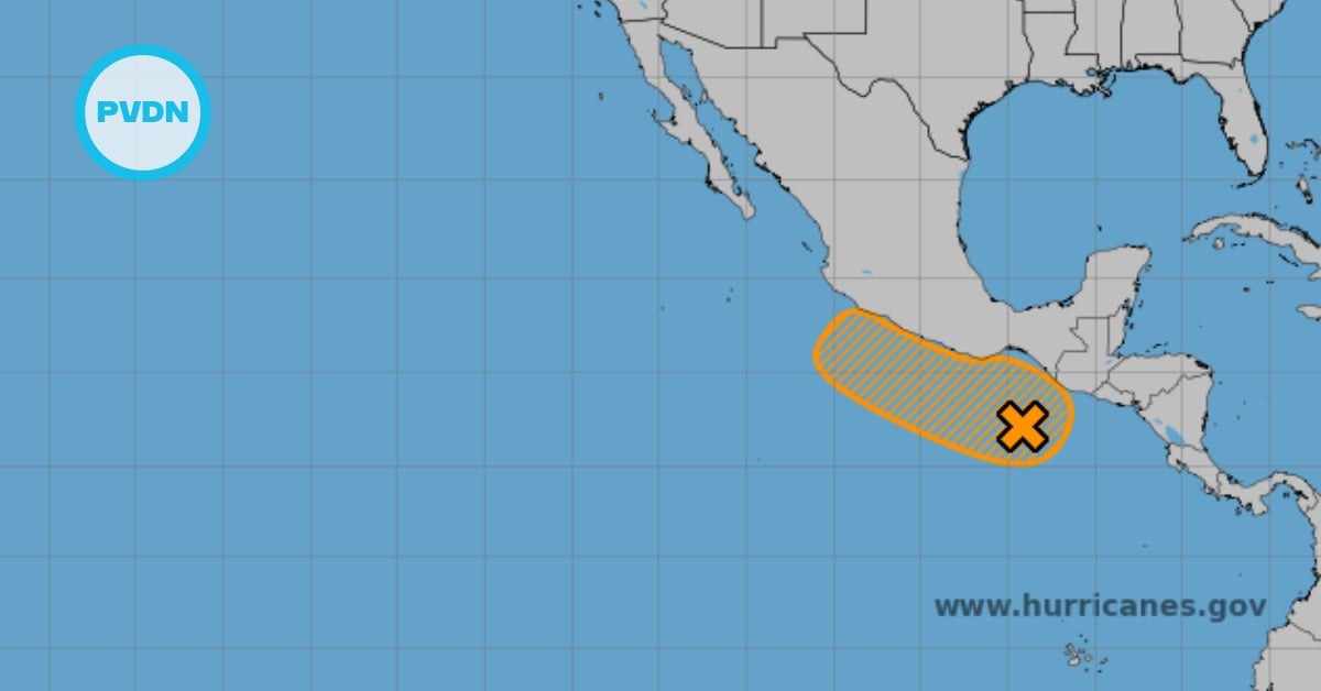
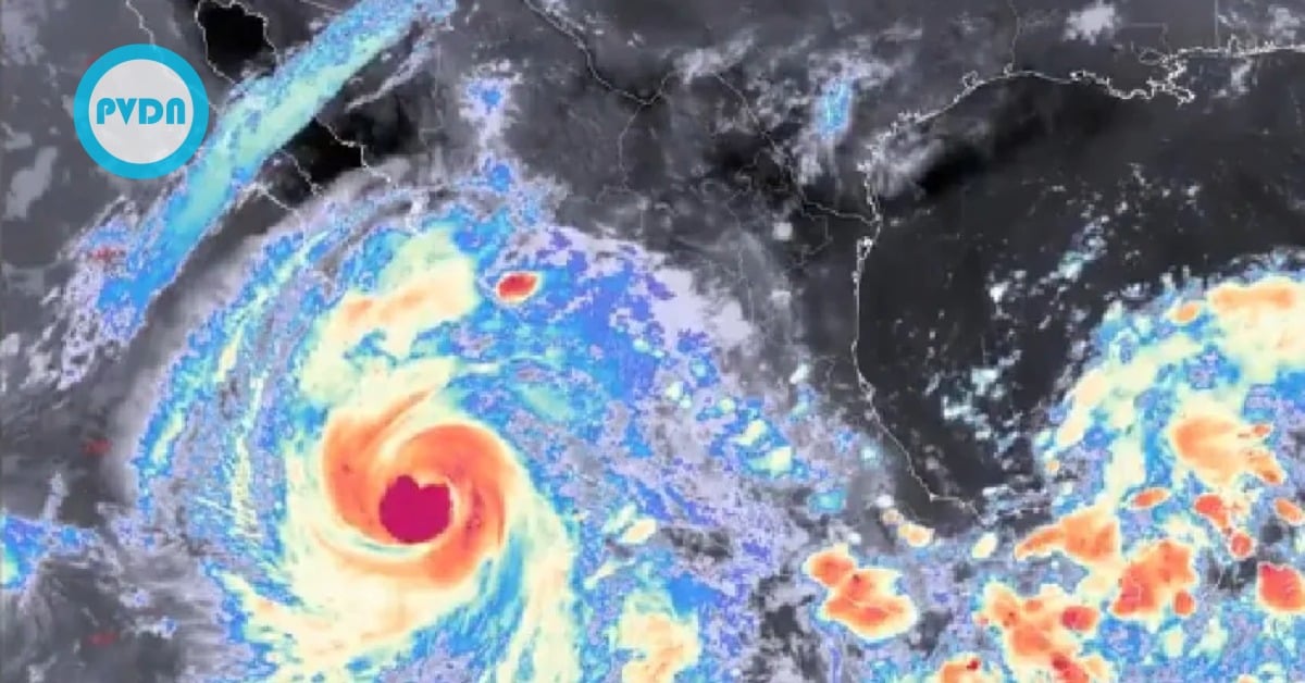
Every May, meteorologists watch the eastern and central Pacific basins for signs of tropical development. Sea surface temperatures climb above the critical threshold of 26.5 °C, and wind shear falls low enough to let thunderstorms cluster around a nascent low-pressure center. Surges of moisture from the Intertropical Convergence Zone feed deep convection. If this thunderstorm activity becomes sufficiently organized, the system can progress from tropical disturbance to depression, tropical storm, and sometimes hurricane strength.
Unlike the Atlantic, where hurricanes often form off Africa and track westward, Pacific storms typically develop off the coast of southern Mexico and Central America. The region’s warm ocean currents—fed by the North Equatorial Current and the Costa Rica Coastal Current—provide ample energy. However, dry air from the North American monsoon anticyclone can wrap into the system and weaken it. This dance between fueling warmth and intrusive dryness means that many Pacific depressions struggle to intensify into hurricanes.
Climatology and Historical Trends
On average, the eastern Pacific sees about 15 named storms, eight hurricanes, and four major hurricanes (Category 3 or higher) each season. Peak activity falls between late August and early October, when ocean heat content and mid-level moisture both reach annual highs. In recent decades, satellite imagery and forecasting improvements have refined our understanding of seasonal trends. Researchers have noted subtle shifts in storm patterns linked to El Niño and La Niña phases—El Niño can boost formation by reducing wind shear, while La Niña often suppresses storms through stronger shear and cooler upwelling.
Climate change also factors into long-term behavior. Studies suggest that while the total number of tropical cyclones may not rise dramatically, the share of more intense storms could increase. Higher sea surface temperatures intensify rainfall rates and boost rapid-intensification potential, as seen in Hurricane Patricia’s record-breaking jump to Category 5 in 2015. These shifts underscore the need for robust forecasting and hazard planning year after year.
Forecasting and Preparedness
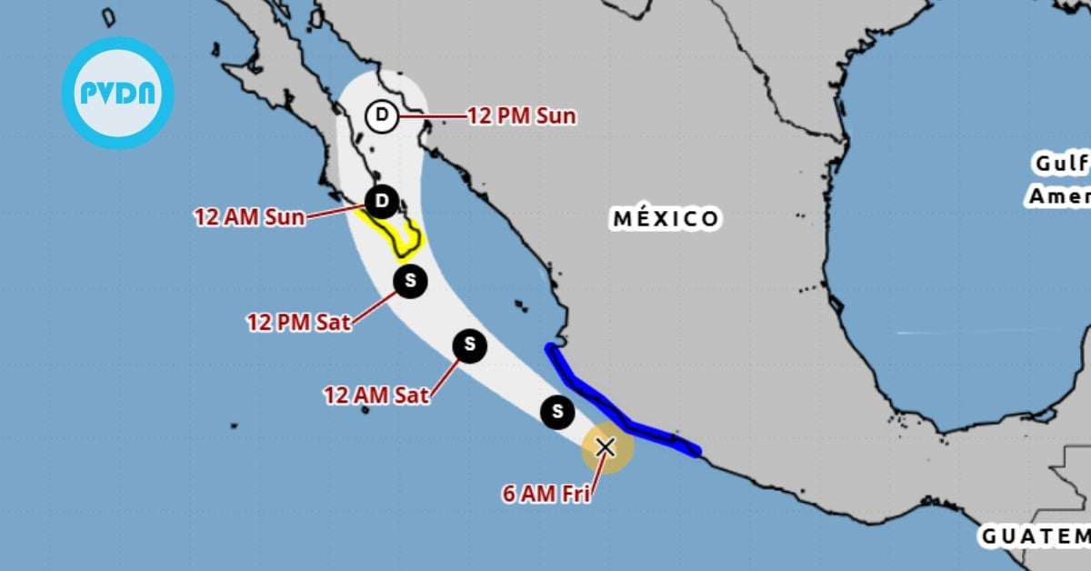
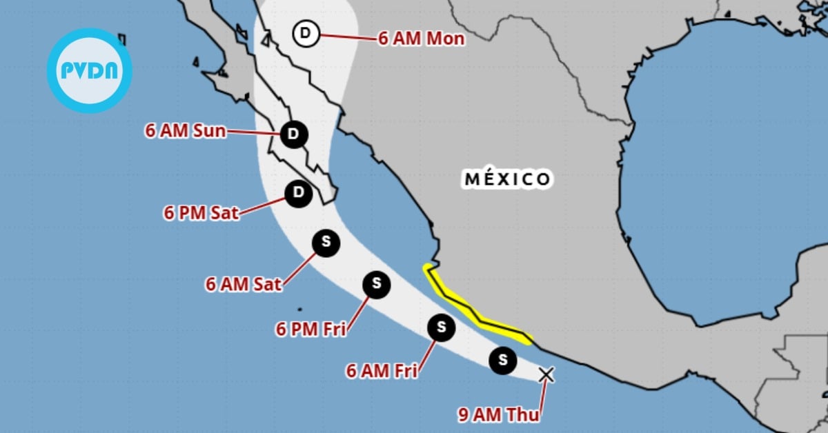
Advances in remote sensing and computer models have sharpened track and intensity forecasts over the past thirty years. Today, a five-day track forecast typically holds an error margin of about 200 nautical miles—down from 400 miles three decades ago—while intensity forecasts improve with better representation of inner-core dynamics and air-sea interaction. Agencies like NOAA’s National Hurricane Center issue tropical outlooks daily during the season, escalating to advisories every six hours once a system enters named-storm status.
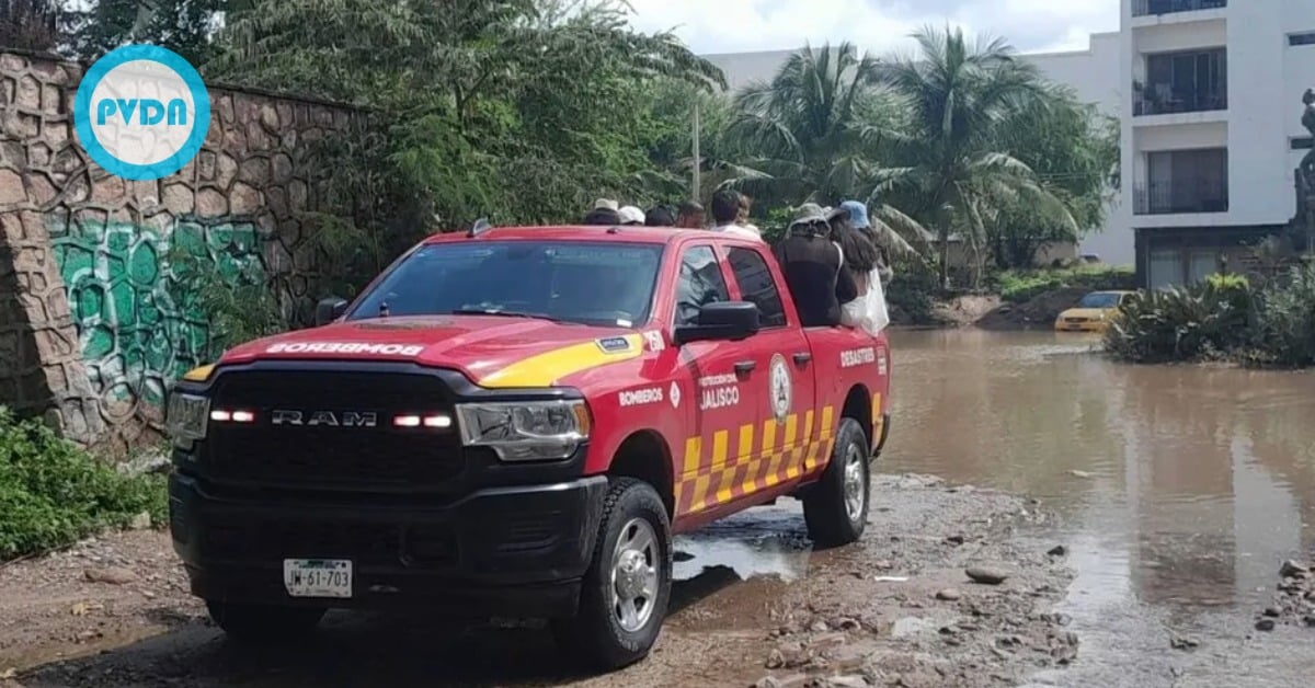
Local authorities along Mexico’s Pacific coast work closely with federal agencies to prepare communities. Early-warning systems broadcast alerts over radio, television, and mobile networks. Evacuation routes hinge on topography, since heavy rain can trigger flash floods and landslides in mountainous terrain. Residents secure windows and doors, trim trees, and clear drainage channels. In some regions, community shelters open for those in high-risk zones. These measures reduce casualties but cannot fully eliminate property damage from wind, rain, and storm surge.
Puerto Vallarta, nestled on Banderas Bay in Jalisco, sits at a crossroads between the open Pacific and the Sierra Madre mountains. Its tropical climate and coastal geography make it vulnerable to heavy rainfall and rough surf when hurricanes or tropical storms pass nearby. Direct hits remain rare, but several storms have tested the city’s resilience.
One of the most notable events was Hurricane Kenna in October 2002. Kenna rapidly intensified to Category 5 offshore before making landfall near San Blas, about 80 miles northwest of Puerto Vallarta. Though the strongest winds stayed west of Banderas Bay, Puerto Vallarta recorded sustained tropical-storm-force gusts, minor storm surge, and torrential rains. The city’s beachfront boardwalk flooded, and roads leading uphill experienced mudslides. Local authorities evacuated low-lying hotels and deployed emergency crews to clear debris. Remarkably, fatal casualties remained low, thanks to timely advisories and coastal evacuations.
Hurricane Patricia in October 2015 offered a stark reminder of rapid intensification risks. Patricia leaped from tropical storm to Category 5 strength in under 24 hours, setting records for the strongest landfalling Pacific hurricane. Although it made landfall farther north along the Jalisco coast—closer to Cuixmala—the massive circulation channeled heavy rainfall and gusty winds into Puerto Vallarta. Flooding displaced hundreds, and several offshore vessels sustained damage. Yet, the city’s improved infrastructure—drainage upgrades and reinforced sea walls—helped limit losses compared to earlier decades.
More recently, Tropical Storm Blanca in May 2021 funneled moisture into the region, triggering landslides in mountain areas behind Puerto Vallarta. While not a hurricane, its rains caused road closures and minor property damage. These events illustrate that even weaker systems can disrupt daily life in the resort city.
Today, Puerto Vallarta’s municipal government invests in early-warning sirens, flood-monitoring sensors, and public-awareness campaigns. Hotels and businesses conduct annual storm drills. Community organizations partner with meteorological services to ensure warnings reach remote neighborhoods. Still, challenges remain: unplanned urban sprawl along hillsides increases runoff, and climate change intensifies rainfall extremes. Continued vigilance and investment are key to safeguarding residents and tourists alike.
The eastern Pacific hurricane season poses a yearly test of science, infrastructure, and community preparedness. From the early stirrings of a tropical disturbance near Central America to the life cycle of hurricanes brushing Mexico’s western shore, the season demands close monitoring and rapid response. Puerto Vallarta’s experiences with storms like Kenna, Patricia, and Blanca highlight both the power of tropical systems and the value of resilience planning. Ultimately, the season’s rhythm shapes life along Mexico’s Pacific coast. By blending scientific insight with community action, cities like Puerto Vallarta can stand firm when the winds howl—and recover with that unmistakable coastal spirit once the skies clear.
