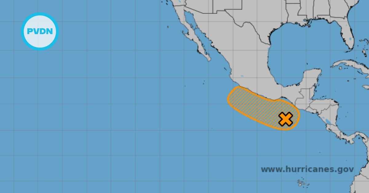
A broad low has parked off southern Mexico, and forecasters say it could slowly organize into potential cyclone Sonia by the weekend. Currently, the odds are low over the next 48 hours, but they are expected to jump over the next seven days. The real near-term threat is rain for Chiapas, Oaxaca, and Guerrero, especially in the mountains and along saturated river basins. Here’s what the models and agencies see so far—and what would have to change for a named storm to form.
Tropical forecasters are tracking a disorganized but persistent low just off Mexico’s southern Pacific coast. Early Tuesday, Mexico’s national weather service and the U.S. National Hurricane Center highlighted the same feature: a broad swath of storms roughly 415 kilometers south of Boca de Pijijiapan, Chiapas, with a 10% chance of development in 48 hours and about a 50% chance within seven days. In plain terms, that means slow, gradual organization is possible into the weekend, but nothing is guaranteed in the short term.
Potential cyclone Sonia
The system doesn’t yet have the structure of a tropical depression. It’s a messy cluster of thunderstorms, pulsing with daytime heating and sputtering at night. Still, the environment looks marginally favorable for slow development—warm water, intermittent bursts of convection, and periods of lighter upper-level winds. If sustained winds ever reach 39 mph, the next Eastern Pacific name on the list is Sonia. Until then, it’s just “the low south of Chiapas,” and that matters for expectations: rain first, wind and surf later, if at all.
Forecast guidance hints at a system that meanders near the coast for a day or two, then edges northwest, hugging the shores of southern and southwestern Mexico. That slow drift matters. It keeps moisture aimed at the Sierra Madre del Sur, where terrain squeezes storms and wrings out heavy downpours. Even a non-named system can trigger flash flooding and landslides—especially along steep slopes, smaller river basins, and low-lying urban zones with poor drainage. The signal to watch isn’t just a wind forecast; it’s where the deepest thunderstorms repeatedly set up.
Rain is the first concern
For communities in Chiapas, Oaxaca, and Guerrero, the practical takeaway is simple: treat the mid-week period as a rain-first event. Road washouts, quick-rise arroyos, and mudslides tend to show up before any tropical-storm-force gusts in set-ups like this. If the organization improves late in the week, seas and surf will build along open Pacific beaches, with rip currents a likely early hazard. If it doesn’t, the risk remains mostly hydrologic—localized flooding, ponding, and occasional power knocks from thunderstorm outflows.
A note on names, because headlines can get ahead of reality: a storm isn’t “Sonia” until it crosses the threshold to tropical-storm strength. The list used in the 2019 cycles is back this year, which is why you’re seeing “Sonia” mentioned as the probable name if development occurs. That context helps keep the signal separate from the noise. The forecast today is about odds and timing, not inevitability.
As of Tuesday morning, there are no coastal watches or warnings tied directly to this disturbance. That can change quickly if the organization ramps up. Still, the messaging from forecasters is calibrated: low odds in 48 hours, better odds by seven days, and a pattern that favors intermittent bursts rather than a rapid spin-up. Keep an eye on official updates from Mexico’s weather service and the NHC through the week. If the center consolidates and banding shows up on satellite, you’ll see the probabilities nudge higher—and that’s when the conversation shifts from “maybe” to “likely.”