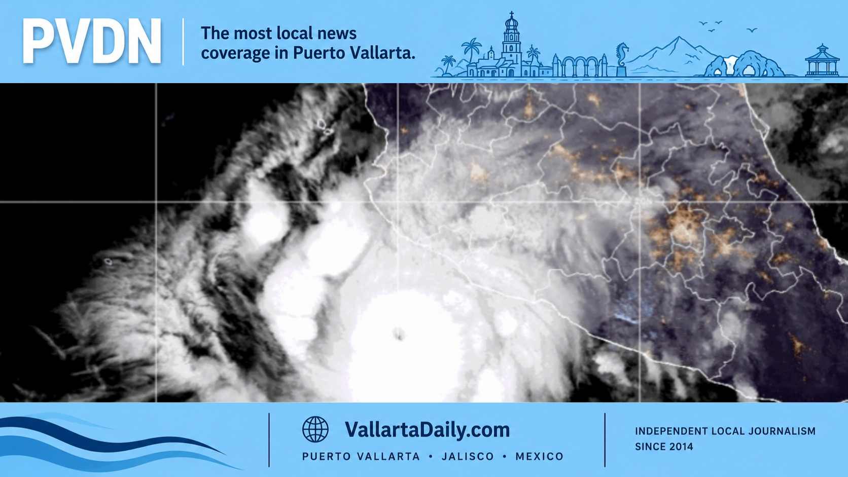
Puerto Vallarta, Jalisco, Oct. 11, 2026 — Hurricane Simon remained a Category 4 storm early Sunday as Puerto Vallarta woke up with little of the severe weather residents expected overnight.
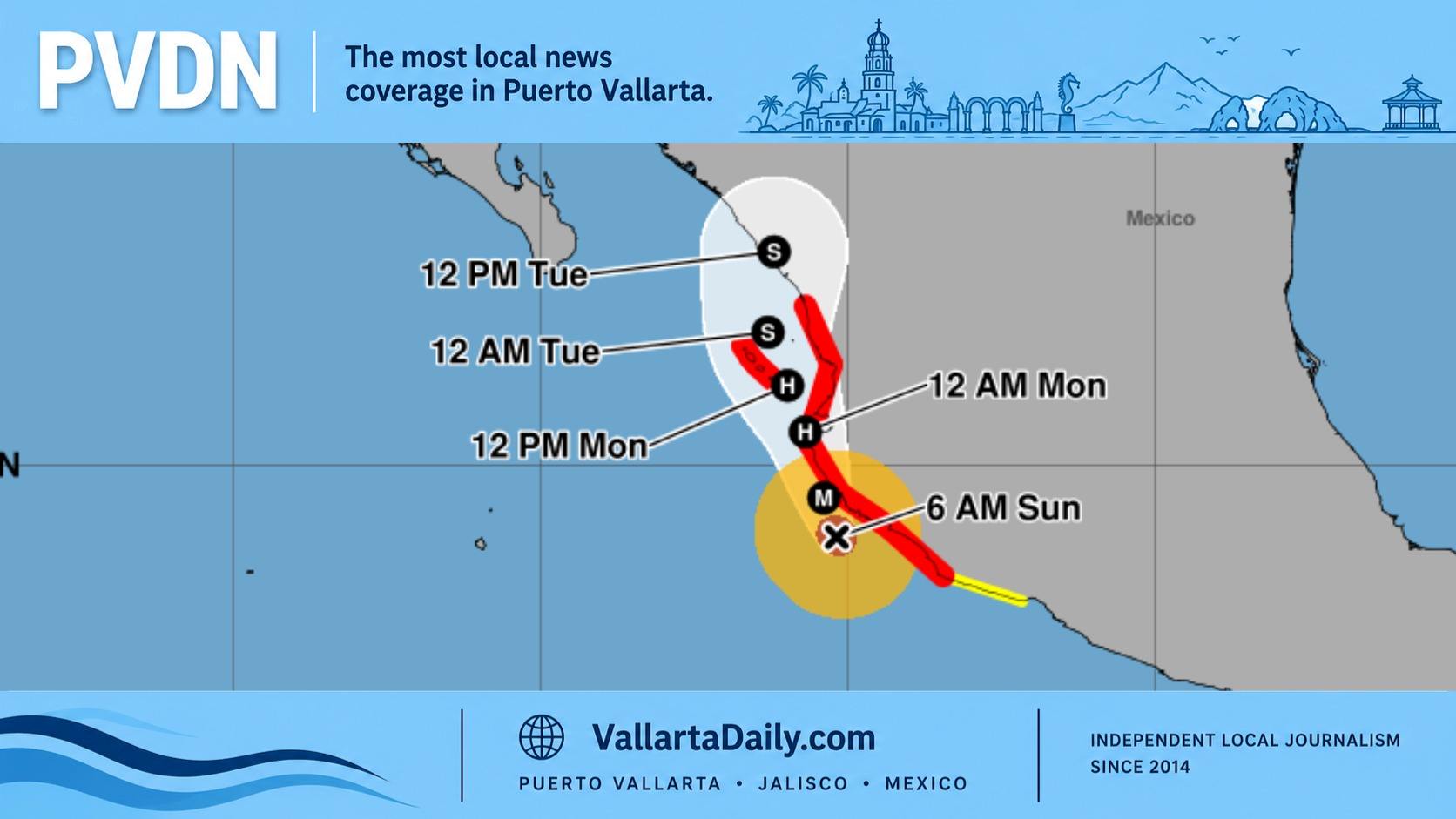
At 6 a.m., the National Hurricane Center placed Simon 110 miles south-southeast of Cabo Corrientes. Maximum sustained winds had decreased to 150 mph, while the storm continued north-northwest at 6 mph.
Forecasters expect Simon to move near or just inland over west-central Mexico later Sunday. Tropical-storm conditions are forecast to spread northward through the hurricane warning area during the day.
Puerto Vallarta Experiences a Quieter Night Than Expected
After days of preparations, emergency warnings and predictions of severe weather, Puerto Vallarta experienced a relatively quiet period late Saturday night.
In our overnight coverage of Hurricane Simon, PVDN reported at 11:49 p.m. Saturday that conditions remained relatively quiet.
The contrast between the warnings and the conditions experienced overnight has raised questions about whether Puerto Vallarta will receive the hurricane’s strongest effects.
The latest forecasts provide some encouraging information, particularly regarding the probability of destructive winds. However, the storm’s slow movement means the period of greatest concern has shifted later into Sunday.
Precautions remain in effect following Saturday’s maximum hurricane alert for Puerto Vallarta.
The city has already experienced substantial disruptions from preparations. Airport operations were suspended Saturday afternoon, beaches were closed, and SEAPAL Vallarta announced a preventive shutdown of the city’s drinking water supply.
Federal Civil Protection authorities have instructed residents of Puerto Vallarta, Cabo Corrientes and neighboring coastal municipalities to remain sheltered.
Hurricane Wind Probabilities Drop for Puerto Vallarta
One of the most significant developments Sunday morning is the change in projected wind probabilities for Puerto Vallarta.
At 9 p.m. Saturday, the National Hurricane Center estimated a 15% probability of sustained hurricane-force winds reaching the city.
By 3 a.m. Sunday, that probability had fallen to 4%.
The probability of sustained winds reaching at least 58 mph also declined, from 37% to 23%.
According to the 3 a.m. wind probability forecast, Puerto Vallarta now faces the following risks during the five-day forecast period:
- 69% probability of sustained winds reaching at least 39 mph, the threshold for tropical-storm-force winds.
- 23% probability of sustained winds reaching at least 58 mph, which can cause damage to trees, roofs and exposed structures.
- 4% probability of sustained winds reaching at least 74 mph, the threshold for hurricane-force winds.
These figures represent sustained wind speeds, not occasional gusts. They also do not measure the risk of flooding, dangerous waves or landslides.
The updated numbers indicate that tropical-storm-force winds are considerably more likely than sustained hurricane-force winds in Puerto Vallarta.
They also demonstrate why the hurricane’s Category 4 classification should not be interpreted as a forecast of Category 4 winds throughout Banderas Bay.
Why Hurricane Simon Has Not Reached Puerto Vallarta
Two factors help explain the relatively quiet conditions overnight.
First, Simon has been moving slowly. At 3 a.m. Sunday, the hurricane was moving north-northwest at about 6 mph, delaying its approach toward Cabo Corrientes and Banderas Bay.
Second, forecasters have adjusted the expected path somewhat farther west, potentially keeping the hurricane’s strongest winds offshore.
In its 3 a.m. forecast discussion, the National Hurricane Center acknowledged that several forecasting models had shifted offshore.
Forecasters wrote that “it is simply too close to call whether landfall will occur.”
The agency also described confidence in the storm’s longer-term forecast as very low, citing disagreement among computer models and uncertainty about how nearby mountains could affect its circulation.
Simon is also a relatively compact hurricane.
According to the National Hurricane Center, hurricane-force winds extend outward approximately 25 miles from its center. Tropical-storm-force winds extend as far as 90 miles.
This means areas outside the hurricane’s central circulation can experience much weaker winds than the storm’s maximum reported intensity.
The strongest winds are concentrated around the eyewall, rather than being spread evenly across every community in the hurricane warning area.
Sunday Remains the Main Period of Concern
The National Hurricane Center’s Sunday morning forecast places Simon near latitude 19.5 north and longitude 105.4 west by noon.
By midnight Sunday into Monday, the forecast places the center near latitude 20.5 north and longitude 105.7 west, close to Cabo Corrientes.
These projected positions would bring the hurricane closer to Puerto Vallarta during Sunday and Sunday night, rather than during the early morning hours when many residents expected conditions to deteriorate.
The forecast is not a guarantee of where the storm will travel. Even a modest change in its path could alter wind conditions along the coast.
The National Hurricane Center expects tropical-storm conditions to spread northward through the hurricane warning area Sunday.
Heavy Rain and Flooding Remain Serious Concerns
Although the chances of hurricane-force winds have decreased for Puerto Vallarta, the rainfall forecast still poses significant risks.
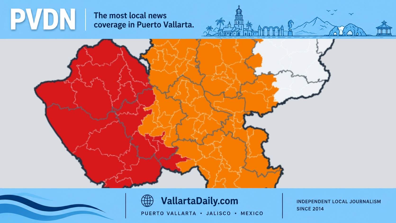
The National Hurricane Center warns that portions of Jalisco, Colima and Michoacán could receive an additional 10 to 20 inches of rain through Monday, with isolated totals reaching 30 inches.
Those amounts apply to portions of the broader region. They do not predict that Puerto Vallarta itself will receive that much rainfall.
Heavy rain could still create dangerous conditions in communities near the Cuale and Ameca rivers, low-lying neighborhoods and areas below steep hillsides.
Puerto Vallarta has a history of flooding when runoff from the surrounding mountains overwhelms drainage systems and river channels. PVDN has previously examined why streets flood during heavy rain, including the risks created by rapid runoff and drainage limitations.
Coastal conditions also remain dangerous.
The National Hurricane Center warns that Simon could produce large waves, hazardous surf and strong rip currents along sections of Mexico’s Pacific coast.
Residents should continue avoiding the Malecón, closed beaches, river crossings and other exposed coastal areas while restrictions remain in place.
Those living in areas vulnerable to flooding or landslides should follow evacuation instructions from local Civil Protection authorities. PVDN’s Puerto Vallarta emergency shelter and evacuation guide includes information on designated facilities.
The latest wind forecasts offer a reduced probability of a direct destructive wind impact on Puerto Vallarta, but they do not eliminate the threats from Simon’s rainfall and coastal conditions. Local emergency restrictions remain the appropriate guidance until authorities announce changes.