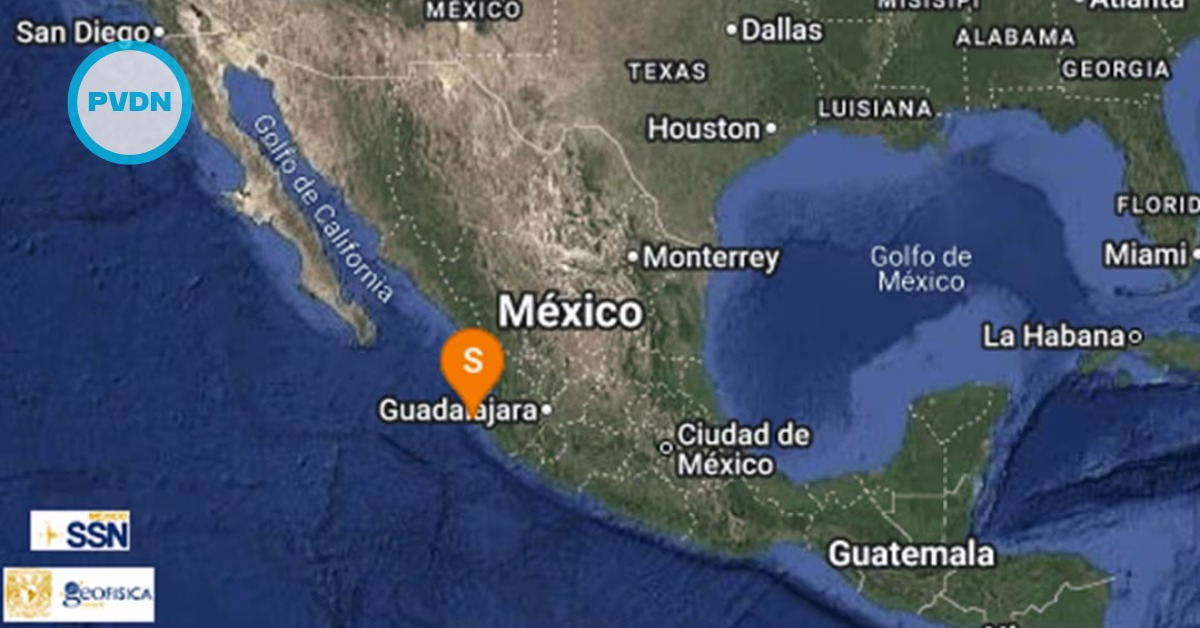
A magnitude 4.0 earthquake shook the Pacific off Jalisco early Tuesday, recorded 79 kilometers southwest of Puerto Vallarta at a depth of 17.6 kilometers. According to the National Seismological Service, the quake struck at 6:38 a.m. Central Mexico time and was centered at latitude 20.404 and longitude -105.96, in the open ocean off Bahía de Banderas. By the first hours of the morning, there were no official reports of damage or injuries in the resort city or nearby communities.
Events of this size are considered light by seismologists, especially when they occur offshore. International scales describe magnitude 4.0 to 4.9 earthquakes as noticeable but generally limited to minor effects such as rattling windows and objects, with serious structural damage unlikely. How strongly a tremor is felt depends on distance, depth and local ground conditions, but a moderate event nearly 80 kilometers from shore is not expected to cause major impacts on land.
Mexico is one of the world’s most seismically active countries. It sits where several tectonic plates meet, including the North American, Cocos, Rivera and Pacific plates along the Pacific margin. Off the coast of Jalisco and neighboring states, the Cocos and Rivera plates are slowly subducting beneath the North American plate, a process that has produced some of Mexico’s largest earthquakes over the past century. On an average day, national monitoring networks detect dozens of tremors of different magnitudes scattered across the country.
Puerto Vallarta earthquake
For people waking up in Puerto Vallarta, the Puerto Vallarta earthquake registered more as a line on a seismogram than a strong jolt in the street. Yet each small quake quickly revives a familiar question for residents across Mexico’s coastal cities: why did the seismic alert not sound? The answer lies in how the country’s early warning system is built and who it is designed to protect.
Mexico’s official seismic alert system relies on a chain of sensors installed along the Pacific coast and in parts of the interior. The network, operated by the Center for Seismic Instrumentation and Recording, was developed to detect strong shaking along the coast and send radio signals to selected cities before the most damaging waves arrive. Today, around ninety sensors stretch from Bahía de Banderas, near the Jalisco coast, down to the Isthmus of Tehuantepec and across high-risk areas of Guerrero, Puebla and Oaxaca.
The public alert, the one that sounds over loudspeakers and broadcast media, only covers a limited list of cities. Guadalajara, Colima, Morelia, Acapulco, Chilpancingo, Puebla, Oaxaca and Mexico City are currently configured to receive that official signal. Puerto Vallarta itself is not part of the cities where the government operates a public loudspeaker network tied to the seismic alert, even though sensors off its coast contribute to the system.
Even in those covered cities, the siren is not designed to react to every tremor. The software behind the network analyzes the first seconds of seismic data and estimates how strong shaking is likely to be in each city. An alert is issued only when the expected intensity exceeds pre-set thresholds for moderate or strong shaking. A magnitude 4.0 event offshore, far from dense urban areas, sits well below those values. In practical terms, that means it is normal for a quake like Tuesday’s to appear in official records without triggering sirens.
The system has another important limitation. Because the alert must detect a quake, process the signal and then send the warning, it works best when the epicenter is far enough from the city being protected. When an earthquake starts very close to a covered city, the first strong waves can arrive at almost the same time as, or even before, the warning. And when an event occurs outside the network’s monitored corridor, no early warning is possible at all. These design choices explain why many Mexicans feel shaking without hearing any alarm, even in places where the seismic alert is part of daily life.
Living with Mexico’s big quakes
While Tuesday’s offshore tremor was modest, it is part of a much longer story. Historical records show that Mexico has experienced some of the most powerful earthquakes on the planet. One of the largest known events occurred on March 28, 1787, along the Pacific coast of what is now Oaxaca and Guerrero. Modern studies estimate that earthquake at around magnitude 8.6. It generated a tsunami that swept several kilometers inland, making it the biggest tsunami documented in Mexican history.
More recently, two dates are burned into the national memory: September 19, 1985, and September 19, 2017. The 1985 earthquake, with a magnitude estimated near 8.2 and an epicenter off the coast of Guerrero, devastated large areas of Mexico City and other parts of the country. Official counts recorded thousands of deaths and widespread destruction of homes, hospitals and public buildings. In response, citizens organized massive rescue efforts and demanded better building codes, urban planning and emergency response.
Exactly thirty-two years later, on another September 19, a magnitude 7.1 earthquake struck with an epicenter between Puebla and Morelos. That event caused 369 confirmed deaths in central Mexico and serious damage to schools, apartment buildings and offices. The coincidence of dates deepened the emotional impact for many people, turning “19-S” into a shorthand for both grief and resilience. Each year, nationwide drills and public ceremonies recall those tragedies and aim to strengthen a culture of prevention.
Scientists and civil protection agencies point out that Mexico’s Pacific margin, including the so-called Guerrero Gap, remains capable of producing very large earthquakes and tsunamis. Research on the 1787 event and later quakes suggests that segments of the subduction zone can accumulate energy over long periods before releasing it in a single, powerful rupture. No one can predict exactly when such an event will occur, but authorities use these studies to update hazard maps, refine building standards and improve emergency plans.
Against that backdrop, a light offshore tremor near Puerto Vallarta can seem minor. Yet it is also a reminder that the region sits on an active boundary between oceanic and continental plates. The absence of a seismic alert does not mean there was no earthquake; it only reflects the way the early warning system is designed. For residents and visitors, the practical lesson is simple: even when the sirens stay silent, it is worth knowing basic safety steps, paying attention to official information and recognizing that the calm surface of the Pacific hides a restless geology below.