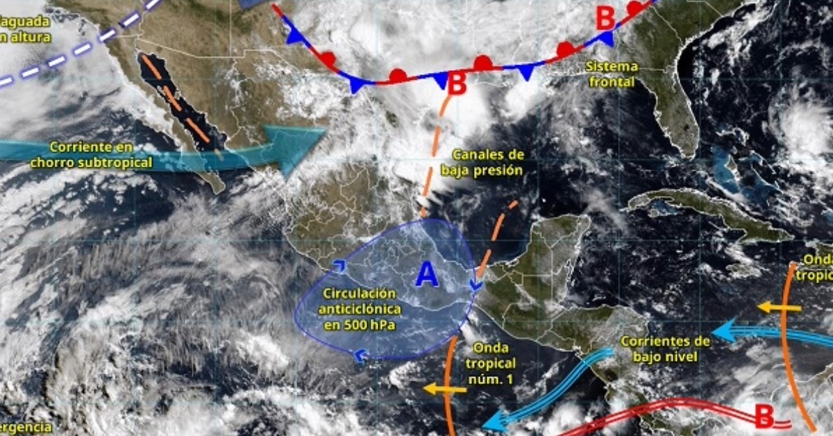
Puerto Vallarta’s long dry stretch may be nearing a shift. Meteorologist Víctor Manuel Cornejo López said the first relevant rains could arrive in the bay next week, tied to the movement of tropical waves and the early development of Pacific weather systems. The forecast does not mean a storm is headed for the city, but it does point to a seasonal change that often brings heavier afternoon clouds, heat, runoff, and short-notice weather changes across the bay.
Puerto Vallarta Rains Are Nearing
Puerto Vallarta could see its first significant rains of the season next week as tropical waves and early Pacific weather systems begin to develop, according to meteorologist Víctor Manuel Cornejo López.
Cornejo López said the first relevant rainfall in the bay could occur toward the end of May, with the possibility of more organized activity in Pacific waters around May 30 or 31. He linked the shift to the arrival of tropical waves, atmospheric instability, and the formation of low-pressure systems in the eastern Pacific.
The forecast marks a possible turn after weeks of heat and mostly dry conditions in Puerto Vallarta and the surrounding areas. It does not mean a tropical cyclone is expected to affect the city next week, but it does suggest that the rainy-season pattern may be taking shape.
Early signs of the rainy season
Cornejo López said tropical waves are already entering Mexico, creating instability and favoring rain across different parts of the country. In Puerto Vallarta, the timing of the first rains will depend on how those systems interact with trade winds and developing low-pressure areas over the Pacific.
The Pacific hurricane season officially began May 15 and runs through Nov. 30. Seasonal forecasts call for an active Pacific basin in 2026, with 18 to 21 named systems expected. That forecast covers the broader Pacific, not Puerto Vallarta specifically.
As of Thursday evening, the National Hurricane Center said tropical cyclone formation was not expected in the eastern and central North Pacific during the next seven days. That keeps the immediate picture limited to early-season moisture, instability, and changing rain chances, rather than a named-storm threat.
Heat could continue before the pattern changes
Rain next week would not necessarily bring an immediate break from hot weather. Early-season showers in Puerto Vallarta often arrive unevenly, with clouds building later in the day while heat remains in place.
Jalisco and Nayarit have both been included in recent forecasts for high temperatures, isolated rain, and strong wind gusts as Mexico moves deeper into the transition from dry-season heat to summer rainfall.
That transition can be uneven. Some areas may see brief showers while others stay dry. A single rain event also does not mean the full rainy season has settled into its usual rhythm.
A season to watch closely
Cornejo López previously warned that Puerto Vallarta’s 2026 rainy season could be outside the normal range, with the possibility of above-average rainfall during the months ahead. He also noted that long-range projections can change as atmospheric conditions evolve.
In Puerto Vallarta, early rain is closely watched because heavy downpours can affect streets, drainage channels, rivers, and hillside areas. Even without a direct tropical storm, heavy local rain can cause pooling, runoff, and short disruptions in low-lying parts of the city.
The next several days should show whether the developing tropical pattern brings only scattered showers or the bay’s first more noticeable rain event of the season.