The rainy season left the region’s reservoirs looking healthy, but that doesn’t guarantee flowing rivers all spring. A local meteorologist says hotter months and stubborn high-pressure systems could thin out streams across the Bay of Banderas, with a few stretches even disappearing at the surface. If you’ve ever had your tap sputter during the dry season, this is the moment to pay attention. Here’s what the warning means, why riverbeds can go quiet fast, and the small habits that can keep the next few months from turning into a scramble.
A dry-season squeeze is taking shape
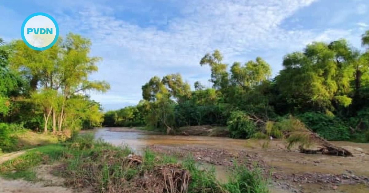
A meteorologist, Víctor Manuel Cornejo López, warns the Bay of Banderas to brace for water stress in the months ahead. He says rising temperatures and stubborn high-pressure systems can squeeze the region’s available moisture. When that happens, river and stream levels drop, and smaller channels can dry out for a time. Cornejo López says the risk is not limited to rivers. He adds that reservoirs and lakes can also feel the same pressure, raising the odds of a sharp dry spell. There is one piece of good news. After last year’s rainy season, many local dams reached normal or above-normal storage, he says, citing national water data. Even so, he notes that some rivers are already running low, especially the Pitillal and Mascota. If the pattern holds, flows could thin until some stretches vanish at the surface. His message is to start conserving now, not when the next rains finally arrive.
Heat and high pressure drain what’s left
On the Pacific coast, the dry season often isn’t dramatic at first. It arrives as clearer skies, warmer afternoons, and fewer soaking rains. A persistent high-pressure ridge acts like a lid, pushing storms away and thinning cloud cover. With more sun and wind, water evaporates faster from river surfaces and exposed soil. Plants also pull more moisture from the ground through evapotranspiration. That combination matters because many local rivers depend on slow groundwater release to keep moving between storms. When the ground dries out, that base flow weakens. In the Bay of Banderas, the first signs appear in small arroyos that feed the larger channels. A river can still exist, but it may retreat into gravel beds and run below the surface. To anyone walking the bank, it looks like it disappeared overnight. This is why the warning focuses on the next few months. Once the flow drops, a short heat wave can turn a shallow stream into disconnected pools.
Why taps can feel it first
For most residents, the first sign is not a dry riverbank. It is a weaker stream of water at home. For newcomers, that can be a surprise. Puerto Vallarta’s water system leans heavily on groundwater. SEAPAL Vallarta says 85.5% of the local supply comes from deep wells. The rest comes from filtration galleries and surface intakes linked to rivers. As the dry season approaches, the dynamic level in wells can fall. That drop reduces the amount of water that can be pumped. The utility also notes that running equipment near maximum capacity increases wear. It can force corrective maintenance and create short interruptions in supply. When demand rises during warm weeks and holiday travel, those dips get noticed fast. It can be worse in higher neighborhoods that rely on storage tanks and steady pressure. This is why low river levels matter even if you rarely visit them. Rivers help recharge aquifers, and some supply still depends on surface capture.
Discipline now beats panic later
Cornejo López’s call for discipline is not about fear. It is about buying time during the hardest part of the dry season. If you have a tinaco, cistern, or rooftop tank, make sure it is working before you need it. A stuck float valve, a cracked lid, or an empty reserve turns a minor outage into a lost day. Inside the home, the quickest wins are usually boring. Fix drips, replace worn toilet flappers, and keep showers tight, especially when visitors are in town. Capture the cold water while the shower warms, then use it for cleaning or watering plants. Run laundry and dishes only with full loads, and skip the hose when a bucket will do. Outside, water plants early, use mulch, and let the lawn go a little golden. These are small moves, but they add up across a neighborhood. In a place where residents and tourists share the same pipes, conservation is also a form of courtesy.
When relief could arrive
The forecast is not all dry. Cornejo López says current climate models point to early rains this cycle. He expects showers in March and April across central Mexico, then a possible extension into May. May can also bring rain to the Bay of Banderas, which would ease pressure on rivers and wells. Still, local water officials often describe the real turning point as steady summer rain that recharges aquifers. SEAPAL has said that recharge typically becomes noticeable in July and August, after the rainy season settles in. In the wider Lerma–Santiago–Pacific basin, drought monitoring has also flagged pockets of abnormally dry conditions. Between now and then, expect the story to change week by week. A few storms can lift a river for a day, then it drops again. Watch for utility advisories, protect stored water from contamination, and report leaks quickly. If you plan remodeling or landscaping, schedule the thirstiest work for the wet months. The best time to prepare is before the riverbed goes quiet.
With information from Quadratín Jalisco, SEAPAL Vallarta, Grupo Milenio