Puerto Vallarta, Jalisco, Sept. 5, 2026 – Puerto Vallarta faces a humid Saturday with afternoon thunderstorms possible and elevated swell affecting beaches along the Jalisco coast.
The latest airport observation, recorded at 7:40 a.m. Mexico City time, showed scattered clouds and 27°C (81°F). Humidity was about 84%, making it feel closer to 30°C (86°F). Northeast wind was 11 km/h (7 mph).
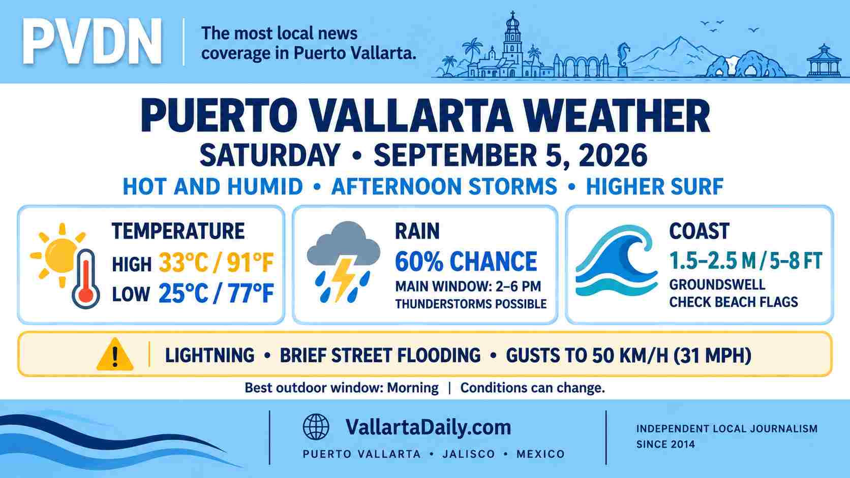
Temperatures should reach about 33°C (91°F), with an overnight low near 25°C (77°F). A local hourly forecast places the rain chance near 60%, mainly during the afternoon. The Puerto Vallarta airport forecast identifies approximately 2 to 6 p.m. as the main window for temporary thunderstorms and rain.
Afternoon storms could produce brief flooding
The National Meteorological Service forecast places western Jalisco within an area where isolated rainfall totals could reach 50 to 75 millimeters, or roughly 2 to 3 inches.
That amount is a regional maximum, not a citywide prediction for Puerto Vallarta. Storm coverage and rainfall totals can vary across the bay, mountains, and individual neighborhoods.
Heavier cells may include lightning, reduced visibility, and wind gusts of 30 to 50 km/h (19 to 31 mph). Street flooding, rising streams, and hillside runoff are possible where the heaviest rain develops.
Tropical Wave 36 is moving westward away from the Colima and Jalisco coasts after increasing the region’s rain potential. Hurricane Marie is also moving away from Mexico, and the morning federal bulletin did not identify a direct cyclone threat to Puerto Vallarta.
Elevated swell reaches the Jalisco coast
Federal forecasters expect a groundswell of 1.5 to 2.5 meters, or about 5 to 8 feet, along the Jalisco coast. Actual breaking waves inside Banderas Bay will depend on the beach’s exposure and local conditions.
The official port-status map showed Puerto Vallarta open to all navigation at 8:05 a.m. Port status and swimming conditions are separate safety decisions, and either can change during the day.
A same-morning citywide beach-flag report was not available at publication time. Beachgoers should check the flag posted at each beach and follow lifeguard instructions, especially near river mouths, rocks, and areas exposed to larger sets.
The better window for Saturday plans
Morning remains the more dependable period for errands and outdoor activities. Heat and humidity will build before the afternoon storm window, so shade, water, and breaks will be important.
Anyone driving after 2 p.m. should allow extra time if storms form and avoid streets with standing water. Beach and boat plans should be checked again before departure. Conditions can change quickly around individual storm cells.