Puerto Vallarta, Jalisco, August 10, 2026 – Puerto Vallarta was partly cloudy and about 25°C (77°F) at 6:35 a.m. local time. Humidity was near 80%, making it feel closer to 29°C (85°F).
The nearby airport-area observation showed light wind from the east-northeast. No rain was falling at the time of observation.
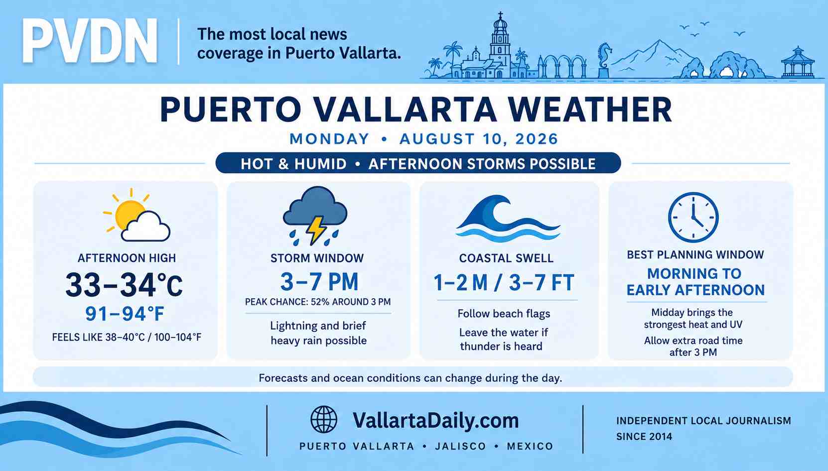
Temperatures are forecast to reach 33–34°C (91–94°F) this afternoon. Humidity will make it feel closer to 38–40°C (100–104°F) during the hottest hours.
Afternoon storm window
Scattered thunderstorms are most likely from midafternoon into the evening. One current hour-by-hour forecast shows a 52% chance of rain around 3 p.m. and 42% at 4 p.m.
A second local hourly outlook keeps a 33% to 55% chance of showers or isolated thunderstorms from about 3 p.m. through late evening. The differences between forecasts reflect uncertainty about where storms will form and how long they will last.
Heat before the rain
The morning should offer the most reliable dry weather. Heat will build quickly after 10 a.m., however, and the UV index is expected to reach extreme levels around midday.
Outdoor work, walking, and errands will be more comfortable early on. Anyone outside in the afternoon should take regular shade breaks and carry water, even if clouds begin to develop.
Flooding and lightning risk
The 6 a.m. national forecast places Jalisco’s heaviest rain in central and eastern parts of the state, outside Puerto Vallarta. It still calls for thunderstorms across the central Pacific region, with lightning and sudden wind gusts possible.
A storm directly over the city could produce brief street flooding, poor visibility and water accumulation in low areas. Drivers should avoid crossing water when its depth or current cannot be judged. Beachgoers should leave the water and exposed shoreline when thunder is heard.
Swell along the Jalisco coast
A long-period swell of 1 to 2 meters, or about 3 to 7 feet, is forecast along the Jalisco coast. Local wind should remain light for much of the day, although stronger gusts may develop near thunderstorms.
The swell can strengthen shore break and currents even when the beach appears calm. Check the flag posted at each beach and follow lifeguard instructions. Small-boat operators should confirm the official port status before departure.
Best window for Monday plans
Morning through early afternoon should provide the driest conditions, with the tradeoff of increasing heat and intense sun. From about 3 p.m. onward, carry rain protection and allow extra travel time.
Weather and ocean conditions can change quickly. This report reflects observations and forecasts checked at 6:35 a.m. on August 10.