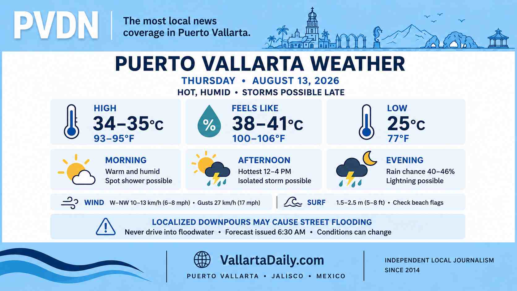
Puerto Vallarta, Jalisco, August 13, 2026 – Puerto Vallarta began Thursday with broken cloud cover and humid air. The 5:40 a.m. airport observation recorded 25°C (77°F), humidity near 83%, visibility of 9.7 kilometers (6 miles), and a northeast wind near 9 km/h (6 mph).
Temperatures are expected to reach 34–35°C (93–95°F) this afternoon, with an overnight low near 25°C (77°F). The heat index could reach 38–41°C (100–106°F) during the early to midafternoon, depending on cloud cover.
A spot shower is possible from late morning onward, but the stronger rain signal develops later in the day. Thunderstorms will remain localized, and rainfall could vary sharply between neighborhoods. This forecast was reviewed at 6:30 a.m. Thursday, and conditions can change during the day.
Rain Chances Increase During the Evening
The hourly Puerto Vallarta forecast shows scattered shower chances around midday and early afternoon. The probability rises again after 7 p.m., reaching roughly 40% to 46% during parts of the evening.
This does not point to continuous rain across the city. Some areas may remain dry while a nearby neighborhood receives a brief downpour. Lightning may accompany stronger cells, especially during the late afternoon and evening.
Western Jalisco Included in Heavier Regional Forecast
The latest extended forecast from Mexico’s National Meteorological Service calls for localized rainfall totals of 50 to 75 millimeters (2 to 3 inches) in parts of western and eastern Jalisco between 8 a.m. Thursday and 8 a.m. Friday.
That is a regional forecast, not a prediction that Puerto Vallarta will receive those totals. The agency does not identify which western Jalisco municipalities are most likely to see the heaviest rain.
If a strong storm forms over Banderas Bay or the mountains east of the city, brief street flooding, reduced visibility, and rising water in streams or drainage channels are possible. Drivers should avoid entering flooded streets because water depth and pavement conditions can be difficult to judge.
Elevated Swell Along the Jalisco Coast
Local winds should remain light to moderate, shifting toward the west or northwest during the afternoon at around 10–13 km/h (6–8 mph). Gusts could approach 27 km/h (17 mph).
The SMN forecasts a regional Pacific swell of 1.5 to 2.5 meters (5 to 8 feet) along the Jalisco coast. Conditions inside Banderas Bay will vary, and those figures do not represent the exact breaking-wave height at every Puerto Vallarta beach.
Swimmers should check the flag posted by lifeguards before entering the water. Small-boat operators and tour passengers should confirm conditions with their operator or the port authority, particularly if thunderstorms develop offshore.
Plan Early and Leave Room for a Wet Evening
The morning offers the most dependable window for errands, outdoor work and beach plans. Heat exposure becomes the main concern from late morning through midafternoon, when shade, water and breaks from direct sun will be useful.
Anyone traveling during the evening should carry rain protection and allow extra time if a storm develops. Beach, road and port conditions can change quickly once thunderstorms begin.