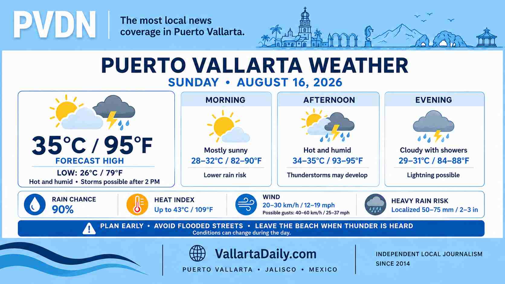
Puerto Vallarta, Jalisco, August 16, 2026 – Puerto Vallarta begins Sunday under mostly cloudy skies after overnight thunderstorms. Another hot day is expected before the risk of rain and lightning increases during the afternoon.
At about 6:15 a.m., a city weather observation showed overcast skies and a temperature of 25°C (77°F). Humidity was 94%, with northeast wind near 13 km/h (8 mph), making it feel closer to 26°C (79°F).
The latest airport observation, recorded at 4:40 a.m., was similar: mostly cloudy skies, 26°C (79°F), 89% humidity and north wind near 19 km/h (12 mph).
Heat builds before the storms
The temperature is forecast to reach 34°C to 35°C (93°F to 95°F) around midday and early afternoon.
Humidity will make the heat feel stronger. Hourly guidance estimates a peak heat index near 43°C (109°F) between noon and 3 p.m.
Anyone working, exercising, or walking outdoors should plan for frequent water and shade breaks. The morning will be more comfortable, but temperatures will rise quickly after 9 a.m.
Rain and lightning become more likely after midday
The overall chance of rain is around 90% for Sunday. Forecast guidance places the more likely period for showers and thunderstorms from mid-afternoon through the evening, although the first cells could develop around 2 p.m.
The Servicio Meteorológico Nacional’s 6 a.m. forecast places western Jalisco in a zone where localized rainfall totals could reach 50 to 75 millimeters (2 to 3 inches).
That range describes possible regional storm maximums and does not mean every part of Puerto Vallarta will receive that amount. Tropical downpours can concentrate heavy rain over one section of the city while nearby neighborhoods receive much less.
Wind, roads and beach conditions
The national forecast calls for sustained wind of 20 to 30 km/h (12 to 19 mph) in Jalisco, with possible gusts of 40 to 60 km/h (25 to 37 mph). Those are statewide estimates, and the strongest local gusts would be most likely near thunderstorms.
A slow-moving downpour could produce street flooding, poor visibility, and rising water in streams or low crossings. Drivers should avoid water-covered streets because depth and pavement damage can be difficult to judge.
The morning national bulletin did not include a specific high-surf forecast for the Jalisco coast on Sunday. Beach conditions can still change when storms approach. Check the posted beach flag before entering the water and leave the beach or pool when thunder is heard.
The best window for Sunday plans
Morning offers the lowest rain risk for errands, beach visits, and other outdoor plans. Heat will become the main concern by late morning, followed by a growing storm risk after 2 p.m.
Keep afternoon plans flexible and check the radar before traveling across the city. Rain timing and intensity can change quickly around Banderas Bay.