Puerto Vallarta, Jalisco, August 17, 2026 – Puerto Vallarta was cloudy at about 26°C (79°F) at 6:17 a.m. CST. Humidity was near 87%, with a heat index around 32°C (89°F) and a light east-northeast wind near 6 km/h (4 mph).
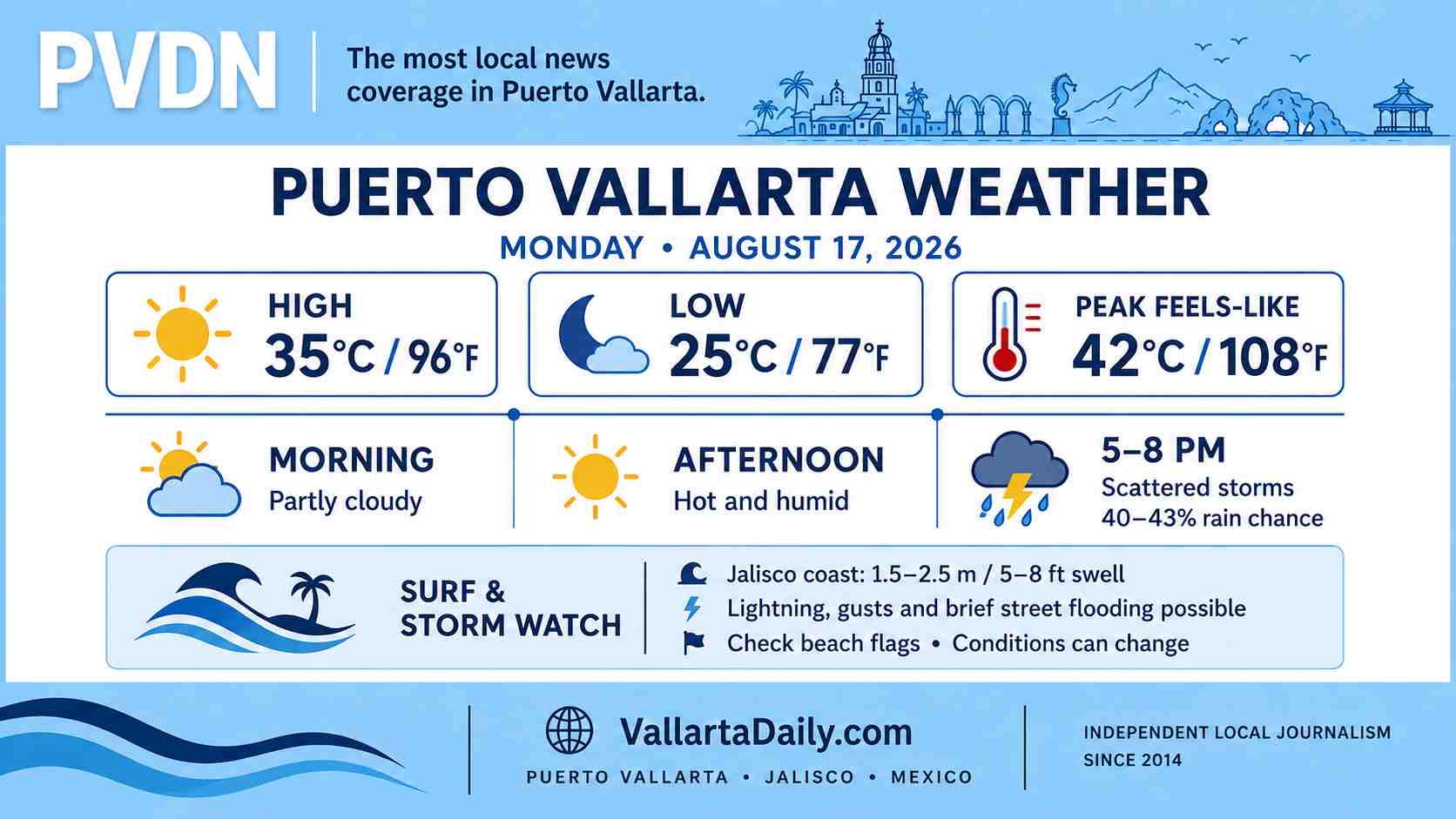
The temperature is forecast to reach about 35°C (96°F) Monday afternoon before falling to roughly 25°C (77°F) overnight. Humidity will keep apparent temperatures well above the measured air temperature.
Scattered thunderstorms are most likely from late afternoon into the evening. Conditions can change quickly if storms develop over the mountains or move inland from Banderas Bay.
Afternoon heat will feel more intense
The hourly Puerto Vallarta forecast shows the heat index climbing toward 42°C (108°F) between 2 p.m. and 5 p.m. Winds should remain fairly light outside thunderstorms, generally 6 to 13 km/h (4 to 8 mph).
People working or exercising outdoors should move strenuous activity to the morning when possible. Shade and water will be important during the afternoon, even where cloud cover increases.
Evening brings the highest rain chance
Puerto Vallarta’s hourly rain chance rises to about 40% to 43% between 5 p.m. and 8 p.m. Scattered thunderstorms or showers could continue later in the evening, although rain will be uneven across the city.
The national forecast issued Sunday evening calls for 25 to 50 millimeters (1 to 2 inches) of rain in parts of western Jalisco. Those regional totals are not expected in every Puerto Vallarta neighborhood. Any stronger storm could bring lightning, brief gusts, reduced visibility and localized street flooding.
Drivers should allow additional time after sunset and avoid entering flooded streets. Water can rise quickly near arroyos, river crossings and low sections of road during a concentrated downpour.
Elevated swell along the Jalisco coast
The same official forecast warns of long-period swell reaching 1.5 to 2.5 meters (5 to 8 feet) along parts of the Jalisco coast. Conditions inside Banderas Bay will vary by beach and may be lower than the regional forecast.
A same-day municipal beach-flag report was not available in the sources reviewed by 6:17 a.m. Beachgoers should check the flag posted at their location, follow lifeguard instructions and stay out of river mouths. Small-boat and excursion conditions may also change if thunderstorms produce stronger gusts.
No active tropical cyclone was listed near Mexico in the eastern North Pacific outlook early Monday. The absence of a named storm does not remove the local lightning, rain or surf risk.
Plan outdoor time before late afternoon
Morning through early afternoon offers the better window for errands, beach visits and outdoor work, although the midday heat will be considerable. Anyone with evening plans should carry rain protection and expect possible traffic delays if a storm crosses the city.
Forecast timing, beach flags and marine conditions can change during the day.