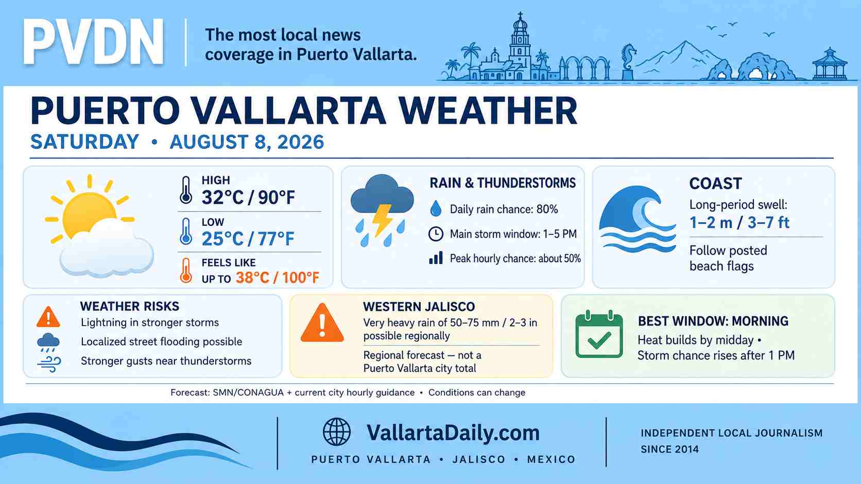
Puerto Vallarta, Jalisco, August 8, 2026 – Puerto Vallarta began Saturday cloudy and humid, with temperatures near 25°C (77°F) at 6:20 a.m. local time. The morning should offer the day’s more reliable window for outdoor plans before temperatures rise and the chance of thunderstorms increases during the afternoon.
Rain overnight had largely eased by daybreak. Current hour-by-hour guidance places the better chance for renewed showers between roughly 1 p.m. and 5 p.m., with probabilities reaching around 50% during part of that period. The same city forecast gives Puerto Vallarta an overall 80% chance of rain during the day, although coverage and timing remain uncertain.
The larger concern comes from the official regional forecast. The Servicio Meteorológico Nacional’s 6 a.m. outlook calls for pockets of very heavy rain of 50 to 75 mm (2 to 3 inches) across western and northern Jalisco as tropical wave No. 25 moves along the state’s coast. That is a regional forecast and does not mean Puerto Vallarta itself will receive those totals.
Heat builds quickly after the morning
Temperatures are expected to climb to around 32–34°C (90–93°F) during the afternoon.
Humidity was close to 90% around daybreak, and the combination of heat and moisture could push the feels-like temperature to roughly 38–39°C (100–102°F) during the hottest part of the day.
For errands, walking, or other outdoor activity, the morning through late morning offers the better combination of lower temperatures and reduced rain chances. By midday, heat becomes the more immediate concern even if skies remain dry.
Thunderstorms could bring localized flooding
Any stronger afternoon storm can produce lightning and a quick period of heavy rain. The National Weather Service warns that the heavier storms across western Jalisco may cause street flooding, higher water levels in rivers and streams, and landslides in vulnerable areas.
At 6:20 a.m., those warnings represented forecast risks, not a report of citywide flooding in Puerto Vallarta.
Drivers should be particularly cautious if heavy rain develops over the city. Visibility can fall quickly, and low-lying streets can collect water faster than rainfall totals across the wider city might suggest. Do not attempt to drive through a flooded street where the depth is unclear.
No active tropical cyclone was listed in the eastern Pacific early Saturday by the National Hurricane Center. The weather affecting Jalisco is associated with tropical wave No. 25 rather than a named tropical storm or hurricane.
Jalisco coast faces 1–2 meter swell
Coastal conditions deserve some attention Saturday. The National Weather Service forecasts long-period swell of 1 to 2 meters, about 3 to 7 feet, along the Jalisco coast.
That figure shows offshore swell and does not mean every Puerto Vallarta beach will have breaking waves that high. Conditions can vary considerably from one beach to another.
Swimmers should follow the flag posted at their beach and instructions from lifeguards. Lightning is also a reason to leave the water even when surf conditions appear manageable.
Local winds should generally remain modest outside thunderstorms, although the regional forecast allows west winds of 20–30 km/h (12–19 mph) with gusts reaching 40–60 km/h (25–37 mph) in parts of Jalisco. Boaters should check the current Puerto Vallarta port status before departure.
Saturday’s best weather window
Morning plans have the advantage Saturday. Temperatures rise sharply toward midday, while the more credible window for showers and thunderstorms begins during the early afternoon.
Anyone heading to the beach, driving into the mountains or planning an afternoon outdoor activity should keep an eye on changing skies rather than relying solely on the morning forecast. Conditions can change quickly when thunderstorms develop along the coast and surrounding mountains.