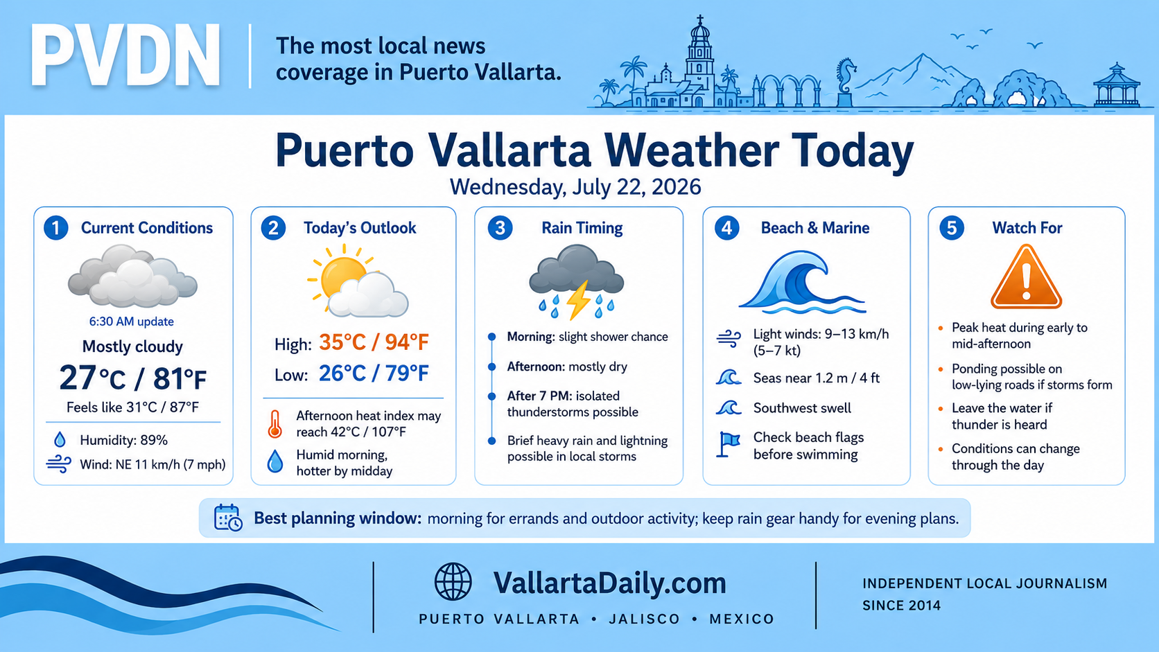
Puerto Vallarta, Jalisco, July 22, 2026 – Puerto Vallarta began Wednesday partly cloudy and humid, with the day’s main weather concern expected to be afternoon heat followed by a limited chance of evening thunderstorms.
The latest airport weather-station report, issued at 5:47 a.m. and reviewed at 6:30 a.m., showed a temperature of about 27°C (81°F). Humidity was 89%, making it feel closer to 31°C (87°F).
Winds were from the northeast at approximately 11 km/h (7 mph), with visibility near 13 kilometers (8 miles). Conditions and storm timing can change during the day.
Heat builds through the afternoon
Forecast services place Wednesday’s high between 33°C and 35°C (92°F and 94°F), with an overnight low near 25°C to 26°C (77°F to 79°F).
Humidity will fall somewhat as temperatures rise, but it will remain high enough to push the apparent temperature well above the measured air temperature. The hour-by-hour forecast shows the heat index reaching about 38°C (100°F) by 10 a.m. and peaking near 42°C (107°F) between early and mid-afternoon.
Outdoor work, exercise, and errands will be more comfortable during the morning. People spending extended periods outside should take regular shade and water breaks through the hottest part of the day.
Evening brings the better rain chance
A brief shower was possible around sunrise, followed by a low rain chance through most of the morning and afternoon.
The city-specific hourly forecast increases the chance of isolated thunderstorms after approximately 7 p.m., with rain probabilities around 14% to 23% through late evening. Any storm that develops could bring a short period of heavy rain and lightning, even when nearby neighborhoods remain dry.
The National Meteorological Service forecast for Jalisco includes strong to locally very heavy rainfall of 50 to 75 millimeters in parts of the state. That is a statewide forecast and does not mean those totals will occur throughout Puerto Vallarta.
Drivers should use caution if an evening storm develops, particularly on low-lying streets, at underpasses and near waterways where ponding can form quickly. Beachgoers should leave the water when thunder is heard rather than waiting for rain to reach the shoreline.
Light winds with a southwest swell
A nearshore marine forecast calls for light winds of approximately 9 to 13 km/h (5 to 7 knots) during the morning and around 7 to 9 km/h (4 to 5 knots) during the afternoon.
Southwest seas are forecast near 1.2 meters (4 feet), with wave periods of 10 to 11 seconds. The National Hurricane Center’s eastern Pacific marine outlook reports that swell generated by Hurricane Fausto is reaching parts of southwestern Mexico through Thursday, although the hurricane continues moving westward and away from the coast.
Local beach conditions will vary. Swimmers and small-boat operators should check beach flags and updated notices before entering the water.
Plan outdoor time before the peak heat
Wednesday morning offers the most comfortable period for walking, shopping and outdoor work. By late morning, the combination of heat and humidity will make extended exposure uncomfortable.
Most daytime plans should remain possible, but evening activities may need to adjust around a localized shower or thunderstorm. Carry rain protection after sunset and check updated radar before driving across the city.