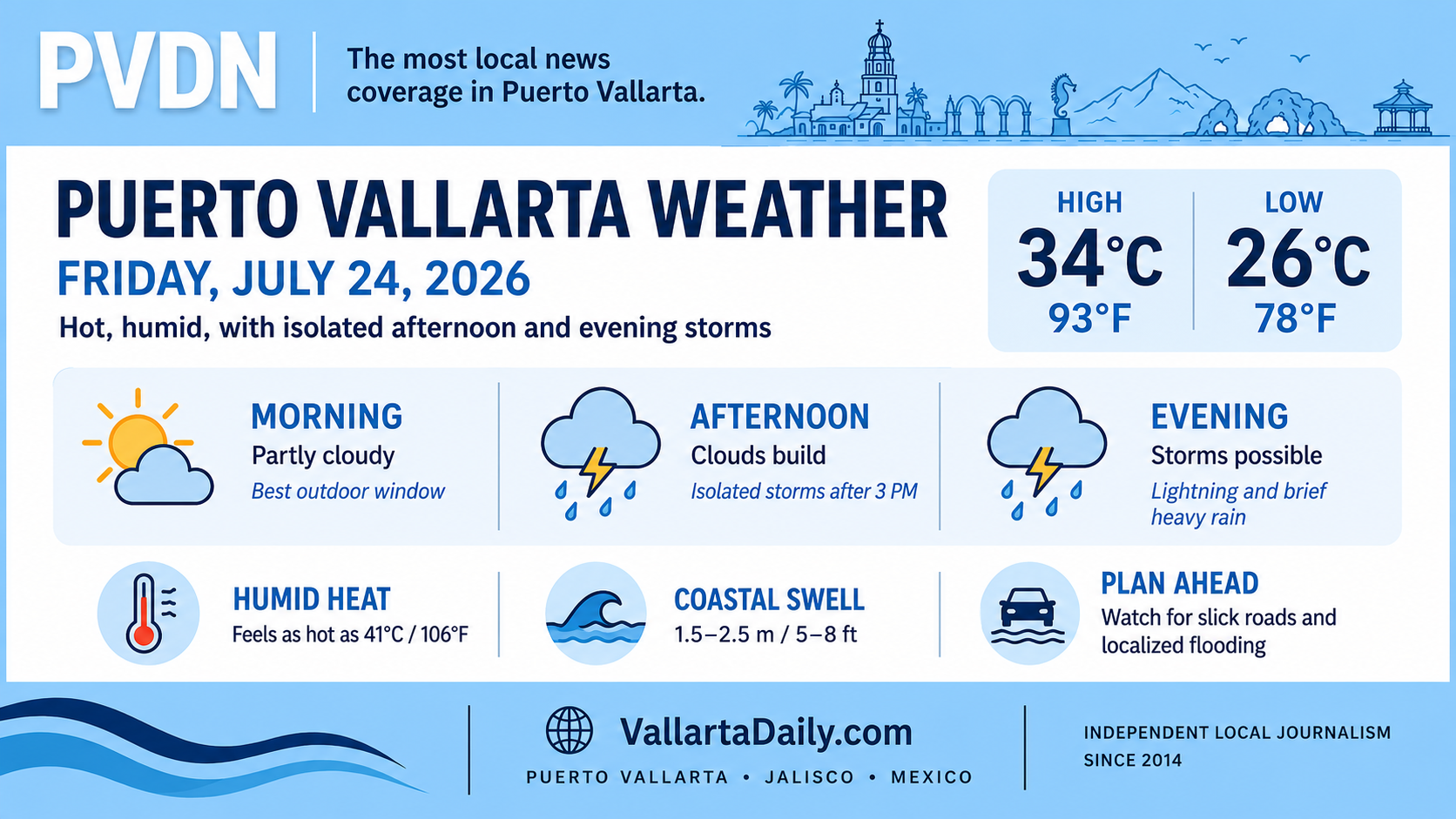
Puerto Vallarta, Jalisco, July 24, 2026 – Puerto Vallarta begins Friday warm and humid, with passing clouds and a greater chance of isolated thunderstorms from the afternoon into the evening.
At 5:45 a.m., the latest airport weather report showed 28°C (82°F), 94% humidity, and a heat index near 34°C (94°F). Wind was light from the northeast at 3 km/h (2 mph). The observation was reviewed at 6:28 a.m. local time.
Temperatures are expected to reach about 33°C to 34°C (92°F to 93°F), with an overnight low near 26°C (78°F).
Humid heat builds before afternoon clouds
The morning should remain partly cloudy with little immediate risk of rain. Humidity will make the temperature feel considerably hotter, with the heat index potentially reaching 41°C (106°F) around midday and early afternoon.
People working or exercising outside should plan demanding activity for the morning, drink water regularly, and take breaks from direct sun. Vehicles can heat rapidly even during cloudy periods.
Light winds will provide little relief. Forecast speeds remain mostly below 10 km/h (6 mph), shifting toward the west during the afternoon.
Storm chances increase later Friday
Forecast models agree that thunderstorms are possible from mid-afternoon through the evening, but they differ on how widespread the rain will become.
The hourly Puerto Vallarta forecast places the rain chance near 15% to 20% between 3 p.m. and 10 p.m., with the highest probability around 8 p.m. to 9 p.m. Another daily forecast places the chance of at least one storm during Friday as high as 90%.
Mexico’s National Meteorological Service forecast calls for strong to very heavy rain across parts of western and southern Jalisco. That is a regional forecast and does not mean every part of Puerto Vallarta will receive heavy rain.
Any storm that develops could bring lightning, brief heavy rain, and localized street flooding. Drivers should use extra care on flood-prone roads and avoid crossing moving water. Rainfall in the mountains can also raise river and stream levels downstream even when rain is lighter near the coast.
Higher swell along the Jalisco coast
The federal forecast includes long-period swell of 1.5 to 2.5 meters (5 to 8 feet) along the Jalisco coast Friday. Conditions can vary inside Banderas Bay, but stronger waves and currents may affect exposed beaches, rocky shorelines and river mouths.
Beach visitors should follow lifeguard flags and local Civil Protection instructions. Boat passengers should confirm departures directly with their operator, particularly for trips outside the bay.
Best window for Friday plans
Morning offers the most reliable period for errands, outdoor work and beach plans, although the heat index will rise quickly. Keep rain gear available after mid-afternoon and allow extra travel time if storms form near the evening commute.
Weather, beach and road conditions can change quickly during summer storms. Check updated radar, official warnings and local conditions before late-day travel or marine activities.