Puerto Vallarta, Jalisco, July 27, 2026 – Puerto Vallarta began Monday warm and humid, with clouds and pockets of light rain. At 6:15 a.m., the temperature was about 26°C (79°F), humidity was 85%, and the apparent temperature was 30°C (86°F).
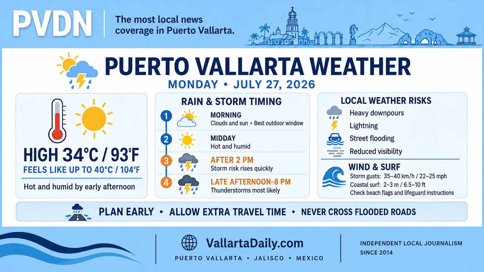
The temperature is forecast to reach about 34°C (93°F) during the early afternoon. Humidity will make it feel closer to 40°C (104°F) at the hottest point of the day.
Rain chances rise during the afternoon
The morning should offer the most dependable period for outdoor plans, with a mixture of clouds and sun expected through midday.
Rain chances begin increasing after 1 p.m., rising from about 35% to 65% by 2 p.m. and above 85% from approximately 3 p.m. through early evening. Thunderstorms are most likely between late afternoon and 8 p.m., although their location and intensity will vary across the bay.
The national 96-hour forecast places western Jalisco under the possibility of localized rainfall totals between 75 and 150 millimeters, or roughly 3 to 6 inches, during the forecast period. That regional range does not mean every part of Puerto Vallarta will receive those amounts.
Lightning and street flooding remain the main concerns
Any stronger storm could produce frequent lightning, sudden downpours, and brief gusty winds. Localized flooding is possible on low-lying and poorly drained streets, particularly during the afternoon commute.
Drivers should allow extra time if storms develop and avoid attempting to cross water-covered roads. Conditions can deteriorate quickly around underpasses, river crossings, and streets that regularly collect runoff.
Winds in the city are expected to remain mostly light to moderate, but gusts near thunderstorms could approach 35 to 40 km/h (22 to 25 mph). The official Jalisco forecast allows for isolated gusts as high as 50 km/h (31 mph).
Elevated surf along the Jalisco coast
Waves of 2 to 3 meters, or approximately 6.5 to 10 feet, are forecast along the Jalisco coast Monday. Conditions inside Banderas Bay will not be uniform, but exposed beaches may experience stronger breakers and rip currents.
Beach visitors should check the flag posted at their location and follow lifeguard instructions. Small-craft excursions and other marine activities may be adjusted if local sea conditions worsen.
Major Hurricane Genevieve was located several hundred miles south-southwest of the Baja California Peninsula early Monday and was moving northwest, according to the National Hurricane Center’s 5 a.m. Pacific update. It was not near Puerto Vallarta, and no additional tropical cyclone formation was expected in the eastern Pacific during the next seven days.
Best window for Monday plans
Morning errands, exercise and beach visits should be completed before the afternoon storm risk increases. Anyone outdoors near midday should account for the apparent temperature approaching 40°C (104°F), seek shade and carry water.
Evening plans remain possible, but residents and visitors should expect delays or short-notice changes if thunderstorms develop. This forecast was prepared shortly after 6:15 a.m. Monday and should be checked again before beach trips, boat departures, or travel later in the day.