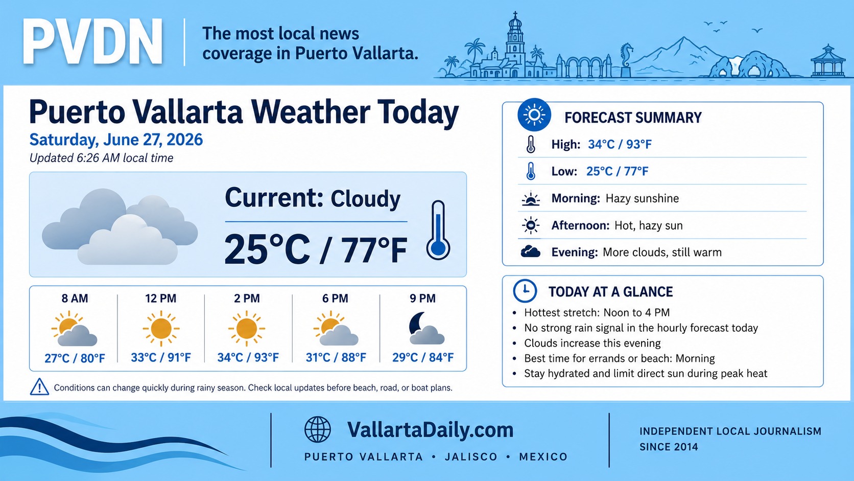
Puerto Vallarta, Jalisco, June 27, 2026 – Puerto Vallarta started Saturday under cloudy skies, with current conditions checked at 6:22 a.m. showing 25°C (77°F). The day is expected to turn hotter by midday, with a forecast high near 34°C (93°F) and a low tonight near 25°C (77°F).
Rain is not expected to dominate the full day. The main window to watch is late afternoon into early evening, roughly between 4 p.m. and 8 p.m., when scattered showers or thunderstorms could develop around the bay.
Conditions can change quickly during the rainy season, especially over the mountains behind the city and along the southbound coastal road.
Morning Conditions in Puerto Vallarta
Early conditions are warm, humid, and cloudy. Local forecasts published overnight placed morning humidity above 90%, which can make the air feel heavier even before the day reaches its peak temperature.
For residents and visitors planning errands, beach time, airport pickups or a walk along the Malecón, the morning remains the better part of the day for outdoor plans.
Heat, Humidity and Rain Timing
The hottest stretch is expected from late morning through mid-afternoon, with temperatures climbing into the low 30s Celsius and low 90s Fahrenheit. The heat index could feel like 37°C (99°F) during the most humid part of the day.
Light rain is possible later in the day, with a better chance of showers or a thunderstorm after about 4 p.m. Local forecasts place the most likely rain window in the late afternoon and early evening, with light to moderate rainfall possible before conditions ease overnight.
People heading to outdoor restaurants, evening events, sports bars or the Romantic Zone should keep a light rain layer handy and allow extra time if showers hit during the dinner-hour commute.
Wind, Surf and Beach Conditions
Wind around the city is expected to stay light for much of the day, though Mexico’s Servicio Meteorológico Nacional lists Jalisco among areas where gusts could reach 30 to 50 km/h, or about 19 to 31 mph, in broader regional conditions.
The same official forecast also keeps mar de fondo in the outlook for the Jalisco coast, with a swell of 1.5 to 2.5 meters (about 5 to 8 feet), decreasing during the afternoon. Conditions inside Banderas Bay can differ from exposed coastlines, but swimmers and small-boat operators should still follow lifeguard flags, marina guidance, and port instructions.
Storm and Flooding Risks Today
The National Hurricane Center reported no active tropical cyclones in the Eastern Pacific as of its early Saturday update. That means today’s local risk is tied more to seasonal afternoon rain, lightning, and surf than to a named storm.
If a storm forms over the city, the usual low-lying, flood-prone streets can experience short-term ponding. Drivers should be careful around underpasses, river crossings, construction zones, and streets that collect runoff during heavy bursts of rain.
Beachgoers should leave the water if thunder is heard or if lifeguards raise caution flags.
Best Windows for Saturday Plans
The best window for outdoor plans is morning through early afternoon. Plan beach time, shopping, airport runs, and errands before the late-afternoon chance of rain builds.
For evening plans, expect warm, humid conditions with possible passing showers. Keep phones charged, watch official updates if storms develop, and check beach or port conditions before heading onto the water.