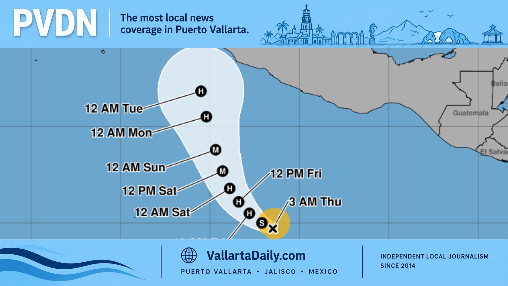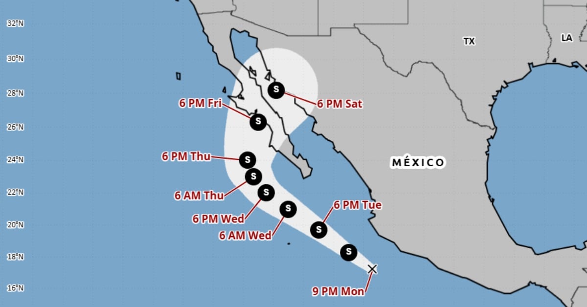
A new system in the eastern Pacific has organized into Tropical Depression Twelve-E. It is not threatening the Mexican mainland tonight, but its bands are already spreading heavy rain over parts of the coast. The center is located off the Colima shoreline, approximately 230 km south-southwest of Manzanillo, and is currently tracking west-northwest. Forecasters expect it to strengthen and bend slowly north, with Baja California Sur in the cone later this week. Here’s what the early guidance and rain outlook mean for coastal communities.
Tropical Depression Twelve-E
A tropical depression formed Monday night (September 1) south of Mexico’s southwest coast. The center is at 17.2°N, 105.4°W, which places it off the Colima coast, about 145 miles south-southwest of Manzanillo. Maximum sustained winds are near 35 mph and the system is moving west-northwest. There are no coastal watches or warnings for the mainland tonight.
The coordinates matter because people know Manzanillo and Colima. Saying “17.2N 105.4W” is abstract; saying “off Manzanillo, Colima” makes the location real for readers along the central Pacific coast.
Track and timing
Guidance points to a gradual turn to the northwest, then north-northwest, with a slower forward speed over the next couple of days. The depression is over very warm water and light shear, so strengthening is likely, and it could reach tropical-storm strength on Tuesday.
As steering weakens later in the week, the system is forecast to arc northward toward Baja California Sur. Forecasters note that a Tropical Storm Watch may be needed for parts of Baja California Sur on Tuesday, depending on how the track and wind field evolve.
Rainfall and hazards
Moisture well east and northeast of the center is already affecting the mainland. Heavy rain bands from Colima, extending through Jalisco, Nayarit, and into Sinaloa, could persist tonight into Tuesday, with isolated flash flooding possible in mountainous terrain.
For Baja California Sur, bands of heavy rain are expected Wednesday through Friday. Early totals of 4 to 8 inches are possible in some areas, with locally higher amounts if slow-moving bands set up. The flood risk will hinge on the eventual track and intensity.
What this means for coastal communities
For the Mexican mainland, tonight’s message is steady vigilance. There are no warnings posted, but rain bands can trigger flash floods and mudslides on steep slopes even when the center remains offshore.
For residents of Baja California Sur, it is recommended to begin preparations now. If watches are issued Tuesday, that will shorten your lead time. Mariners and beachgoers should plan for building swells, dangerous surf, and rip currents well ahead of any direct impacts.