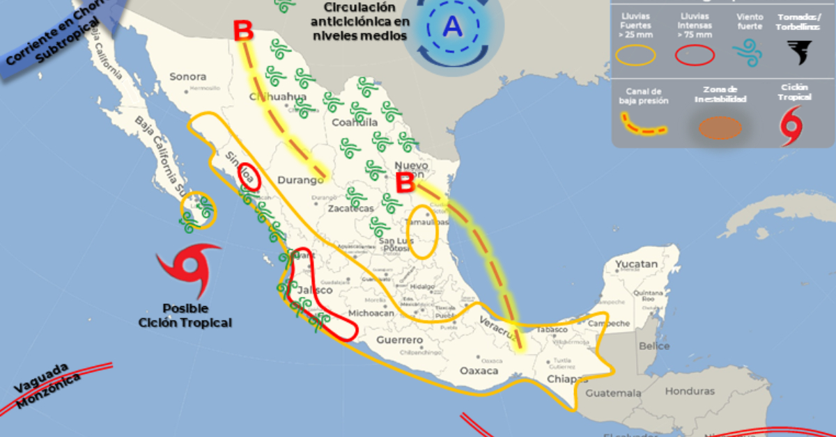
Tropical Storm Lester will move towards the coast of Guerrero today and interact with a low-pressure zone that is expected to develop into Tropical Storm Madelinepossible located southwest of the coast of Jalisco. The interaction of both storms will cause intense rains in Jalisco, Colima, Michoacán, Guerrero, and Oaxaca, as well as strong winds and high waves off the coast . . .