Tropical Storm Flossie is forecast to strengthen and may impact Mexico’s southwest coast from Zihuatanejo to Cabo Corrientes with heavy rain, flooding, and hazardous surf early this week.
Tropical Storm Flossie is expected to deliver heavy rains, gusty winds, and dangerous surf conditions to Mexico’s southwestern coast in the coming days, prompting authorities to issue a Tropical Storm Watch from Zihuatanejo to Cabo Corrientes.
As of 6:00 p.m. CST Sunday, the center of Flossie was located near latitude 13.7 North and longitude 100.7 West, moving west-northwest at around 8 mph (13 km/h). This general motion is forecast to continue for several days as the storm gains strength over warm Pacific waters.
Maximum sustained winds have reached 40 mph (65 km/h) with stronger gusts reported. The U.S. National Hurricane Center anticipates steady intensification, with Flossie likely to become a hurricane late Monday or early Tuesday. Currently, tropical-storm-force winds extend outward up to 105 miles (165 km) from the storm’s center.
Rainfall Threat and Flooding Risk
The most urgent concern for residents in the affected regions is heavy rainfall. Flossie is expected to dump between 3 to 6 inches of rain across the states of Oaxaca, Guerrero, Michoacán, Colima, and Jalisco, with some isolated areas potentially receiving up to 10 inches.
Authorities are warning that this level of rainfall could result in life-threatening flooding and mudslides, particularly in mountainous or steep terrain where runoff can accumulate rapidly. Local emergency services across the region are being placed on alert, and residents in vulnerable areas are advised to remain vigilant and follow updates from civil protection agencies.
Areas Under Tropical Storm Watch
The Tropical Storm Watch issued covers the coastal stretch from Zihuatanejo in Guerrero to Cabo Corrientes in Jalisco. This means tropical storm conditions—including strong winds and heavy rainfall—are possible in these areas within 48 hours.
While Flossie’s center remains offshore for now, outer bands may begin impacting the coast as early as late Monday. The situation could worsen if the storm moves closer to land or strengthens faster than forecast.
Dangerous Surf and Rip Currents
Alongside wind and rain, Flossie is expected to generate large ocean swells that will affect coastal communities in southwestern Mexico. These swells may bring life-threatening surf and rip current conditions, making swimming and coastal recreation extremely dangerous during this period.
Beachgoers, surfers, and fishermen are advised to avoid entering the water until conditions improve. Local officials will likely post warnings and restrict access to some beaches if necessary.
What Residents Should Do
Residents along the southwestern coast should monitor updates from the National Meteorological Service (SMN) and local authorities. Preparedness is key in situations like these—ensuring emergency kits are stocked, securing outdoor items, and reviewing evacuation routes if needed.
Authorities urge everyone in the region to stay informed through official channels and not to rely on unverified social media posts for emergency information.
Outlook
Flossie is part of the 2025 eastern Pacific hurricane season, which typically spans from May 15 through November 30. The Pacific basin has already seen increased activity this season, and Flossie’s development is a reminder that conditions can change quickly.
If current projections hold, Flossie may strengthen into a hurricane by midweek while remaining offshore. However, even without a direct landfall, its impact on coastal communities could be significant due to torrential rains and rough surf.
For up-to-date forecasts and warnings, visit hurricanes.gov or consult Mexico’s national weather service at smn.conagua.gob.mx.
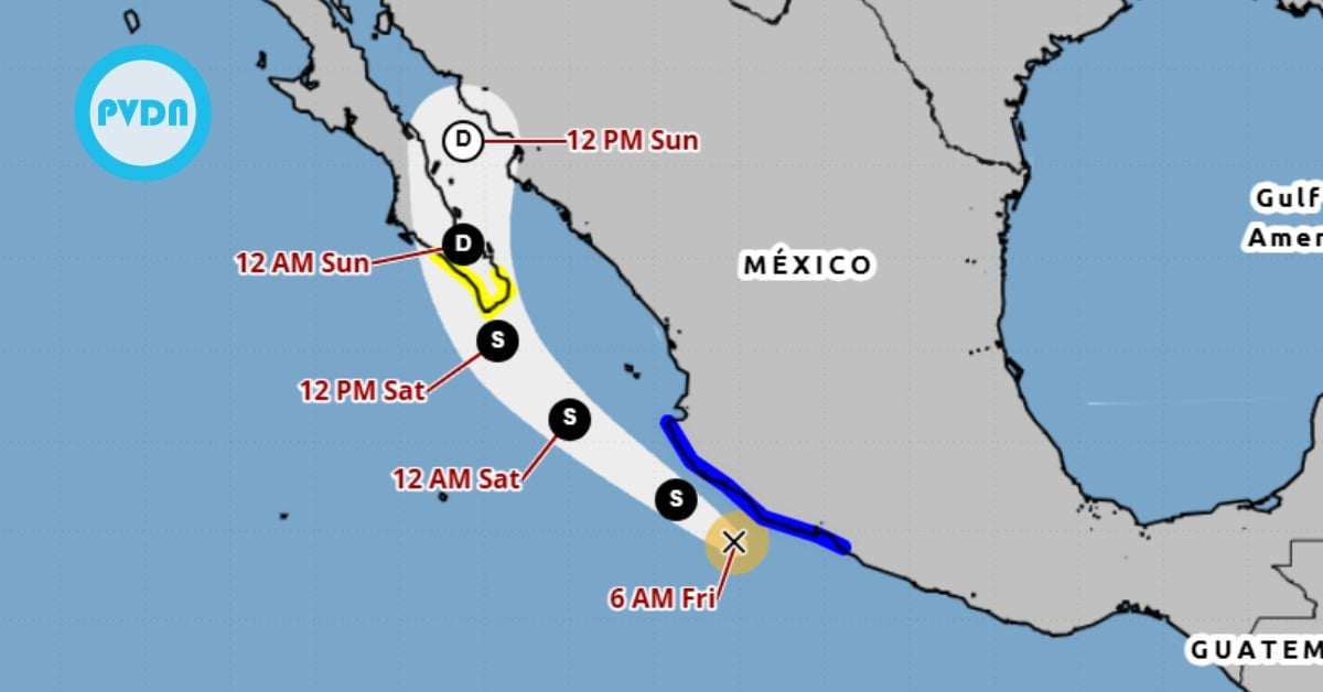
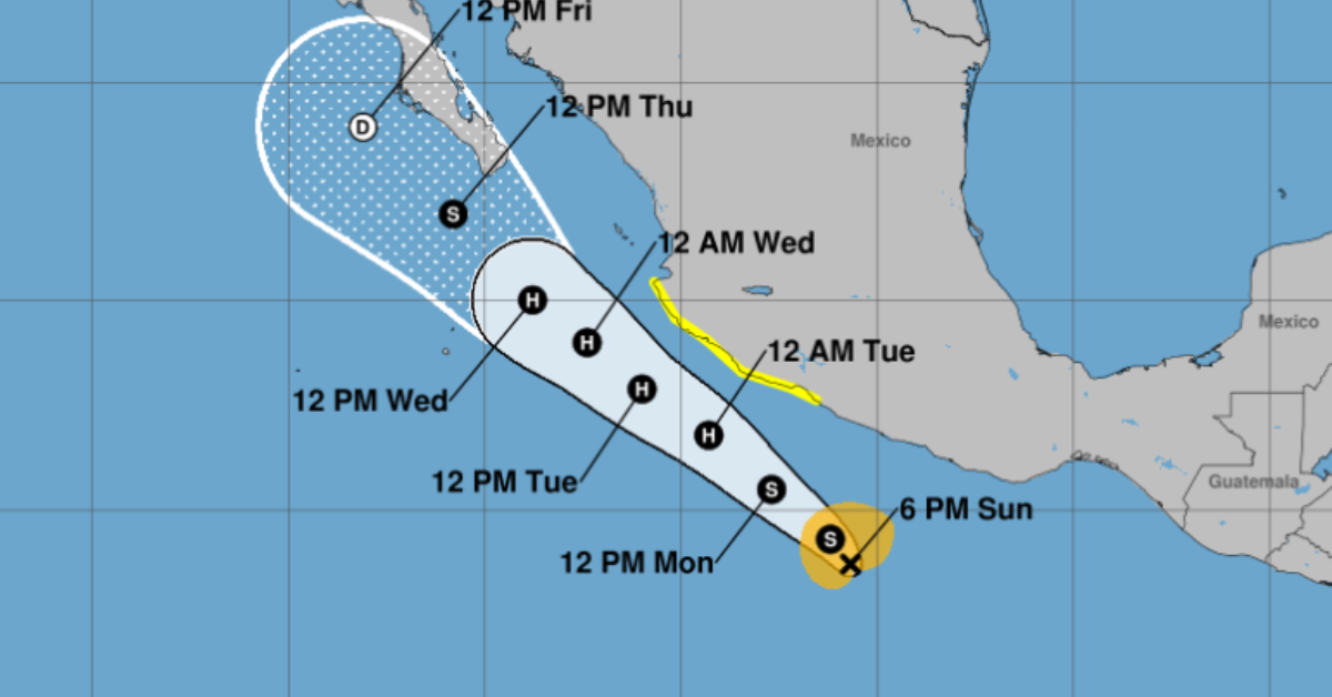
Tropical Storm Flossie is forecast to strengthen and may impact Mexico's southwest coast from Zihuatanejo to Cabo Corrientes with heavy rain . . .