PUERTO VALLARTA (PVDN) – Authorities have issued a Hurricane Warning for parts of the Baja California peninsula from Punta Abreojos to Cabo San Quintin as Hurricane Hilary, a Category 4 storm, approaches. Additionally, a Hurricane Watch is in effect from north of Cabo San Quintin to Ensenada.
Tropical Storm Warnings have been issued for several areas, including the Baja California peninsula from Punta Abreojos southward, the entire east coast of the Baja California peninsula, and the area from north of Cabo San Quintin to the California/Mexico border. Mainland Mexico north of Guaymas, the California/Mexico border to Point Mugu, and Catalina Island are also under Tropical Storm Warning.
A Tropical Storm Watch is in effect for mainland Mexico from Huatabampito to Guaymas.
Hurricane Hilary is currently moving towards the north-northwest at approximately 13 mph (20 km/h). The storm is expected to move close to the west-central coast of the Baja California peninsula tonight and on Sunday, before moving across southern California on Sunday afternoon and night.
Hilary’s maximum sustained winds are near 130 mph (215 km/h) with higher gusts. The hurricane is expected to begin weakening today but will still be a hurricane as it approaches the west coast of the Baja California peninsula tonight and Sunday morning. It is anticipated that Hilary will weaken to a tropical storm by midday Sunday before it reaches southern California.
Hurricane-force winds extend up to 50 miles (85 km) from the center, while tropical-storm-force winds extend outward up to 265 miles (425 km). A sustained wind of 46 mph (74 km/h) and a gust to 62 mph (100 km/h) were recently reported at the Cabo San Lucas Marina.
Hilary is expected to produce 3 to 6 inches of rain, with isolated maximum amounts of up to 10 inches, across parts of the Baja California Peninsula through Sunday night. This could cause flash and urban flooding, especially in the northern portions of the peninsula.
Heavy rainfall associated with Hilary is also expected across the Southwestern United States, peaking on Sunday and possibly lasting through Monday. Rainfall amounts of 3 to 6 inches, with isolated amounts of 10 inches, are expected across parts of southern California and southern Nevada. This may cause dangerous to locally catastrophic flooding. Elsewhere across parts of the Western United States, rainfall totals of 1 to 3 inches are expected, resulting in localized flash flooding.
A dangerous storm surge is expected along the western Baja California peninsula of Mexico near where the center of the storm passes the coast, potentially accompanied by large and destructive waves.
A tornado or two may occur on Sunday over parts of the lower Colorado River Valley, Mojave Desert, and Imperial Valley regions.
Large swells generated by Hilary will affect parts of the coast of southwestern Mexico, the Baja California peninsula, and southern California in the coming days. These swells may cause life-threatening surf and rip current conditions.
Residents and visitors in the affected areas are urged to complete preparations to protect life and property and to monitor local weather reports and advisories.
For storm information specific to your area in the United States, please monitor products issued by your local National Weather Service forecast office. For storm information specific to your area outside of the United States, please monitor products issued by your national meteorological service.
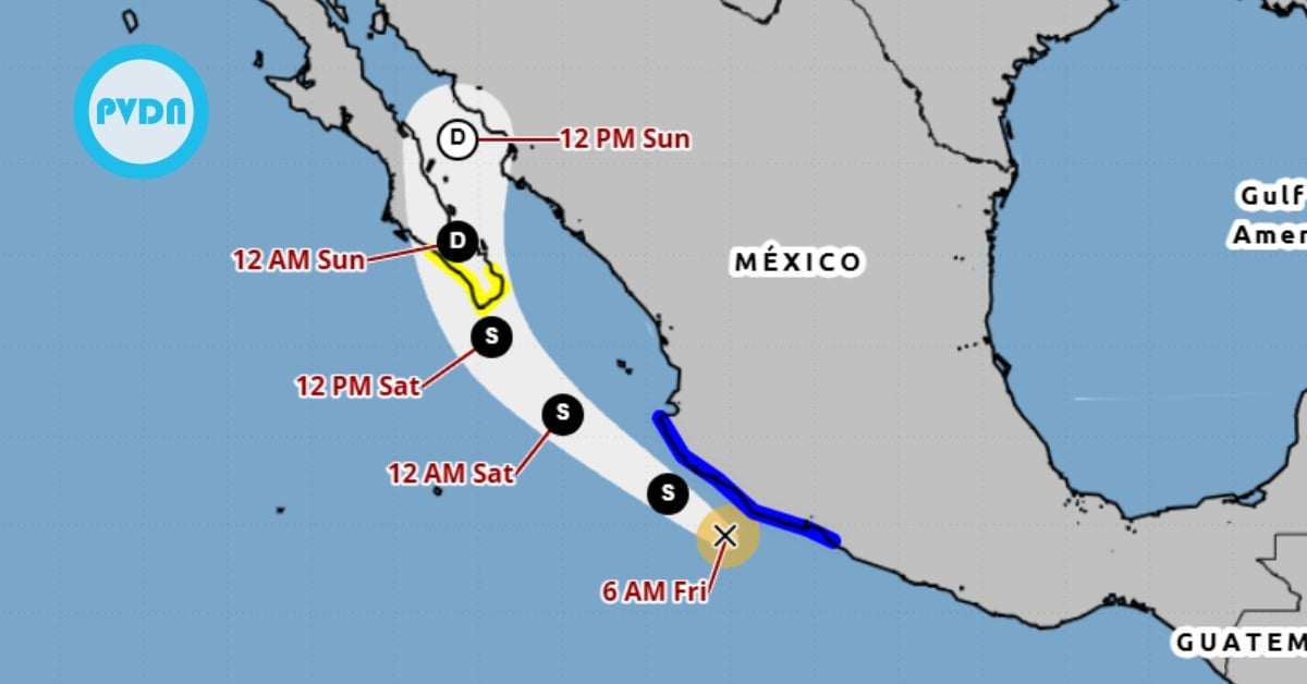
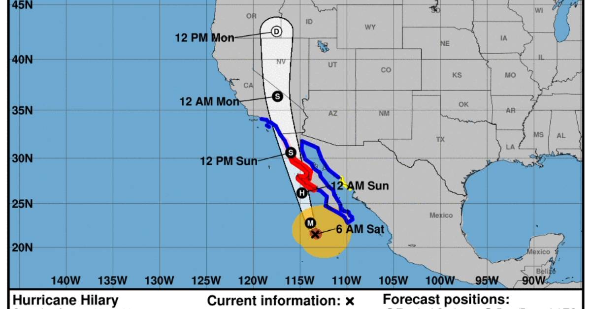
PUERTO VALLARTA (PVDN) - Authorities have issued a Hurricane Warning for parts of the Baja California peninsula from Punta Abreojos to Cabo San Quintin as . . .