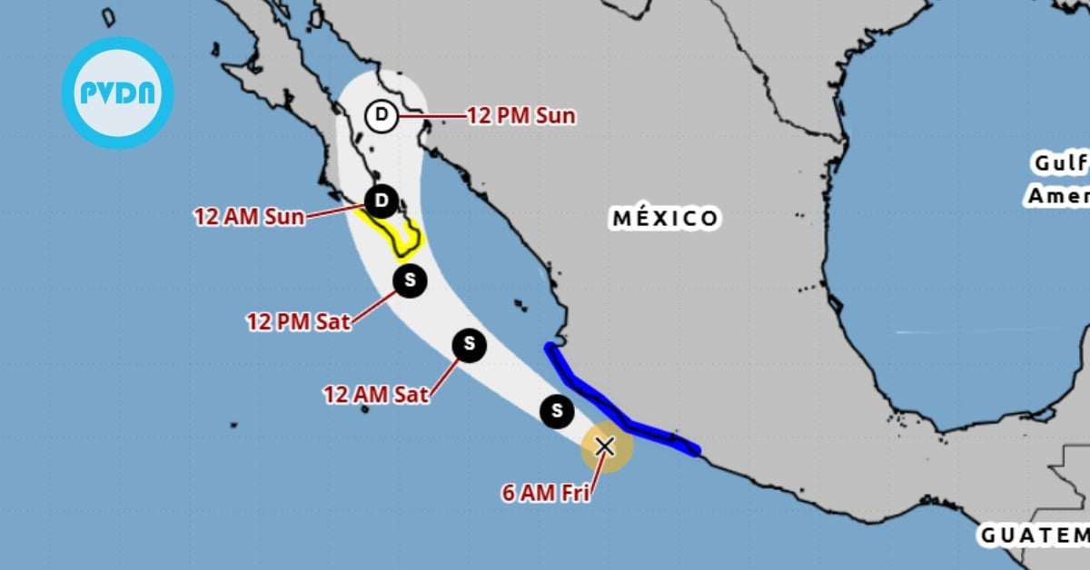
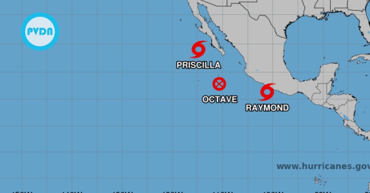
The National Water Commission ( Conagua ) reported this Wednesday night that Tropical Depression “Nineteen E ” was formed, located south of the coasts of Oaxaca and Guerrero, with a high potential to intensify during the next few hours to a Tropical Storm, and strengthen Friday into Hurricane Roslyn.
“As of Friday, it could intensify into a hurricane, moving parallel to the coasts of Michoacán, Colima, and Jalisco, with a possible impact on land”. The current ‘cone of uncertainty’ places the Bay of Banderas in the center of Roslyn’s path on Saturday.
PVDN subscribers, please log in to your account for live updates beginning on Friday, October 21. You can track the storm progress from the dashboard and read any current warnings and advisories. If you are not a subscriber, please consider subscribing today.
According to the agency, it was located 230 kilometers south-southwest of Tecpan de Galeana and 280 km south of Zihuatanejo, both in the state of Guerrero. It has maximum sustained winds of 55 kilometers per hour, gusts of 75 km/h, and displacement to the west-northwest at 7 km/h.

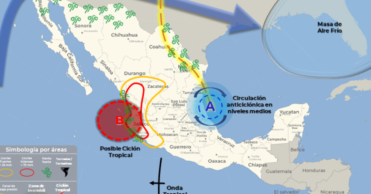
In a press videoconference, Alejandra Margarita Méndez Giró, head of the National Meteorological Service ( SMN ), declared that during the storm’s path, the system will leave intense rains in Oaxaca, Guerrero, Michoacán, Colima, Jalisco, Nayarit and the south of Sinaloa; heavy rains in Durango, Guanajuato and the State of Mexico, as well as strong winds and high waves on the coasts of Guerrero, Michoacán, Colima, Jalisco, Nayarit, and southern Sinaloa.
In total, from October 19 to 25, accumulated rainfall of 250 to 350 millimeters (mm) is expected in Jalisco, 200 to 300 mm in Nayarit, 150 to 250 mm in Colima, Michoacán, Guerrero, and Sinaloa, as well as 100 to 200 mm in Oaxaca.
The forecast rainfall may be accompanied by electric shocks, strong winds, and possible hailstorms, in addition to causing landslides, and increased levels of rivers and streams. Therefore, the unit called on the population and local authorities to take extreme precautions. (continue story below)
Recent News about Roslyn
Continue story… On behalf of the Civil Protection Subsection of the Secretary of the Navy ( SEMAR ), Lieutenant Commander Miguel de Jesús Márquez Bañuelos, stated that for the next 24 hours waves of 7 to 10 feet are expected on the coast of Michoacán and Guerrero, as well as 10 to 14 feet over the central Pacific region. Meanwhile, in 48 hours, waves of 8 to 12 feet will prevail in Colima, Michoacán, and Guerrero, 12 to 16 feet in the central and southern Pacific regions, as well as 5 to 7 feet in the Revillagigedo Islands.
The 72-hour forecast indicates waves of 8 to 12 feet in Jalisco, Colima, and Michoacán, as well as 6 to 10 feet on the coast of Guerrero, the South Pacific region, and the Revillagigedo Islands.
The maritime-port community that carries out coastal or sport fishing, nautical, beach, and tourist activities, among others, in Guerrero and Oaxaca, was recommended to follow the indications and guidelines of the maritime and local authorities, in relation to the prevention and safeguarding of human life in the sea, waterways, coasts, and beaches.
The SEMAR also pointed out that, as a preventive measure, the ports that remain closed to larger vessels are those of Acapulco and Puerto Marqués, in Guerrero, as well as Bahías de Huatulco, in Oaxaca.
The National Water Commission ( Conagua ) reported this Wednesday night that Tropical Depression "Nineteen E " was formed, located south of the coasts of Oaxaca and . . .