Puerto Vallarta, Jalisco, August 16, 2026 — Development odds on two areas of the Pacific rose from 30 percent to 50 percent through seven days by Sunday morning, although the latest projections keep both expected formation zones well away from Puerto Vallarta. The more immediate issue around Banderas Bay is heavy rain tied to Mexico’s summer weather pattern, separate from any tropical cyclone near the coast.
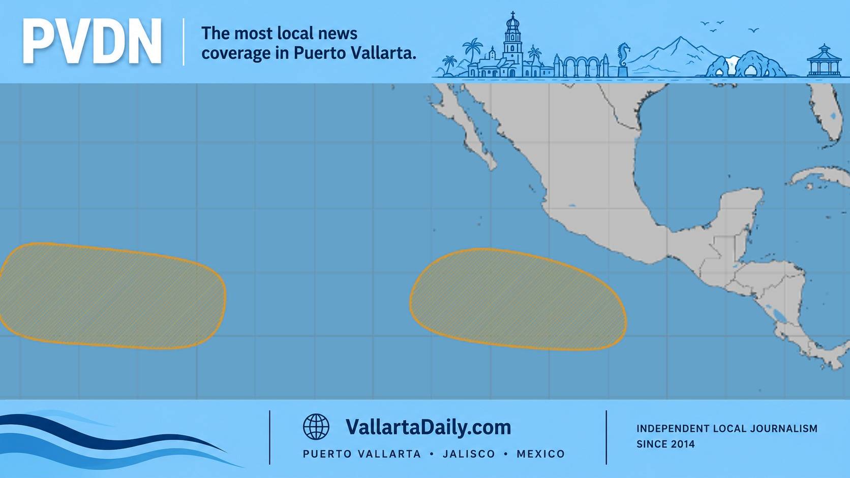
In its 5 a.m. PDT outlook Sunday, the National Hurricane Center said an area of low pressure could form several hundred miles south of southern Mexico around midweek. Gradual development may follow, with a tropical depression possible late in the week or over the weekend as the system moves west-northwest well south of Mexico.
Its chance of development through 48 hours remained near zero. The 50 percent figure applies across the full seven-day period.
A second broad low could form well southeast of Hawaii during the middle or latter part of the week. That area also carries a 50 percent seven-day development chance and near-zero odds through 48 hours. Its projected movement is westward across the western East Pacific and into the Central Pacific, away from Mexico.
The percentages measure the chance that a tropical depression or storm will form somewhere within each designated area during the stated period. They are not landfall probabilities in Mexico or Puerto Vallarta.
An initial Saturday report placed both areas at 30 percent. The increase to 50 percent means forecasters now see a more favorable development window later this week, while the location and projected motion still keep the outlook from indicating a direct threat to the Jalisco coast.
Hernan, the eighth named cyclone of the 2026 Eastern Pacific season, became a remnant low Saturday about 2,835 kilometers west of the southern tip of Baja California. The NHC ended advisories with no coastal watches or warnings in effect. Iselle is the next name on the Eastern Pacific list if a future system reaches tropical storm strength.
The rain forecast across western Mexico is a separate concern. The SMN national outlook issued Saturday indicated that parts of Jalisco could receive 75 to 150 millimeters Sunday, while parts of Nayarit could receive 50 to 75 millimeters. The SMN tied the western rainfall to the Mexican monsoon, low-pressure channels and atmospheric circulation over the mainland.
Thunderstorms may also bring lightning, strong gusts and rapid rises in streams or low-lying flood zones. Those state rainfall ranges describe the heaviest isolated totals and do not mean every community will record the same amount.
PVDN’s detailed Sunday forecast puts the city-level emphasis on afternoon and evening thunderstorms, lightning and localized flooding.
No tropical cyclone watch or warning covered Mexico’s Pacific coast Sunday morning. Any meaningful change in the local risk would require a system to form and its projected path to move much closer to the coast. The current outlook keeps the possible development south of Mexico and later in the week.